Category:Old maps of Florida in the American Civil War
Jump to navigation
Jump to search
States of the United States: Alabama · Arkansas · Florida · Georgia · Kentucky · Louisiana · Maryland · Mississippi · Missouri · North Carolina · Pennsylvania · South Carolina · Tennessee · Texas · Virginia – Washington, D.C.
Media in category "Old maps of Florida in the American Civil War"
The following 6 files are in this category, out of 6 total.
-
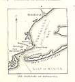
103 of 'History of the American Civil War, etc' (11059297275).jpg 818 × 895; 137 KB
-
498 of 'History of the American Civil War, etc' (11059606693).jpg 860 × 1,061; 213 KB
-
OlusteeAtlas.jpg 894 × 506; 123 KB
-
Pensacola-harbor-florida.jpg 915 × 665; 108 KB


