Category:Old maps of Berbice
Jump to navigation
Jump to search
Subcategories
This category has only the following subcategory.
Media in category "Old maps of Berbice"
The following 14 files are in this category, out of 14 total.
-
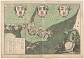
 Berbice in 1720.jpg 2,000 × 1,208; 2.73 MB
-

-
 The-case-and-replication-of-the-legal-representatives MG 1192.tif 4,599 × 3,561; 46.89 MB
-
 Landkaart van de Volkplantingen Suriname en Berbice (1767).jpg 5,500 × 4,623; 2.05 MB
-
 Map of the Colonies of Suriname and Berbice WDL11334.png 1,285 × 1,024; 2.3 MB
-
 Berbice in 1780.jpg 10,242 × 6,716; 15.35 MB
-

-

-
 AMH-6906-KB Map of Berbice.jpg 2,400 × 1,321; 429 KB
-
 AMH-8057-KB Map of a part of the rivers of Berbice and Canjé.jpg 2,400 × 1,757; 704 KB
-
 Berbice -NG-477.jpg 7,986 × 5,626; 9.18 MB
-

-

-
 Westelijk gedeelte der kolonie Suriname (1835).jpg 5,500 × 4,465; 1.29 MB


.jpg)


.jpg)


.jpg)
.jpg)
.jpg)
.jpg)