Category:Maps of Dutch Guiana
Jump to navigation
Jump to search
| NO WIKIDATA ID FOUND! Search for Maps of Dutch Guiana on Wikidata | |
| Upload media |
Subcategories
This category has the following 4 subcategories, out of 4 total.
O
- Old maps of Demerara (10 F)
- Old maps of Essequibo (8 F)
Media in category "Maps of Dutch Guiana"
The following 12 files are in this category, out of 12 total.
-
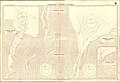 Admiralty Chart No 99 Entrances to Rivers in Guiana, Published 1932.jpg 16,176 × 11,067; 69.52 MB
-
 Batalla de Surinam.png 5,624 × 3,416; 412 KB
-
 Courantyne River Composite from Chart No 99 Entrances to Rivers in Guiana, Published 1932.jpg 11,668 × 23,344; 45.85 MB
-
 Dutch Guiana map.svg 600 × 600; 225 KB
-
 Dutch Guina 1803 Map.png 706 × 830; 94 KB
-
 Flag Map of Dutch Suriname 1954 -1975.png 2,558 × 2,658; 188 KB
-
 Flag Map of Dutch Suriname.png 1,426 × 1,454; 99 KB
-
 Guiana and Amazon Region - 1649.jpg 19,160 × 14,645; 44.39 MB
-
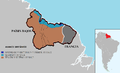
 LocationNetherlandsGuiana.png 250 × 115; 5 KB
-
 Maroni River Cropped from Chart No 99 Entrances to Rivers in Guiana, Published 1932.jpg 5,359 × 10,883; 16.16 MB
-
 Région littorale de la colonie de Suriname - btv1b530251144.jpg 10,318 × 5,445; 6.4 MB
-
 Venezuela and British Guiana in 1826.jpg 748 × 474; 119 KB


