Category:Old geological maps of France
Jump to navigation
Jump to search
Subcategories
This category has only the following subcategory.
A
Media in category "Old geological maps of France"
The following 49 files are in this category, out of 49 total.
-
 "Dressé par Vuillemin". (4514416868).jpg 4,356 × 2,942; 2.67 MB
-

-

-

-

-

-

-
-
-
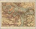
 Achille Delesse, Carte geologique souterraine de la ville de Paris, 1858 - David Rumsey.jpg 32,856 × 23,604; 198.9 MB
-
 Barbot, carte geologique de la France, 1884, graveur Dalang.jpg 999 × 937; 610 KB
-

-

-

-

-
 Bulletin de la Société géologique de France (1892) (20250637619).jpg 3,392 × 2,236; 2.02 MB
-
 Bulletin de la Société géologique de France (1892) (20437290515).jpg 2,896 × 2,074; 2.72 MB
-
 Bulletin de la Société géologique de France (1894) (19816546903).jpg 1,942 × 2,984; 2.65 MB
-
 Bulletin de la Société géologique de France (1894) (20411241336).jpg 1,901 × 2,962; 2 MB
-
 Bulletin de la Société géologique de France (1898) (19816161023).jpg 3,216 × 2,102; 2.5 MB
-
 Bulletin de la Société géologique de France (1900) (20411477966).jpg 3,848 × 2,100; 2.88 MB
-
 Bulletin de la Société géologique de France (1905) (20411127626).jpg 3,104 × 2,023; 1.83 MB
-
 Bulletin de la Société géologique de France (1907) (19814332594).jpg 1,820 × 2,950; 2 MB
-
 Carte géologique du Dauphiné... - par M. Ch. Lory... - btv1b53085073n.jpg 7,742 × 10,445; 14.32 MB
-
 Carte géologique du département de la Sarthe - 1874.jpg 7,887 × 9,575; 15.62 MB
-
 Carte géologique du département de la Savoie - 1869.jpg 9,980 × 7,122; 17.57 MB
-

-
 Carte géologique et agronomique du département du Gers.jpg 9,184 × 6,724; 12.72 MB
-
 Carte géologique Ille-et-Vilaine - 1866.png 8,183 × 11,201; 162.44 MB
-
 Carte géologique Rade de Brest.jpg 875 × 618; 278 KB
-
 Carte géologique, minéralurgique et topographique du département de l'Allier - 1860s.jpg 9,209 × 6,853; 10.18 MB
-
 Carte Mineralogique de France (BM 1914,0520.673).jpg 2,500 × 1,962; 1,016 KB
-

-

-
 Carte routière et géologique de la Corse - 1884.jpg 4,284 × 5,632; 3.29 MB
-

-
 France & Colonies-1894-géologie.jpg 4,384 × 5,344; 3.85 MB
-
-
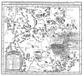 Guettard-1759--mineralogie de l'Auvergne--carte.png 889 × 800; 708 KB
-

-

-

-

-
 Les affleurements de kersantite.jpg 320 × 280; 66 KB
-
 Mines du Boulonnais - Carte géologique des terrains primaires du Boulonnais.jpg 4,235 × 3,111; 12.23 MB
-
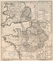
 Service géologique des mines, Paris et ses environs, 1890 - David Rumsey.jpg 11,765 × 9,409; 27.52 MB
-

-

-
 War Office (Great Britain) - Paris, 1944 - McMaster University.jpg 23,018 × 16,782; 222.47 MB
.jpg)
.jpg)
.jpg)
.jpg)
%27_(11023178816).jpg)

.jpg)
.jpg)
%27_(11015587534).jpg)


_-_Essai_sur_la_geographie_mineralogique_des_environs_de_Paris--carte_geognostique.jpg)
_-_Essai_sur_la_geographie_mineralogique_des_environs_de_Paris--pl.02-C.jpg)
_(20442591621).jpg)
_(20246386259).jpg)
_(20250637619).jpg)
_(20437290515).jpg)
_(19816546903).jpg)
_(20411241336).jpg)
_(19816161023).jpg)
_(20411477966).jpg)
_(20411127626).jpg)
_(19814332594).jpg)


.jpg)


._Traduit_de_l%27allemand,_avec_l%27autorisation_de_l%27auteur_et_annot%C3%A9e_sous_la_direction_de_Emm._de_Margerie._Avec_une_pr%C3%A9f._par_Marcel_Bertrand_(1897)_(14591426879).jpg)
._Traduit_de_l%27allemand,_avec_l%27autorisation_de_l%27auteur_et_annot%C3%A9e_sous_la_direction_de_Emm._de_Margerie._Avec_une_pr%C3%A9f._par_Marcel_Bertrand_(1897)_(14591448190).jpg)
._Traduit_de_l%27allemand,_avec_l%27autorisation_de_l%27auteur_et_annot%C3%A9e_sous_la_direction_de_Emm._de_Margerie._Avec_une_pr%C3%A9f._par_Marcel_Bertrand_(1897)_(14774950341).jpg)
._Traduit_de_l%27allemand,_avec_l%27autorisation_de_l%27auteur_et_annot%C3%A9e_sous_la_direction_de_Emm._de_Margerie._Avec_une_pr%C3%A9f._par_Marcel_Bertrand_(1897)_(14777756412).jpg)


.jpg)
.jpg)
_-_Paris,_1944_-_McMaster_University.jpg)