Category:Official topographic maps of Miranda (state)
Jump to navigation
Jump to search
Federal territory: Capital District ·
Media in category "Official topographic maps of Miranda (state)"
The following 10 files are in this category, out of 10 total.
-
 Hoja 6746 - LA VICTORIA, CAGUA, VILLA DE CURA, TEJERÍAS - DCN 1972.jpg 8,332 × 6,597; 64.89 MB
-
 Hoja 6747 - LOS TEQUES, EL JUNQUITO, COLONIA TOVAR, CATIA LA MAR, CARAYACA - DCN 1971.jpg 8,328 × 6,624; 67.3 MB
-
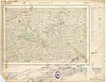 Hoja 6846 - VALLES DEL TUY, CHARALLAVE, CÚA, OCUMARE, SANTA TERESA, YARE - DCN 1969.jpg 4,238 × 3,291; 23.27 MB
-
 Hoja 6847 - CARACAS, VARGAS, GUARENAS, GUATIRE, SAN ANTONIO DE LOS ALTOS - DCN 1964.jpg 8,129 × 6,559; 63.46 MB
-
 Hoja 6946 - CAUCAGUA, VÍA A ORIENTE - DCN 1970.jpg 4,280 × 3,302; 21.88 MB
-
 Hoja 6947 - HIGUEROTE, BARLOVENTO, LITORAL - DCN 1970.jpg 4,259 × 3,298; 21.62 MB
-
 Hoja 7046 - CÚPIRA, EL GUAPO, RÍO CHICO, VÍA A ORIENTE, TACARIGUA - DCN 1964.jpg 8,572 × 6,627; 51.19 MB
-
 Hoja 7046 - CÚPIRA, EL GUAPO, RÍO CHICO, VÍA A ORIENTE, TACARIGUA - DCN 1974.jpg 8,344 × 6,613; 59.11 MB
-
 Hoja 7047 - PLAYAS DE RÍO CHICO, PAPARO, LOS CANALES - DCN 1963.jpg 8,440 × 6,856; 60.95 MB
-
 Hoja 7146 - PUERTO PÍRITU, BOCA DE UCHIRE - DCN 1974.jpg 8,332 × 6,605; 58.5 MB


