Category:October 2009 in Northumberland
Jump to navigation
Jump to search
Deutsch: Bilder, die im Oktober 2009 in Northumberland aufgenommen worden sind. Bitte beachten Sie, dass dies weder das Datum des Uploads noch das Datum des Scannens eines Fotos ist.
English: Images/pictures taken in Northumberland during October 2009. Note this is not the date of the upload, nor the date a photo was scanned.
Español: Fotografías o imágenes tomadas en Northumberland durante octubre 2009. No es la fecha de subida ni escaneo, sino la fecha en que las fotografías o imágenes se crearon.
Esperanto: Bildoj faritaj en Northumberland en oktobro 2009. Tio ne estas la dato, kiam la bildoj estis alŝutitaj aŭ skanitaj.
Français : Photographies ou images prises en Northumberland durant octobre 2009. Ce n'est pas la date du téléchargement ou du scan.
Galego: Fotografías ou imaxes tomadas en Northumberland durante outubro 2009. Non é a data de subida nin escaneamento, senón a data na que se crearon as fotografías ou imaxes.
Italiano: Fotografie o immagini scattate a Northumberland nel ottobre 2009. Nota bene: la data non si riferisce né a quella di upload né a quella in cui la foto è stata digitalizzata.
Norsk bokmål: Bilder tatt i Northumberland i løpet av oktober 2009. Merk at dette ikke er datoen for opplasting, eller når et bilde har blitt skannet.
Norsk nynorsk: Bilete teke i Northumberland i løpet av oktober 2009. Merk at dette ikkje er datoen for opplasting, eller når eit bilete har vorte skanna.
Русский: Изображения, сделанные в Northumberland в течение октябрь 2009 (не дата загрузки изображения).
Українська: Зображення, зроблені в Northumberland протягом жовтень 2009. Зауважте, що це не дата завантаження чи дата сканування фотографії.
| October 2008 | ← | October 2009 | → | October 2010 | |||||||
| Jan | Feb | Mar | Apr | May | Jun | Jul | Aug | Sep | Oct | Nov | Dec |
| 40 | 34 | 179 | 34 | 29 | 60 | 27 | 38 | 47 | 54 | 10 | 29 |
|---|---|---|---|---|---|---|---|---|---|---|---|
Subcategories
This category has only the following subcategory.
Media in category "October 2009 in Northumberland"
The following 53 files are in this category, out of 53 total.
-
-

-
 Apache Helicopter MOD 45150281.jpg 4,256 × 2,837; 3.29 MB
-
 Apache Helicopter MOD 45150282.jpg 2,620 × 3,930; 10.48 MB
-
 Apache Helicopter MOD 45150283.jpg 3,747 × 2,498; 6.29 MB
-
 Bamburgh Castle Entrance - geograph.org.uk - 3486904.jpg 1,440 × 1,080; 563 KB
-
 Bamburgh Castle from Front Street - geograph.org.uk - 3486899.jpg 1,440 × 1,080; 402 KB
-
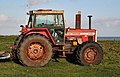
 Beach Tractor - geograph.org.uk - 1562856.jpg 640 × 420; 124 KB
-
 Beach Tractor - geograph.org.uk - 1563415.jpg 640 × 412; 97 KB
-
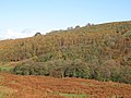
 Cockshaw Rigg - geograph.org.uk - 1556165.jpg 640 × 480; 83 KB
-
 Conduit house - geograph.org.uk - 1557316.jpg 640 × 426; 66 KB
-
 Cottage near Codlaw Hill Farm - geograph.org.uk - 1557348.jpg 600 × 450; 146 KB
-
 Cottages near Soppit Farm - geograph.org.uk - 1520562.jpg 640 × 480; 91 KB
-
 East Allen Dale (6) - geograph.org.uk - 1587071.jpg 640 × 480; 117 KB
-
 East Allen Dale (7) - geograph.org.uk - 1587088.jpg 640 × 480; 104 KB
-
 East Allen Dale (8) - geograph.org.uk - 1587099.jpg 640 × 480; 87 KB
-
 East Allen Dale (9) - geograph.org.uk - 1587457.jpg 640 × 480; 85 KB
-
 East Allen Dale at Sinderhope (10) - geograph.org.uk - 1585640.jpg 640 × 480; 118 KB
-
 East Allen Dale at Sinderhope (11) - geograph.org.uk - 1585663.jpg 640 × 480; 103 KB
-
 East Allen Dale at Sinderhope (12) - geograph.org.uk - 1585835.jpg 640 × 480; 107 KB
-
 East Allen Dale at Sinderhope (13) - geograph.org.uk - 1586057.jpg 640 × 480; 85 KB
-
 East Allen Dale at Sinderhope (14) - geograph.org.uk - 1587411.jpg 640 × 480; 65 KB
-
 East Allen Dale at Sinderhope (3) - geograph.org.uk - 1588160.jpg 640 × 480; 69 KB
-
 East Allen Dale at Sinderhope (4) - geograph.org.uk - 1588164.jpg 640 × 480; 77 KB
-
 East Allen Dale at Sinderhope (5) - geograph.org.uk - 1588168.jpg 640 × 480; 101 KB
-
 East Allen Dale near The Holms (2) - geograph.org.uk - 1587312.jpg 640 × 480; 93 KB
-
 East Allen Dale near The Holms - geograph.org.uk - 1587302.jpg 640 × 480; 90 KB
-

-
 East Allen Dale north of The Holms - geograph.org.uk - 1587319.jpg 640 × 480; 80 KB
-
 East Allen Dale south of Pry Hill - geograph.org.uk - 1589091.jpg 640 × 480; 66 KB
-
 Footbridge over the Long Nanny Burn - geograph.org.uk - 1541472.jpg 640 × 480; 78 KB
-
 Footpath by the side of Square Wood - geograph.org.uk - 1557395.jpg 600 × 450; 93 KB
-

-
 Grace Darling Memorial at Bamborough Church.jpg 1,024 × 438; 150 KB
-
 Holy Island - geograph.org.uk - 1557256.jpg 640 × 426; 49 KB
-
 Howick - geograph.org.uk - 1562871.jpg 640 × 427; 156 KB
-
 Howick - geograph.org.uk - 1562901.jpg 640 × 310; 75 KB
-
 Howick - geograph.org.uk - 1563292.jpg 640 × 318; 100 KB
-
 Howick - geograph.org.uk - 1563427.jpg 640 × 434; 168 KB
-
 Howick Scar - geograph.org.uk - 1562880.jpg 640 × 427; 164 KB
-
 Howick Scar - geograph.org.uk - 1562883.jpg 640 × 275; 68 KB
-

-
 Lindisfarne Castle - geograph.org.uk - 1557174.jpg 426 × 640; 76 KB
-
 Lindisfarne Castle - geograph.org.uk - 1557245.jpg 640 × 426; 53 KB
-
 Longhoughton Parish Church - geograph.org.uk - 1562867.jpg 640 × 422; 125 KB
-
 Longhoughton Steel - geograph.org.uk - 1563384.jpg 640 × 335; 93 KB
-
 Longhoughton Steel - geograph.org.uk - 1563391.jpg 640 × 286; 77 KB
-

-
 The Marketplace - geograph.org.uk - 1557294.jpg 640 × 426; 90 KB
-
 The Ouse - geograph.org.uk - 1557262.jpg 426 × 640; 58 KB
-
 The Ouse - geograph.org.uk - 1557545.jpg 640 × 426; 60 KB
-
 The Ouse - geograph.org.uk - 1558878.jpg 640 × 426; 75 KB
-
 Wallington Bridge - geograph.org.uk - 1552399.jpg 640 × 480; 122 KB


_-_geograph.org.uk_-_1587071.jpg)
_-_geograph.org.uk_-_1587088.jpg)
_-_geograph.org.uk_-_1587099.jpg)
_-_geograph.org.uk_-_1587457.jpg)
_-_geograph.org.uk_-_1585640.jpg)
_-_geograph.org.uk_-_1585663.jpg)
_-_geograph.org.uk_-_1585835.jpg)
_-_geograph.org.uk_-_1586057.jpg)
_-_geograph.org.uk_-_1587411.jpg)
_-_geograph.org.uk_-_1588160.jpg)
_-_geograph.org.uk_-_1588164.jpg)
_-_geograph.org.uk_-_1588168.jpg)
_-_geograph.org.uk_-_1587312.jpg)

_-_geograph.org.uk_-_1587331.jpg)


