Category:October 2006 in County Down
Jump to navigation
Jump to search
English: Images taken in County Down, Northern Ireland in this month of 2006 (not the date of the upload).
| Jan | Feb | Mar | Apr | May | Jun | Jul | Aug | Sep | Oct | Nov | Dec | ||
| ← | 18 | 25 | 49 | 17 | 43 | 71 | 74 | 97 | 51 | 64 | 35 | 36 | → |
|---|
Media in category "October 2006 in County Down"
The following 64 files are in this category, out of 64 total.
-

-

-

-

-

-

-

-
 Audley's Castle, through trees.jpg 640 × 426; 169 KB
-
 Ballydown Bleachworks, Banbridge - geograph.org.uk - 260503.jpg 640 × 426; 120 KB
-
 Banbridge bypass, Belfast-Dublin road (3) - geograph.org.uk - 260486.jpg 640 × 426; 123 KB
-
 Banbridge bypass, Belfast-Dublin road (4) - geograph.org.uk - 260493.jpg 640 × 426; 124 KB
-
 Bangor lifeboat (2) - geograph.org.uk - 253885.jpg 640 × 426; 132 KB
-
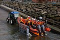 Bangor's new lifeboat - geograph.org.uk - 254239.jpg 640 × 426; 162 KB
-
-

-
 Disused Newry canal, Scarva (2) - geograph.org.uk - 262586.jpg 640 × 426; 153 KB
-
 Gilford Mill, Gilford - geograph.org.uk - 264791.jpg 640 × 426; 138 KB
-
 Lough Cowey near Portaferry (1) - geograph.org.uk - 265552.jpg 640 × 426; 122 KB
-
 Lough Cowey near Portaferry (2) - geograph.org.uk - 265556.jpg 640 × 426; 136 KB
-
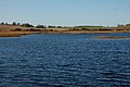
 Loughbrickland lake near Banbridge (1) - geograph.org.uk - 263573.jpg 640 × 426; 100 KB
-
 New flyover, Banbridge bypass - geograph.org.uk - 260881.jpg 640 × 426; 123 KB
-
 Newry River and Shipping Canal - geograph.org.uk - 258698.jpg 640 × 480; 76 KB
-
 Newry ship canal near Dromalane (2) - geograph.org.uk - 254221.jpg 640 × 426; 123 KB
-

-

-
 Old railway at Ballyroney, Co Down - geograph.org.uk - 258346.jpg 640 × 426; 155 KB
-
 Old railway at Huntly, Banbridge - geograph.org.uk - 260641.jpg 640 × 426; 171 KB
-
 Old railway at Kernan near Scarva (1) - geograph.org.uk - 260701.jpg 640 × 426; 134 KB
-

-
 Queen's Parade, Bangor (1) - geograph.org.uk - 257247.jpg 640 × 426; 127 KB
-
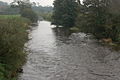
 River Bann at Ballyroney (1) - geograph.org.uk - 268258.jpg 640 × 426; 149 KB
-
 River Bann at Dynes' Bridge - geograph.org.uk - 263611.jpg 640 × 426; 133 KB
-
 River Bann, Dunbar's Bridge (2) - geograph.org.uk - 258143.jpg 640 × 426; 152 KB
-
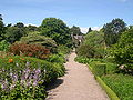 Rowallane Garden.JPG 2,272 × 1,704; 477 KB
-
 ScraboTower.jpg 1,944 × 2,592; 1.32 MB
-
 St. Patrick's Memorial church, Saul - geograph.org.uk - 269924.jpg 640 × 426; 121 KB
-
 The Abbacy Road near Portaferry (1) - geograph.org.uk - 265559.jpg 640 × 426; 164 KB
-
 The Audleystown Road near Strangford - geograph.org.uk - 253912.jpg 640 × 426; 179 KB
-
 The Ballee Road near Downpatrick (1) - geograph.org.uk - 253908.jpg 640 × 426; 175 KB
-
 The Ballee Road near Downpatrick (2) - geograph.org.uk - 253910.jpg 640 × 426; 185 KB
-
 The Bangor road at Cultra (2) - geograph.org.uk - 261314.jpg 640 × 426; 138 KB
-
 The Corbet Road near Banbridge - geograph.org.uk - 265029.jpg 640 × 426; 161 KB
-
 The Finnebrogue Road, Downpatrick - geograph.org.uk - 269842.jpg 640 × 426; 166 KB
-
 The Kircubbin Road, Ballywalter - geograph.org.uk - 265690.jpg 640 × 426; 169 KB
-
 The loughshore near Kircubbin - geograph.org.uk - 265677.jpg 640 × 426; 145 KB
-
 The Mount Ida Road near Banbridge - geograph.org.uk - 268289.jpg 640 × 426; 155 KB
-
 The Mullaghabrack Road near Scarva - geograph.org.uk - 263601.jpg 640 × 426; 168 KB
-
 The Newry River at Narrow Water - geograph.org.uk - 329266.jpg 640 × 426; 133 KB
-

-

-
 The Quoile Pondage near Downpatrick (2) - geograph.org.uk - 269848.jpg 640 × 426; 162 KB
-
 The Quoile Pondage near Downpatrick (3) - geograph.org.uk - 269851.jpg 640 × 426; 147 KB
-

-

-
 The River Bann at Ballyroney (2) - geograph.org.uk - 268264.jpg 640 × 426; 134 KB
-
 The River Bann at Gilford - geograph.org.uk - 264800.jpg 640 × 426; 152 KB
-

-
 The River Bann at Tierkelly (1) - geograph.org.uk - 268275.jpg 640 × 426; 135 KB
-
 The River Bann at Tierkelly (2) - geograph.org.uk - 268280.jpg 640 × 426; 172 KB
-
 The Trassey Bridge near Bryansford - geograph.org.uk - 258358.jpg 640 × 426; 156 KB
-
 The White Bridge near Gilford - geograph.org.uk - 264950.jpg 640 × 426; 145 KB
-
-
 Warrenpoint harbour estate - geograph.org.uk - 253921.jpg 640 × 426; 150 KB
-
 Whitespots Country Park, Newtownards (1) - geograph.org.uk - 256280.jpg 640 × 426; 153 KB
_-_geograph.org.uk_-_254910.jpg)
_-_geograph.org.uk_-_254913.jpg)
_-_geograph.org.uk_-_254919.jpg)
_-_geograph.org.uk_-_254922.jpg)
_-_geograph.org.uk_-_254965.jpg)
_-_geograph.org.uk_-_254966.jpg)
_-_geograph.org.uk_-_254970.jpg)


_-_geograph.org.uk_-_260486.jpg)
_-_geograph.org.uk_-_260493.jpg)
_-_geograph.org.uk_-_253885.jpg)

_-_geograph.org.uk_-_254974.jpg)
_-_geograph.org.uk_-_347496.jpg)
_-_geograph.org.uk_-_262586.jpg)

_-_geograph.org.uk_-_265552.jpg)
_-_geograph.org.uk_-_265556.jpg)
_-_geograph.org.uk_-_263573.jpg)


_-_geograph.org.uk_-_254221.jpg)
_-_geograph.org.uk_-_265040.jpg)


_-_geograph.org.uk_-_260701.jpg)

_-_geograph.org.uk_-_257247.jpg)
_-_geograph.org.uk_-_268258.jpg)

_-_geograph.org.uk_-_258143.jpg)


_-_geograph.org.uk_-_265559.jpg)

_-_geograph.org.uk_-_253908.jpg)
_-_geograph.org.uk_-_253910.jpg)
_-_geograph.org.uk_-_261314.jpg)


_-_geograph.org.uk_-_267867.jpg)
_-_geograph.org.uk_-_267869.jpg)
_-_geograph.org.uk_-_269848.jpg)
_-_geograph.org.uk_-_269851.jpg)
_-_geograph.org.uk_-_267793.jpg)
_-_geograph.org.uk_-_267795.jpg)
_-_geograph.org.uk_-_268264.jpg)


_-_geograph.org.uk_-_268275.jpg)
_-_geograph.org.uk_-_268280.jpg)


_-_geograph.org.uk_-_256280.jpg)