Category:North Wales Coast Line
Jump to navigation
Jump to search
Cymraeg: Rheilffordd Arfordir Gogledd Cymru yw enw'r rheilffordd sy'n cysylltu Caergybi ar nys Môn â thref Crewe yng ngogledd-orllewin Lloegr. Agorwyd yr adran gyntaf yn 1840, rhwng Crewe a Chaer. Adeiladwyd gweddill y rheilffordd gan gwmni Rheilffordd Caer a Chaergybi o 1844 i 1850 fel rhan o wasanaeth yr Irish Mail i Ddulyn, Iwerddon. Ers Ebrill 2006, mae Network Rail yn ystyried y rheilffordd yn Drac 18 yn ei rwydwaith (Prif Reilffordd Arfordir y Gogledd).
English: The North Wales Coast Line is the railway line from Crewe, England to Holyhead, Wales. Avanti West Coast consider their services along it to be a spur of the West Coast Main Line. The line was built between 1844 and 1850 by the Chester and Holyhead Railway Company as the route of the Irish Mail services to Dublin.
railway line in North Wales and Cheshire, England  _crosses_the_Menai_Strait_between_the_Isle_of_Anglesey_and_city_of_Bangor,_Gwynedd,_Wales_07.jpg)  | |||||
| Upload media | |||||
| Instance of |
| ||||
|---|---|---|---|---|---|
| Part of |
| ||||
| Location | Isle of Anglesey, Wales | ||||
| Owned by | |||||
| Operator | |||||
| Date of official opening |
| ||||
| Length |
| ||||
| Terminus | |||||
| official website | |||||
 | |||||
Subcategories
This category has the following 40 subcategories, out of 40 total.
A
B
- Bagillt railway station (2 F)
- Bodorgan railway station (9 F)
C
- Calveley railway station (3 F)
- Canal Road bridge, Chester (4 F)
- Colwyn Bay railway station (12 F)
- Conwy Railway Bridge (153 F)
D
- Deganwy railway station (40 F)
F
- Flint railway station (39 F)
G
- Gaerwen railway station (4 F)
H
L
M
- Mostyn railway station (4 F)
P
- Penmaenbach Railway Tunnel (2 F)
- Prestatyn railway station (22 F)
R
- Rhosneigr railway station (8 F)
S
- Sandycroft railway station (3 F)
- Shotton railway station (61 F)
- Stanley Embankment (34 F)
T
- Talacre railway station (4 F)
- Tŷ Croes railway station (10 F)
V
W
- Waverton railway station (5 F)
- Worleston railway station (2 F)
Media in category "North Wales Coast Line"
The following 85 files are in this category, out of 85 total.
-
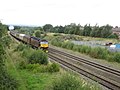
 60026 Chester Racecourse with 6J37 Carlise-Chirk bulk timber.jpg 4,950 × 3,060; 3.1 MB
-
 70817 Colas Rail Roodee junction with 6J37 logs (30630645948).jpg 3,326 × 2,941; 1.68 MB
-
 A huge complex of old and new - geograph.org.uk - 70628.jpg 640 × 480; 97 KB
-
 Benkid77 Dock Road, Connah's Quay 290609.JPG 1,280 × 1,024; 303 KB
-
 Bottom lock of the Northgate flight - geograph.org.uk - 691504.jpg 640 × 480; 114 KB
-
-
 Chester City Walls - north wall footbridge over railway.jpg 3,648 × 2,736; 4.66 MB
-
 Chester to Holyhead Railway - geograph.org.uk - 674841.jpg 480 × 640; 61 KB
-
 Chester to Holyhead railway - geograph.org.uk - 871182.jpg 640 × 479; 124 KB
-
 Chester to Holyhead Railway - West - geograph.org.uk - 411918.jpg 480 × 640; 206 KB
-
 Chester to Holyhead railway line - geograph.org.uk - 656000.jpg 640 × 480; 66 KB
-
 Chester to Holyhead railway line - geograph.org.uk - 656003.jpg 640 × 480; 44 KB
-
 Chester to Shrewsbury railway line near Beeston - geograph.org.uk - 2456415.jpg 4,000 × 3,000; 3.61 MB
-
 Chester, bridge over the railway - geograph.org.uk - 4755719.jpg 3,264 × 2,448; 2.81 MB
-
 Class 221, Vicar's Cross 2.JPG 3,648 × 2,736; 3.56 MB
-
 Class 221, Vicar's Cross 3.JPG 3,648 × 2,736; 3.57 MB
-
 Class 221, Vicar's Cross.JPG 3,648 × 2,736; 3.53 MB
-
 Cob Stanley - Stanley Embankment - geograph.org.uk - 577573.jpg 640 × 428; 158 KB
-
 Conway, Caernarvonshire.jpeg 900 × 690; 311 KB
-
 Conwy Castle MMB 02.jpg 1,536 × 2,228; 1.7 MB
-
 Conwy Castle MMB 04.jpg 2,400 × 1,600; 2.16 MB
-
 Conwy Castle MMB 05.jpg 2,400 × 1,520; 1.62 MB
-
 Crewe-Chester line, Vicar's Cross.JPG 3,648 × 2,736; 3.56 MB
-
 Derelict track side building - geograph.org.uk - 6297832.jpg 1,024 × 768; 187 KB
-
-
-

-
 Hen Golwyn 430254.jpg 640 × 427; 208 KB
-
 Holyhead to Chester Railway - East - geograph.org.uk - 411928.jpg 480 × 640; 77 KB
-
 Holyhead to Chester railway - geograph.org.uk - 872372.jpg 639 × 480; 95 KB
-
 Holyhead to Chester railway line - geograph.org.uk - 6298360.jpg 1,024 × 768; 187 KB
-
 Holyhead to Crewe railway - geograph.org.uk - 6315837.jpg 1,024 × 683; 262 KB
-

-
 Llanfairpwll Level Crossing (Eastbound).jpg 4,032 × 3,024; 8.91 MB
-
 Llanfairpwll Level Crossing.jpg 4,032 × 3,024; 17.72 MB
-
 Looking towards Saltney Junction from Mount Pleasant, Chester.JPG 4,608 × 3,456; 3.67 MB
-
 Near Hawarden Airport - geograph.org.uk - 46751.jpg 640 × 480; 156 KB
-
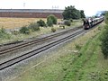
 North Wales Coast Line - geograph.org.uk - 4391990.jpg 640 × 480; 95 KB
-
 North Wales Coast Line between Chester and Saltney.jpg 2,048 × 1,536; 847 KB
-
 North Wales Coast Line from Canal Street, Chester.JPG 4,320 × 3,240; 4.68 MB
-
 North Wales coast line from Chester city walls.jpg 4,320 × 3,240; 3.78 MB
-
 North Wales Coast Line from Curzon Park North, Chester.JPG 3,456 × 4,608; 3.38 MB
-
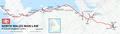
 North Wales Coast Line map.png 960 × 459; 314 KB
-
 North Wales coast railway line - geograph.org.uk - 128339.jpg 640 × 480; 60 KB
-
 North Wales Main line Map.png 7,000 × 2,000; 5.42 MB
-
 Penmaenmawr railway and sea - geograph.org.uk - 154038.jpg 640 × 480; 72 KB
-
 Rail bridge, Queensferry 1.JPG 3,648 × 2,736; 3.61 MB
-
 Rail bridge, Queensferry 2.JPG 3,648 × 2,736; 3.58 MB
-
 Rail cutting and tunnel near Beeston Castle (5349).jpg 4,288 × 2,848; 6.43 MB
-
 Rail Repairs - geograph.org.uk - 335295.jpg 640 × 480; 43 KB
-
 Railway arch, Conwy Town Walls (8061).jpg 4,288 × 2,848; 6.51 MB
-
 Railway arch, Conwy town walls (8086).jpg 4,288 × 2,848; 5.95 MB
-
 Railway cutting outside Bangor - geograph.org.uk - 156614.jpg 640 × 480; 168 KB
-
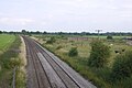
 Railway line - geograph.org.uk - 120566.jpg 640 × 480; 73 KB
-
 Railway Line near Llanddaniel Fab - geograph.org.uk - 113568.jpg 640 × 480; 136 KB
-
 Railway line near to Beeston Castle - geograph.org.uk - 108893.jpg 640 × 480; 167 KB
-
 Railway line near to Star - geograph.org.uk - 120653.jpg 640 × 480; 67 KB
-
 Railway Line Saltney Ferry - geograph.org.uk - 38599.jpg 640 × 480; 176 KB
-
 Railway lines in trees (48810565157).jpg 4,032 × 3,024; 1.81 MB
-

-

-
 Snowy Day at Queensferry - geograph.org.uk - 1470474.jpg 640 × 480; 89 KB
-
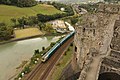
 Steam train passes Conwy Castle - geograph.org.uk - 1355096.jpg 640 × 430; 109 KB
-
-
 The Cardiff train passes Conwy Castle - geograph.org.uk - 1073086.jpg 640 × 480; 143 KB
-
 The Cheshire Plain - geograph.org.uk - 218682.jpg 640 × 480; 31 KB
-
 The Chester-Shrewsbury railway line - geograph.org.uk - 1819310.jpg 3,888 × 2,592; 2.92 MB
-
 The Chester-Shrewsbury railway line - geograph.org.uk - 1819329.jpg 3,888 × 2,592; 2.89 MB
-
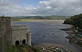
 The Conway tubular bridge on the Chester & Holyhead Railway.jpeg 900 × 659; 313 KB
-

-
 The railway east of Llanfaelog - geograph.org.uk - 1050511.jpg 640 × 480; 52 KB
-
 The railway line behind the wall - geograph.org.uk - 761977.jpg 640 × 324; 53 KB
-

-
 The town of Conway, its church, Plasmawr, wall, towers, &c.jpeg 900 × 693; 351 KB
-
 The town of Conway.jpeg 900 × 598; 358 KB
-
 Traeth Mawr Viaduct IMG 3510c copy.jpg 1,500 × 1,125; 556 KB
-
 Traeth Mawr Viaduct IMG 3517c copy.jpg 1,500 × 1,125; 355 KB
-
 Train arriving - geograph.org.uk - 4128231.jpg 1,024 × 683; 284 KB
-
 Train from Conwy Castle - panoramio.jpg 3,648 × 2,736; 3.53 MB
-
 Train line and A55 North Wales Expressway road - geograph.org.uk - 6297836.jpg 1,024 × 768; 218 KB
-
 Train Passing Conwy Castle - panoramio.jpg 4,320 × 3,240; 4.91 MB
-
 View northeast from Canal Road bridge, Chester.jpg 4,872 × 3,174; 11.88 MB
-

-
 View southwest from Canal Road bridge, Chester.jpg 4,938 × 2,952; 13.03 MB
-
 Welsh Pine Tree.jpg 2,208 × 2,944; 2.59 MB

.jpg)


.jpg)


.jpg)

.jpg)
.jpg)


.jpg)


