Category:North Berwick (civil parish)
Jump to navigation
Jump to search
Scottish parish in East Lothian, Scotland, UK | |||||
| Upload media | |||||
| Instance of | |||||
|---|---|---|---|---|---|
| Part of |
| ||||
| Named after | |||||
| Location |
| ||||
| Population |
| ||||
| Area |
| ||||
 | |||||
Subcategories
This category has the following 3 subcategories, out of 3 total.
Media in category "North Berwick (civil parish)"
The following 200 files are in this category, out of 1,247 total.
(previous page) (next page)-
 "The watcher" - geograph.org.uk - 4881378.jpg 480 × 640; 284 KB
-
 18th century tombstone - geograph.org.uk - 3545484.jpg 1,920 × 2,473; 1.4 MB
-
 18th century tombstone - geograph.org.uk - 3545485.jpg 1,920 × 2,433; 1.27 MB
-
 33 - 45 Victoria Road - geograph.org.uk - 6675265.jpg 1,024 × 678; 573 KB
-
 5 Marine Parade, North Berwick - geograph.org.uk - 6068504.jpg 2,448 × 3,264; 2.07 MB
-
 66 High Street - geograph.org.uk - 6666981.jpg 678 × 1,024; 677 KB
-
 A carpet of crocuses at North Berwick - geograph.org.uk - 2293907.jpg 427 × 640; 172 KB
-
 A carrion crow at North Berwick golf course - geograph.org.uk - 6351978.jpg 1,024 × 772; 472 KB
-

-
 A Fine Display of Crocus in Bloom in North Berwick - geograph.org.uk - 6074449.jpg 1,536 × 2,048; 1.49 MB
-
 A host of golden daffodils in North Berwick - geograph.org.uk - 6804869.jpg 1,600 × 1,107; 747 KB
-
 A North Berwick street - geograph.org.uk - 2981484.jpg 480 × 640; 191 KB
-
 A Photo-finish at North Berwick Harbour - geograph.org.uk - 1898217.jpg 2,560 × 1,920; 3.1 MB
-
 A ripening crop field near Wamphry - geograph.org.uk - 916176.jpg 640 × 427; 125 KB
-
 A Seat with a View at North Berwick - geograph.org.uk - 5907655.jpg 2,048 × 1,536; 1.15 MB
-
 A squally shower over North Berwick Law - geograph.org.uk - 2964173.jpg 640 × 421; 271 KB
-

-

-
 A wooded quarry site under North Berwick Law - geograph.org.uk - 6746805.jpg 1,024 × 683; 575 KB
-
 A198 approaching Castleton - geograph.org.uk - 5892733.jpg 1,024 × 683; 232 KB
-
 A198 towards Whitekirk - geograph.org.uk - 2953580.jpg 640 × 480; 58 KB
-
 A198 towards Whitekirk - geograph.org.uk - 2953684.jpg 640 × 480; 47 KB
-
 Abbey Church, High Street, North Berwick - geograph.org.uk - 2006547.jpg 4,352 × 3,264; 3.04 MB
-
 Abbey Church, North Berwick - geograph.org.uk - 4596078.jpg 3,225 × 2,419; 1.86 MB
-
 Abbey Road - Westgate junction - geograph.org.uk - 3332393.jpg 3,264 × 2,448; 2.5 MB
-
 Above Canty Bay - geograph.org.uk - 6734750.jpg 1,024 × 768; 202 KB
-
 Act of Union Beeches - geograph.org.uk - 931966.jpg 480 × 640; 87 KB
-

-

-

-
 An ornamental lamp at North Berwick - geograph.org.uk - 2977452.jpg 427 × 640; 224 KB
-
 An ornamental lamp at North Berwick - geograph.org.uk - 2977453.jpg 639 × 513; 202 KB
-
 An overgrown car park - geograph.org.uk - 6746947.jpg 1,024 × 683; 579 KB
-

-
 Anchor, North Berwick - geograph.org.uk - 2315811.jpg 800 × 530; 81 KB
-
 Approach to North Berwick - geograph.org.uk - 3753710.jpg 1,024 × 678; 188 KB
-
 Approaches to Tantallon Castle - geograph.org.uk - 2903865.jpg 640 × 480; 81 KB
-

-
 Arable land, Balgone - geograph.org.uk - 5269384.jpg 1,024 × 576; 287 KB
-
 Arctic Tern Sculpture - geograph.org.uk - 2443298.jpg 435 × 640; 352 KB
-

-

-
 Ash trees and hedgerow - geograph.org.uk - 5128355.jpg 3,264 × 2,448; 3.77 MB
-
 At the Lodge Grounds North Berwick - geograph.org.uk - 6812699.jpg 1,600 × 1,200; 337 KB
-
 At the summit of North Berwick Law - geograph.org.uk - 6351973.jpg 1,024 × 691; 391 KB
-
 Attempting to deflect hostility - geograph.org.uk - 6679651.jpg 1,024 × 768; 202 KB
-
 Attractive Houses in the Quadrant North Berwick - geograph.org.uk - 5401123.jpg 2,048 × 1,536; 1.2 MB
-
 Attractive Houses in the Quadrant North Berwick - geograph.org.uk - 5401130.jpg 2,048 × 1,536; 1.21 MB
-
 Awned wheat at Gleghornie - geograph.org.uk - 5868303.jpg 3,044 × 2,278; 3.53 MB
-
 B1347 towards Kingston - geograph.org.uk - 2953084.jpg 640 × 480; 48 KB
-
 B1347 towards Kingston - geograph.org.uk - 2953130.jpg 640 × 480; 42 KB
-
 B1347 towards North Berwick - geograph.org.uk - 2953175.jpg 640 × 480; 46 KB
-
 B1347 towards North Berwick - geograph.org.uk - 2953185.jpg 640 × 480; 50 KB
-
 Back of Couper Avenue, North Berwick - geograph.org.uk - 6553270.jpg 800 × 600; 184 KB
-
 Back of Houses at Lorne Square North Berwick - geograph.org.uk - 5708574.jpg 2,048 × 1,536; 1.03 MB
-
 Balance pond, Gilsland - geograph.org.uk - 6796672.jpg 1,024 × 803; 294 KB
-
 Bales near Craigmoor - geograph.org.uk - 2747117.jpg 3,264 × 2,448; 4.43 MB
-
 Balgone Heughs - geograph.org.uk - 4209913.jpg 800 × 450; 323 KB
-
 Balgone Heughs - geograph.org.uk - 4881374.jpg 640 × 480; 369 KB
-
 Balgone Heughs - geograph.org.uk - 5128159.jpg 3,264 × 2,448; 3.87 MB
-
 Balgone Heughs - geograph.org.uk - 6586469.jpg 1,024 × 768; 358 KB
-
 Balgone Lake - geograph.org.uk - 6580334.jpg 1,024 × 768; 428 KB
-
 Balgone Lake - geograph.org.uk - 6761653.jpg 1,024 × 683; 305 KB
-
 Balgone Loch - geograph.org.uk - 3056426.jpg 800 × 530; 150 KB
-
 Balgone Windmill - geograph.org.uk - 2953140.jpg 1,024 × 809; 67 KB
-
 Balgone Windmill - geograph.org.uk - 4881376.jpg 480 × 640; 180 KB
-
 Balgone windmill - geograph.org.uk - 5128171.jpg 3,264 × 2,448; 4.72 MB
-
 Balgone windmill from the north - geograph.org.uk - 5128172.jpg 3,264 × 2,448; 4.14 MB
-
 Bareback rider - geograph.org.uk - 2710276.jpg 1,690 × 1,282; 367 KB
-
 Barley - geograph.org.uk - 4098341.jpg 640 × 360; 201 KB
-
 Barley Brae housing development, North Berwick - geograph.org.uk - 5892737.jpg 1,024 × 683; 202 KB
-
 Barley field, Sherriff Hall - geograph.org.uk - 3056485.jpg 800 × 530; 129 KB
-
 Barley near Leuchie - geograph.org.uk - 4098319.jpg 640 × 360; 181 KB
-
 Barley near Leuchie - geograph.org.uk - 4100410.jpg 640 × 360; 174 KB
-
 Barley near North Berwick - geograph.org.uk - 4098290.jpg 640 × 360; 195 KB
-
 Barley, North Berwick - geograph.org.uk - 4098281.jpg 800 × 565; 294 KB
-
 Barley, North Berwick - geograph.org.uk - 4100016.jpg 640 × 480; 250 KB
-
 Barley, North Berwick - geograph.org.uk - 4100020.jpg 640 × 360; 231 KB
-
 Barley, Rockville - geograph.org.uk - 2481389.jpg 640 × 480; 262 KB
-
 Basalt crag at Rockville Heughs - geograph.org.uk - 6498971.jpg 1,246 × 1,782; 505 KB
-
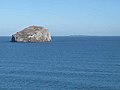
 Bass Rock - geograph.org.uk - 4520811.jpg 1,024 × 768; 106 KB
-
 Bass Rock - geograph.org.uk - 5337916.jpg 2,000 × 1,333; 1.51 MB
-
 Bass Rock - geograph.org.uk - 5666222.jpg 640 × 480; 180 KB
-
 Bass Rock - geograph.org.uk - 6683448.jpg 1,024 × 678; 663 KB
-

-
 Bass Rock and the Isle of May - geograph.org.uk - 2903875.jpg 640 × 480; 51 KB
-
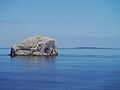 Bass Rock And The Isle Of May - geograph.org.uk - 5397616.jpg 1,600 × 1,201; 216 KB
-
 Bass Rock from Leckmoran Ness - geograph.org.uk - 3752963.jpg 1,024 × 678; 188 KB
-
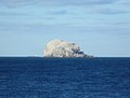
 Bass Rock from North Berwick Golf Club - geograph.org.uk - 2637511.jpg 1,600 × 1,083; 626 KB
-
 Bass Rock from Tantallon Castle - geograph.org.uk - 5070899.jpg 1,024 × 682; 91 KB
-
 Bass Rock from Tantallon Castle - geograph.org.uk - 5070900.jpg 1,024 × 682; 145 KB
-
 Bass Rock from Tantallon Castle - geograph.org.uk - 5070969.jpg 1,024 × 682; 102 KB
-
 Bass Rock From Tantallon Castle - geograph.org.uk - 5397612.jpg 1,600 × 1,201; 369 KB
-
 Bass Rock from the harbour rocks - geograph.org.uk - 3545720.jpg 2,517 × 1,912; 615 KB
-
 Bass Rock from the seafront, East Bay - geograph.org.uk - 3545730.jpg 2,505 × 1,920; 1.56 MB
-
 Bass Rock seen from Cafe above Canty Bay - geograph.org.uk - 5871168.jpg 2,048 × 1,536; 890 KB
-
 Bass Rock viewed from Heugh Brae - geograph.org.uk - 5763529.jpg 800 × 511; 142 KB
-
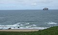
 Bass Rock viewed from North Berwick - geograph.org.uk - 5763136.jpg 800 × 453; 94 KB
-
 Bass Rock ^ Tantallon Castle - 1981 - geograph.org.uk - 2245038.jpg 2,272 × 1,521; 665 KB
-
 Bass Rock ^ Tantallon Castle - 1986 - geograph.org.uk - 2257464.jpg 2,272 × 1,515; 421 KB
-
 Bay below Tantallon Castle - geograph.org.uk - 6683437.jpg 1,024 × 678; 724 KB
-
 Bay below Tantallon Castle - geograph.org.uk - 6683439.jpg 1,024 × 678; 627 KB
-
 Bay beside Tantallon Castle - geograph.org.uk - 5070959.jpg 1,024 × 682; 197 KB
-
 Beach at Milsey Bay North Berwick - geograph.org.uk - 5907660.jpg 2,048 × 1,536; 1.47 MB
-
 Beach at North Berwick - geograph.org.uk - 6177820.jpg 4,592 × 3,448; 2.07 MB
-
 Beach at Rugged Knowes - geograph.org.uk - 5810466.jpg 640 × 477; 52 KB
-
 Beach Huts, North Berwick - geograph.org.uk - 5625736.jpg 3,888 × 2,592; 2.46 MB
-
 Beach, North Berwick - geograph.org.uk - 6666656.jpg 1,024 × 678; 776 KB
-
 Becky's Strip - geograph.org.uk - 3558533.jpg 640 × 480; 262 KB
-
 Becky's Strip - geograph.org.uk - 3558538.jpg 640 × 480; 260 KB
-
 Becky's Strip - geograph.org.uk - 4098334.jpg 640 × 360; 265 KB
-
 Becky's Strip - geograph.org.uk - 4100438.jpg 640 × 360; 273 KB
-
 Becky's Strip - geograph.org.uk - 4100446.jpg 640 × 360; 218 KB
-
 Becky's Strip - geograph.org.uk - 4100463.jpg 640 × 360; 215 KB
-
 Becky's Strip - geograph.org.uk - 4363874.jpg 800 × 450; 309 KB
-
 Becky's Strip - geograph.org.uk - 5880510.jpg 1,024 × 1,024; 794 KB
-
 Becky's Strip - geograph.org.uk - 6580252.jpg 1,024 × 768; 520 KB
-
 Becky's Strip - geograph.org.uk - 6585026.jpg 1,024 × 768; 264 KB
-
 Bedouin Boys Search for Stolen Scaffolding Plank - geograph.org.uk - 1860539.jpg 2,560 × 1,920; 3.21 MB
-
 Behind the Manse - geograph.org.uk - 6065626.jpg 1,024 × 683; 484 KB
-
 Ben Sayers - biographical plaque - geograph.org.uk - 3332379.jpg 2,318 × 2,055; 1.71 MB
-
 Ben Sayers at North Berwick - geograph.org.uk - 3332374.jpg 3,264 × 2,448; 4.58 MB
-
 Ben Sayers Park, North Berwick - geograph.org.uk - 4882280.jpg 640 × 480; 291 KB
-
 Benchmark on shop, North Berwick - geograph.org.uk - 4543635.jpg 640 × 480; 63 KB
-
 Berwick Law above North Berwick - geograph.org.uk - 6748275.jpg 1,024 × 683; 163 KB
-
 Berwick Law from above the harbour - geograph.org.uk - 3545708.jpg 2,541 × 1,869; 1.16 MB
-
 Beside Pilgrim's Way - geograph.org.uk - 6796623.jpg 1,024 × 768; 228 KB
-
 Between Gilbert Avenue and Lochbridge Road - geograph.org.uk - 5529844.jpg 1,024 × 683; 534 KB
-
 Between the lochs, Balgone - geograph.org.uk - 2541146.jpg 640 × 480; 360 KB
-
 Bikes, North Berwick - geograph.org.uk - 2994046.jpg 640 × 360; 251 KB
-
 Blackdykes - geograph.org.uk - 2953720.jpg 640 × 480; 48 KB
-
 Blackdykes Cottages - geograph.org.uk - 2747160.jpg 3,264 × 2,448; 4.36 MB
-
 Blackdykes Strip - geograph.org.uk - 2747172.jpg 3,264 × 2,448; 6.18 MB
-
 Blackdykes Strip - geograph.org.uk - 4098299.jpg 640 × 360; 287 KB
-
 Blocking the corner cutters - geograph.org.uk - 5880458.jpg 1,024 × 1,024; 553 KB
-
 Boats in North Berwick Harbour - geograph.org.uk - 3545646.jpg 640 × 480; 84 KB
-
 Boats in North Berwick harbour - geograph.org.uk - 5516236.jpg 1,024 × 681; 257 KB
-
 Boats, North Berwick Harbour - geograph.org.uk - 5777162.jpg 4,148 × 2,765; 3.6 MB
-
 Bollard - North Berwick Harbour - geograph.org.uk - 6069167.jpg 2,002 × 2,549; 2.45 MB
-
 Bonfire smoke, Wamphray - geograph.org.uk - 6761654.jpg 1,024 × 683; 195 KB
-
 Bonnington - geograph.org.uk - 4100485.jpg 640 × 360; 212 KB
-
 Bonnington and The Law - geograph.org.uk - 3440284.jpg 640 × 480; 236 KB
-
 Bonnington Farm - geograph.org.uk - 3058833.jpg 640 × 480; 230 KB
-
 Broad Beans and the Bass Rock - geograph.org.uk - 5681637.jpg 3,264 × 2,448; 3.11 MB
-
 Broken Ash tree - geograph.org.uk - 5128352.jpg 3,264 × 2,448; 4.04 MB
-
 Building site, Gilsland - geograph.org.uk - 6796618.jpg 1,024 × 768; 153 KB
-
 Buildings in Lodge Grounds North Berwick - geograph.org.uk - 6812659.jpg 1,200 × 1,600; 444 KB
-
 Buildings in the Lodge Grounds North Berwick - geograph.org.uk - 6812681.jpg 1,600 × 1,200; 735 KB
-
 Buildings in the Lodge Grounds North Berwick - geograph.org.uk - 6812713.jpg 1,600 × 1,200; 650 KB
-
 Buildings in the Lodge Grounds North Berwick - geograph.org.uk - 6812723.jpg 1,600 × 1,200; 673 KB
-
 Buoy off Canty Bay, North Berwick - geograph.org.uk - 5515802.jpg 1,024 × 681; 108 KB
-
 Cabbages, North Berwick - geograph.org.uk - 4100655.jpg 640 × 640; 389 KB
-
 Canty Bay - geograph.org.uk - 2953577.jpg 640 × 387; 47 KB
-
 Canty Bay - geograph.org.uk - 4520806.jpg 1,024 × 768; 114 KB
-
 Canty Bay - geograph.org.uk - 5906229.jpg 2,048 × 1,536; 2.27 MB
-
 Canty Bay - geograph.org.uk - 6519748.jpg 1,024 × 768; 205 KB
-
 Canty Bay - geograph.org.uk - 6616321.jpg 6,807 × 3,484; 6.4 MB
-
 Canty Bay - geograph.org.uk - 6633996.jpg 640 × 361; 46 KB
-
 Canty Bay - geograph.org.uk - 6634364.jpg 640 × 360; 77 KB
-
 Canty Bay - geograph.org.uk - 6675546.jpg 1,024 × 678; 641 KB
-
 Canty Bay - geograph.org.uk - 6675547.jpg 1,024 × 678; 734 KB
-
 Canty Bay - geograph.org.uk - 6734746.jpg 1,024 × 768; 231 KB
-
 Canty Bay North Berwick - geograph.org.uk - 5871146.jpg 2,048 × 1,536; 1.03 MB
-
 Canty Bay Rocks - geograph.org.uk - 6748380.jpg 1,024 × 683; 225 KB
-
 Carpet Bed Display in Lodge Grounds at North Berwick - geograph.org.uk - 6804788.jpg 1,600 × 1,200; 903 KB
-
 Carpet Bed Display in Lodge Grounds at North Berwick - geograph.org.uk - 6804822.jpg 1,600 × 1,200; 723 KB
-
 Carved Figure of Ben Sayers at North Berwick - geograph.org.uk - 5870984.jpg 2,048 × 1,536; 1.33 MB
-
 Castle harbour (1) - geograph.org.uk - 5027521.jpg 4,273 × 3,205; 3.15 MB
-
 Castle harbour (2) - geograph.org.uk - 5027525.jpg 4,283 × 3,213; 2.06 MB
-
 Castleton - 1999 - geograph.org.uk - 4410486.jpg 2,272 × 1,704; 208 KB
-
 Castleton Cottages - geograph.org.uk - 2953590.jpg 640 × 353; 36 KB
-
 Castleton Farmhouse (3980475756).jpg 1,599 × 911; 207 KB
-
 Castleton Farmhouse - geograph.org.uk - 916255.jpg 640 × 427; 117 KB
-
 Castleton from Tantallon Castle - geograph.org.uk - 5070923.jpg 1,024 × 682; 166 KB
-
 Castleton house and farm - geograph.org.uk - 3340683.jpg 3,264 × 2,448; 5.36 MB
-
 Castleton in East Lothian - geograph.org.uk - 5810481.jpg 640 × 413; 83 KB
-
 Catherine Watson Memorial - geograph.org.uk - 3545626.jpg 640 × 469; 55 KB
-
 Catherine Watson Memorial - geograph.org.uk - 3545631.jpg 480 × 640; 56 KB
-
 Cattle near Wamphray - geograph.org.uk - 5128195.jpg 3,264 × 2,448; 4.93 MB
-
 CCTV Herefords - geograph.org.uk - 4100479.jpg 640 × 360; 255 KB
-
 Celtic Cross Memorial North Berwick - geograph.org.uk - 3668907.jpg 3,168 × 4,752; 6.88 MB
-
 Celtic Cross Memorial North Berwick - geograph.org.uk - 3668928.jpg 2,294 × 4,242; 6.46 MB
-
 Celtic Cross North Berwick - geograph.org.uk - 2340285.jpg 640 × 480; 43 KB
-
 Cereal field at Chapel farm - geograph.org.uk - 2446718.jpg 2,592 × 1,944; 2.15 MB
-
 Changing Booths at North Berwick - geograph.org.uk - 6460261.jpg 5,184 × 3,888; 3.35 MB
-
 Christmas Time in Quality Street North Berwick - geograph.org.uk - 6708439.jpg 1,600 × 1,200; 496 KB
-
 Christmas Time in Quality Street North Berwick - geograph.org.uk - 6708447.jpg 1,600 × 1,248; 467 KB
-
 Christmas Time in Quality Street North Berwick - geograph.org.uk - 6708450.jpg 1,600 × 1,236; 493 KB
-
 Cliff path round the golf course - geograph.org.uk - 3752950.jpg 1,024 × 678; 205 KB
-
 Cliffs above Oxroad Bay - geograph.org.uk - 4481611.jpg 3,504 × 2,336; 3.01 MB
-
 Clothes moth heaven - geograph.org.uk - 964809.jpg 480 × 640; 127 KB
-

-

-

-

-

-
 Coastal East Lothian , Bedouin at North Berwick Harbour - geograph.org.uk - 2094053.jpg 2,560 × 1,920; 3.13 MB
-

-
 Coastal East Lothian , Bloke In A Boat at North Berwick - geograph.org.uk - 2444890.jpg 2,560 × 1,920; 2.55 MB
-


_-_geograph.org.uk_-_5027521.jpg)
_-_geograph.org.uk_-_5027525.jpg)


.jpg)


&filefrom=Coastal+East+Lothian+%2C+Canty+Bay+%28East+Beach%29%2C+near+North+Berwick+-+geograph.org.uk+-+2296873.jpg#mw-category-media)