Category:Morton, Dumfries and Galloway
Jump to navigation
Jump to search
Scottish parish in Dumfries and Galloway, Scotland, UK | |||||
| Upload media | |||||
| Instance of | |||||
|---|---|---|---|---|---|
| Location |
| ||||
| Population |
| ||||
| Area |
| ||||
 | |||||
Subcategories
This category has the following 3 subcategories, out of 3 total.
C
- Carronhill Glen Viaduct (3 F)
T
Media in category "Morton, Dumfries and Galloway"
The following 200 files are in this category, out of 314 total.
(previous page) (next page)-
 12 and 14 East Morton Street, Thornhill - geograph.org.uk - 5166101.jpg 1,600 × 1,018; 328 KB
-
 15 and 15A East Morton Street, Thornhill - geograph.org.uk - 5167564.jpg 1,600 × 1,090; 283 KB
-
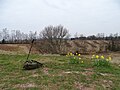
 5 bar gate above Carron Linns, Durisdeer - geograph.org.uk - 5241511.jpg 1,600 × 1,200; 548 KB
-
 86 South Drumlanrig Street, Thornhill - geograph.org.uk - 5782455.jpg 1,600 × 1,012; 382 KB
-
 A 76 crossing Cample Water - geograph.org.uk - 2003836.jpg 1,600 × 1,159; 204 KB
-
 A 76 entering Thornhill - geograph.org.uk - 2003852.jpg 1,024 × 715; 96 KB
-
 A 76, Carronbridge - geograph.org.uk - 2003904.jpg 640 × 480; 81 KB
-
 A minor road and Muirhead Cottage - geograph.org.uk - 3698507.jpg 4,382 × 3,130; 2.01 MB
-
 A sharp bend on the road to Thornhill - geograph.org.uk - 3698539.jpg 4,402 × 3,164; 2.16 MB
-
 A track across the fields - geograph.org.uk - 3698519.jpg 4,608 × 3,456; 2.79 MB
-
 A track to Morton Castle - geograph.org.uk - 3698483.jpg 4,608 × 3,456; 4.91 MB
-
 A trap on Wedder Law - geograph.org.uk - 2736137.jpg 640 × 480; 130 KB
-
 A702 junction at Thornhill - geograph.org.uk - 3476853.jpg 640 × 392; 67 KB
-
 A76 approaching road in Carronbridge - geograph.org.uk - 3476758.jpg 640 × 424; 83 KB
-
 A76 at Meadowbank - geograph.org.uk - 3476763.jpg 640 × 327; 58 KB
-

-
 A76 entering Thornhill - geograph.org.uk - 3476855.jpg 640 × 337; 76 KB
-
 A76 north out of Thornhill - geograph.org.uk - 5208284.jpg 1,024 × 682; 207 KB
-
 A76 southbound near Moss Wood - geograph.org.uk - 4580682.jpg 640 × 481; 70 KB
-
 A76, Thornhill, roadworks - geograph.org.uk - 4259876.jpg 640 × 439; 81 KB
-

-
 Approaching Burnbrae - geograph.org.uk - 3698493.jpg 4,492 × 3,296; 2.61 MB
-
 Approaching Cample Cleuch - geograph.org.uk - 2295468.jpg 640 × 480; 79 KB
-
 Approaching Thornhill - geograph.org.uk - 3698549.jpg 4,556 × 3,386; 2.19 MB
-
 Ashy Cleuch - geograph.org.uk - 6505329.jpg 1,600 × 778; 572 KB
-
 Autumn Woodland - geograph.org.uk - 2179870.jpg 640 × 427; 153 KB
-
 B732 junction at Langmyre Mains - geograph.org.uk - 3476852.jpg 640 × 450; 77 KB
-
 Bank of Scotland, Thornhill - geograph.org.uk - 5782422.jpg 1,600 × 1,086; 301 KB
-
 Beech hedge near Langmyre Farm - geograph.org.uk - 3852926.jpg 768 × 1,024; 301 KB
-
 Beeches near Thornhill Station - geograph.org.uk - 3232870.jpg 640 × 480; 316 KB
-
 Bellybought Hill - geograph.org.uk - 6290244.jpg 1,024 × 577; 199 KB
-
 Bellybought Hill trig - geograph.org.uk - 3605190.jpg 1,600 × 1,067; 509 KB
-
 BellZ - geograph.org.uk - 3232864.jpg 640 × 480; 278 KB
-
 Borrow pit, Clintycleuch Rig - geograph.org.uk - 5804675.jpg 1,024 × 683; 362 KB
-
 Bridge over railway - geograph.org.uk - 925383.jpg 640 × 480; 66 KB
-
 Buccleuch and Queensberry Arms Hotel - geograph.org.uk - 3473075.jpg 640 × 480; 263 KB
-
 Burnbrae road - geograph.org.uk - 925342.jpg 640 × 480; 66 KB
-
 Cample Cleugh from Cairns Hill - geograph.org.uk - 2295428.jpg 640 × 480; 101 KB
-
 Cample Water - geograph.org.uk - 2295410.jpg 640 × 480; 89 KB
-
 Canada Geese on Morton Loch - geograph.org.uk - 4523963.jpg 1,024 × 748; 255 KB
-
 Carron foot Saw Mill Cottage - geograph.org.uk - 1232894.jpg 640 × 480; 103 KB
-
 Carron Linns, Durisdeer - geograph.org.uk - 5241107.jpg 1,600 × 1,200; 896 KB
-
 Carronbank row , Carronbridge - geograph.org.uk - 3663904.jpg 1,024 × 768; 171 KB
-
 Carronbridge - geograph.org.uk - 3501340.jpg 4,320 × 3,240; 3.14 MB
-
 Carronbridge - geograph.org.uk - 6493168.jpg 1,600 × 778; 512 KB
-
 Carronbridge and Lowther hills - geograph.org.uk - 4517250.jpg 1,024 × 768; 179 KB
-
 Carronbridge, New Year's Day - geograph.org.uk - 6014679.jpg 2,976 × 1,984; 3.6 MB
-
 Carronbridge, New Year's Day - geograph.org.uk - 6014682.jpg 2,976 × 1,984; 2.89 MB
-
 Central Thornhill - geograph.org.uk - 4670603.jpg 1,024 × 768; 107 KB
-
 Centre of Thornhill - geograph.org.uk - 3220763.jpg 1,200 × 803; 197 KB
-
 Centre of Thornhill - geograph.org.uk - 5804580.jpg 1,024 × 683; 303 KB
-
 Christmas day - Carronbridge village - geograph.org.uk - 3789394.jpg 1,024 × 768; 295 KB
-
 Co-op, Thornhill - geograph.org.uk - 6014705.jpg 2,976 × 1,984; 2.25 MB
-
 Community centre, Thornhill - geograph.org.uk - 6146455.jpg 1,024 × 577; 175 KB
-
 Cottage - geograph.org.uk - 925332.jpg 640 × 480; 64 KB
-
 Cottage at Kettletonhead - geograph.org.uk - 4386970.jpg 4,608 × 3,456; 5.07 MB
-
 Cottages at Morton Mill - geograph.org.uk - 5804075.jpg 4,608 × 3,456; 5.33 MB
-
 Crossroads in the centre of Thornhill - geograph.org.uk - 3698590.jpg 4,538 × 3,360; 2.1 MB
-
 Dabton Loch - geograph.org.uk - 3852910.jpg 1,024 × 768; 282 KB
-
 Daer Reservoir - geograph.org.uk - 3559140.jpg 3,264 × 2,448; 3.05 MB
-
 Derelict buildings - geograph.org.uk - 3698559.jpg 4,512 × 3,326; 2.1 MB
-
 Drumcork - geograph.org.uk - 6167985.jpg 1,024 × 577; 196 KB
-
 Drumlanrig Cafe - geograph.org.uk - 1820347.jpg 640 × 480; 80 KB
-
 Drumlanrig Restaurant - geograph.org.uk - 5804986.jpg 1,024 × 683; 261 KB
-
 Drumlanrig Restaurant, East Morton Street - geograph.org.uk - 5167638.jpg 1,600 × 1,054; 350 KB
-
 Drumlanrig Street (A76) - geograph.org.uk - 3698610.jpg 4,572 × 3,408; 2.46 MB
-
 Drumlanrig Street - geograph.org.uk - 3230782.jpg 640 × 480; 273 KB
-
 Drumlanrig Street, Thornhill - geograph.org.uk - 3949183.jpg 1,920 × 1,280; 1.58 MB
-
 Drumlanrig Street, Thornhill - geograph.org.uk - 3949233.jpg 1,920 × 1,280; 1.62 MB
-
 Drumlanrig Street, Thornhill - geograph.org.uk - 3949237.jpg 1,920 × 1,280; 1.61 MB
-
 Drumlanrig Street, Thornhill - geograph.org.uk - 3949238.jpg 1,920 × 1,280; 1.54 MB
-
 Drumlanrig Street, Thornhill - geograph.org.uk - 3949240.jpg 1,920 × 1,280; 1.71 MB
-
 Drumlanrig Street, Thornhill - geograph.org.uk - 5045815.jpg 1,714 × 1,156; 370 KB
-
 Drumlanrig Street, Thornhill - geograph.org.uk - 5045822.jpg 1,731 × 1,165; 408 KB
-
 Drumlanrig Street, Thornhill - geograph.org.uk - 5167696.jpg 1,600 × 1,061; 270 KB
-
 Drumlanrig Street, Thornhill - geograph.org.uk - 5167730.jpg 1,600 × 997; 271 KB
-
 Drumlanrig Street, Thornhill - geograph.org.uk - 6137168.jpg 1,024 × 683; 280 KB
-
 Drumlanrig Street, Thornhill - geograph.org.uk - 6167260.jpg 1,600 × 900; 313 KB
-
 Drumshinnoch cottages - geograph.org.uk - 4523948.jpg 1,024 × 768; 221 KB
-
 East Morton Cottage - geograph.org.uk - 4811207.jpg 2,592 × 1,944; 2.26 MB
-
 East Morton Farm, from the train - geograph.org.uk - 1463043.jpg 640 × 438; 38 KB
-
 East Morton fields - geograph.org.uk - 925421.jpg 640 × 480; 62 KB
-
 East Morton fields and garden - geograph.org.uk - 925426.jpg 640 × 480; 82 KB
-
 East Morton Hill - geograph.org.uk - 4386872.jpg 4,608 × 3,456; 5.05 MB
-
 East Morton Hill - geograph.org.uk - 5945701.jpg 1,024 × 769; 331 KB
-
 East Morton Street, Thornhill - geograph.org.uk - 3949225.jpg 1,920 × 1,280; 1.82 MB
-
 East Morton Street, Thornhill - geograph.org.uk - 5166139.jpg 1,600 × 991; 331 KB
-
 East Morton Street, Thornhill - geograph.org.uk - 6405846.jpg 1,024 × 768; 147 KB
-
 East Morton view over fields - geograph.org.uk - 925430.jpg 640 × 480; 71 KB
-
 East Newlands Belt - geograph.org.uk - 6167988.jpg 1,024 × 577; 326 KB
-
 Elmarglen Hotel, Thornhill - geograph.org.uk - 5783031.jpg 1,600 × 997; 393 KB
-
 Emperor Moth, Morton Castle - geograph.org.uk - 4745711.jpg 1,600 × 1,057; 345 KB
-
 Entering Thornhill from the south - geograph.org.uk - 4670596.jpg 1,024 × 768; 90 KB
-
 Estate road climbing on Tansley Rig - geograph.org.uk - 3150373.jpg 1,500 × 1,125; 1.32 MB
-
 Farmer's Arms - geograph.org.uk - 1820337.jpg 640 × 480; 84 KB
-
 Farmer's Arms, Thornhill - geograph.org.uk - 6014701.jpg 2,976 × 1,984; 2.2 MB
-
 Farmland near Brownrig - geograph.org.uk - 4114685.jpg 1,920 × 1,280; 1.73 MB
-
 Farmland near Brownrig - geograph.org.uk - 4114692.jpg 1,920 × 1,280; 1.67 MB
-
 Farmland near Greenhead - geograph.org.uk - 1392435.jpg 480 × 640; 59 KB
-
 Farmland near Holestane - geograph.org.uk - 4114700.jpg 1,920 × 1,280; 657 KB
-
 Farmland near Thornhill - geograph.org.uk - 793124.jpg 640 × 480; 76 KB
-
 Farmland to the east of Drumcruilton - geograph.org.uk - 1857851.jpg 640 × 427; 134 KB
-
 Farmland ^ Woodland near Drum Farm - geograph.org.uk - 4114686.jpg 1,920 × 1,280; 1.81 MB
-
 Field entrance - geograph.org.uk - 3230807.jpg 640 × 480; 262 KB
-
 Field, Drum - geograph.org.uk - 5945695.jpg 1,024 × 801; 440 KB
-
 Field, East Morton - geograph.org.uk - 6168092.jpg 1,024 × 577; 220 KB
-
 Filming in Drumlanrig Street - geograph.org.uk - 3705535.jpg 640 × 473; 65 KB
-

-
 Former E U Church, South Drumlanrig Street, Thornhill - geograph.org.uk - 5782425.jpg 1,246 × 1,600; 409 KB
-
 Former East Morton Street Primary School - geograph.org.uk - 5167340.jpg 1,159 × 1,600; 436 KB
-

-
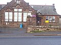
 Former primary school building - geograph.org.uk - 3232865.jpg 640 × 480; 264 KB
-
 Gate on Scaw'd Law - geograph.org.uk - 2257108.jpg 640 × 426; 76 KB
-
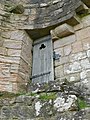
 Gatehouse, Morton Castle - geograph.org.uk - 4745705.jpg 2,793 × 2,093; 2.28 MB
-
 Glenleith Fell - geograph.org.uk - 5804847.jpg 1,024 × 683; 269 KB
-
 Goldie Knoll - 2019 - geograph.org.uk - 6179308.jpg 5,184 × 3,888; 6.52 MB
-
 Goldie Knoll - geograph.org.uk - 5171171.jpg 2,592 × 1,944; 2.3 MB
-
 Goldie Knoll - geograph.org.uk - 6179295.jpg 5,184 × 3,888; 6.92 MB
-
 Goldie Knoll - geograph.org.uk - 6465256.jpg 5,184 × 3,888; 5.67 MB
-
 Goldie Knoll - geograph.org.uk - 6465260.jpg 5,184 × 3,888; 7.18 MB
-
 Goldie Knoll - geograph.org.uk - 6465266.jpg 4,562 × 3,421; 5.09 MB
-
 Goldie Knoll-Gowdey Knowl - geograph.org.uk - 4810239.jpg 2,592 × 1,944; 2.31 MB
-
 Goldie Knoll-Gowdey Knowl - geograph.org.uk - 4810251.jpg 2,592 × 1,944; 2.34 MB
-
 Goldie Knoll-Gowdey Knowl - geograph.org.uk - 4811208.jpg 2,592 × 1,944; 2.38 MB
-
 Goldie Knoll-Gowdey Knowl - geograph.org.uk - 4811209.jpg 2,592 × 1,944; 2.35 MB
-
 Good grazing at Drumcork - geograph.org.uk - 2179747.jpg 640 × 427; 67 KB
-
 Graffiti on tree at Dabton Loch - geograph.org.uk - 3852937.jpg 600 × 800; 132 KB
-
 Greenhead graves - geograph.org.uk - 1392430.jpg 480 × 640; 81 KB
-
 Holestane - geograph.org.uk - 5945698.jpg 1,024 × 769; 383 KB
-
 Horse on the Cross - geograph.org.uk - 3705511.jpg 506 × 640; 17 KB
-
 Intake weir, Glenleith Burn - geograph.org.uk - 5804841.jpg 1,024 × 683; 348 KB
-
 J. McKendrick and Son - geograph.org.uk - 1820343.jpg 480 × 640; 83 KB
-
 Kettleton Bridge and the entrance to Burn - geograph.org.uk - 5547133.jpg 4,000 × 3,000; 4.3 MB
-
 Kettleton Burn - geograph.org.uk - 5804668.jpg 1,024 × 683; 311 KB
-
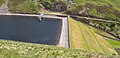
 Kettleton Dam - geograph.org.uk - 2540983.jpg 2,592 × 1,944; 1.36 MB
-
 Kettleton Reservoir - geograph.org.uk - 6505154.jpg 1,600 × 778; 511 KB
-
 Langmyre Mains - geograph.org.uk - 6167984.jpg 1,024 × 577; 220 KB
-
 Laught Mains, Thornhill - geograph.org.uk - 5206800.jpg 1,024 × 682; 106 KB
-
 Log transporter, Drumlanrig Street - geograph.org.uk - 3705547.jpg 640 × 480; 74 KB
-
 Looking south from the track above Kettlleton Reservoir - geograph.org.uk - 2540985.jpg 2,592 × 1,944; 1.4 MB
-
 Looking southeast from Thornhill - geograph.org.uk - 5782464.jpg 1,600 × 1,067; 439 KB
-
 Lunch Hut at Blackhill Moss - geograph.org.uk - 6505081.jpg 1,600 × 778; 396 KB
-
 Main street Thornhill - geograph.org.uk - 2277429.jpg 640 × 426; 203 KB
-
 Manse Road, Thornhill - geograph.org.uk - 1606714.jpg 640 × 391; 74 KB
-
 Mercat Cross on Drumlanrig Street, Thornhill - geograph.org.uk - 3949181.jpg 1,920 × 1,280; 1.53 MB
-
 Minor road beside Moss Wood - geograph.org.uk - 6117516.jpg 4,000 × 3,000; 3.39 MB
-
 Minor road junction - geograph.org.uk - 3698497.jpg 3,303 × 2,092; 1.84 MB
-

-
 Monument to Joseph Thomson - geograph.org.uk - 5166292.jpg 1,063 × 1,600; 430 KB
-
 Monument to Joseph Thomson - geograph.org.uk - 5208277.jpg 1,024 × 682; 186 KB
-
 Morton Castle - geograph.org.uk - 1871743.jpg 3,472 × 2,604; 1.63 MB
-
 Morton Castle - geograph.org.uk - 3501348.jpg 480 × 640; 118 KB
-
 Morton Castle - geograph.org.uk - 4523956.jpg 1,024 × 768; 308 KB
-
 Morton Castle - geograph.org.uk - 4745702.jpg 3,256 × 2,170; 2.79 MB
-
 Morton Castle - geograph.org.uk - 4745708.jpg 3,504 × 2,336; 4.09 MB
-
 Morton Castle - geograph.org.uk - 5712972.jpg 640 × 480; 95 KB
-
 Morton Castle - geograph.org.uk - 5712982.jpg 640 × 480; 94 KB
-
 Morton Castle - geograph.org.uk - 6168074.jpg 1,024 × 577; 221 KB
-
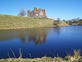
 Morton Castle and Loch - geograph.org.uk - 4745820.jpg 3,504 × 2,336; 3.49 MB
-
 Morton Castle and Loch near Thornhill - geograph.org.uk - 6507958.jpg 1,799 × 1,199; 358 KB
-
 Morton Loch - geograph.org.uk - 1474711.jpg 640 × 480; 82 KB
-
 Morton Loch - geograph.org.uk - 4745412.jpg 3,504 × 2,336; 2.93 MB
-
 Morton Loch - geograph.org.uk - 5712918.jpg 640 × 480; 92 KB
-
 Morton Loch - geograph.org.uk - 6168067.jpg 1,024 × 577; 190 KB
-

-
 Morton Mill, Carronbridge - geograph.org.uk - 5804065.jpg 4,608 × 3,456; 5.08 MB
-
 Morton Parish Church, Thornhill - geograph.org.uk - 5317859.jpg 1,024 × 768; 156 KB
-
 Morton Parish Church, Thornhill - geograph.org.uk - 6397983.jpg 1,024 × 768; 235 KB
-
 Muirhead Cottage - geograph.org.uk - 3698513.jpg 4,608 × 3,456; 2.43 MB
-
 New School - geograph.org.uk - 1471595.jpg 640 × 427; 70 KB
-
 New Street, Thornhill - geograph.org.uk - 3949235.jpg 1,920 × 1,280; 1.49 MB
-
 Nithsdale landscape - geograph.org.uk - 3152038.jpg 3,264 × 2,448; 2.8 MB
-
 North Drumlanrig Street, Thornhill - geograph.org.uk - 6397979.jpg 1,024 × 768; 155 KB
-
 Old barn at Gateslack - geograph.org.uk - 2179780.jpg 640 × 427; 67 KB
-
 Old lower track at Kettleton Burn - geograph.org.uk - 6505508.jpg 1,600 × 778; 478 KB
-

-

-
 Old Morton Academy building , Thornhill - geograph.org.uk - 3675683.jpg 1,024 × 768; 197 KB
-
 Old Morton Academy, Thornhill - geograph.org.uk - 3698567.jpg 4,438 × 3,220; 2.43 MB
-
 Open fields - geograph.org.uk - 3329404.jpg 1,024 × 685; 121 KB
-
 Ordnance Survey Cut Mark with Rivet (missing) - geograph.org.uk - 3718791.jpg 4,000 × 3,000; 4.25 MB
-
 Ordnance Survey Flush Bracket G392 - geograph.org.uk - 3718796.jpg 4,000 × 3,000; 3.83 MB
-
 Ordnance Survey Flush Bracket G395 - geograph.org.uk - 3718829.jpg 4,000 × 3,000; 4.26 MB
-
 Passing storm, Kettletonhead - geograph.org.uk - 5804662.jpg 1,024 × 683; 277 KB
-
 Pasture, Morton - geograph.org.uk - 6290242.jpg 1,024 × 577; 246 KB
-
 Patchy snow cover on Wedder Law - geograph.org.uk - 3409879.jpg 4,608 × 3,456; 5.59 MB
-
 Path by Morton Castle - geograph.org.uk - 6290247.jpg 1,024 × 577; 275 KB
-
 Path to Morton Castle - geograph.org.uk - 4745699.jpg 3,282 × 2,165; 2.71 MB
-
 Police Station, Thornhill - geograph.org.uk - 1389937.jpg 480 × 640; 60 KB
-
 Post box at Burnbrae - geograph.org.uk - 925363.jpg 480 × 640; 92 KB
-
 Post box, Thornhill Post Office - geograph.org.uk - 5783038.jpg 1,600 × 1,242; 423 KB
-
 Post Office, North Drumlanrig Street, Thornhill - geograph.org.uk - 5783036.jpg 1,600 × 1,067; 470 KB
-
 Railway bridge at Drum farm - geograph.org.uk - 4523978.jpg 1,024 × 768; 216 KB
-
 Railway bridge, Carronhill - geograph.org.uk - 6167994.jpg 1,024 × 577; 275 KB
-
 Rhododendron in bloom - geograph.org.uk - 4025496.jpg 1,024 × 768; 343 KB
-
 River Carron - geograph.org.uk - 3504023.jpg 800 × 600; 225 KB
-
 River Carron - geograph.org.uk - 3552591.jpg 800 × 600; 179 KB
-
 Road above Kettleton Reservoir - geograph.org.uk - 5804700.jpg 1,024 × 683; 303 KB
-
 Road and cottages - geograph.org.uk - 925376.jpg 640 × 480; 82 KB
-


_-_geograph.org.uk_-_3698610.jpg)


_-_geograph.org.uk_-_1463049.jpg)


_-_geograph.org.uk_-_3718791.jpg)


