Category:Moats in England
Jump to navigation
Jump to search
Subcategories
This category has the following 20 subcategories, out of 20 total.
*
- Moats in Kent (30 F)
- Moats in Leicestershire (1 F)
B
- Berkhamsted Castle moats (23 F)
- Blo Norton Hall (5 F)
C
- Cooden Moat, Bexhill-on-Sea (6 F)
H
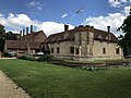
- Harvington Hall (48 F)
I
K
- Kentwell Hall (116 F)
L
- Little Moreton Hall moat (6 F)
M
- Moat Garden, Speke Hall (8 F)
P
- Pendragon Castle (56 F)
R
- Rock moated site (4 F)
Media in category "Moats in England"
The following 128 files are in this category, out of 128 total.
-
 2022-01-29 Rye House (front, wide view).jpg 4,032 × 2,268; 2.84 MB
-
 2022-01-29 Rye House Gatehouse (front).jpg 3,024 × 4,032; 2.95 MB
-
 Acton Trussell Moat House.JPG 838 × 507; 110 KB
-
 Ancient moat - geograph.org.uk - 1075830.jpg 480 × 640; 187 KB
-
 Arley Hall - geograph.org.uk - 921704.jpg 640 × 428; 199 KB
-
 Baddesley.jpg 560 × 373; 82 KB
-
 Beckley Park with moat.jpg 1,600 × 1,200; 380 KB
-
 Birtsmorton Court - geograph.org.uk - 80256.jpg 640 × 402; 49 KB
-
 Bodiam Castle from the south.jpg 1,544 × 1,024; 620 KB
-
 Bodiam Castle with ducks in foreground.jpg 1,605 × 903; 444 KB
-
 Bodiam-castle-10My8-1185.jpg 1,354 × 900; 583 KB
-
 Bodiam-castle-10My8-1188.jpg 1,354 × 900; 707 KB
-
 Bodiam-castle-10My8-1194.jpg 1,354 × 900; 1.01 MB
-
 Bodiam-castle-10My8-1197 (cropped).jpg 800 × 600; 363 KB
-
 Bodiam-castle-10My8-1197.jpg 1,348 × 899; 766 KB
-
 Bodiam-castle-10My8-1216.jpg 1,354 × 900; 721 KB
-
 Bodiam-castle-10My8-1219.jpg 1,354 × 900; 727 KB
-
 Bridge at Hulme Hall 01.jpg 4,000 × 3,000; 6.44 MB
-
 Bridge at Hulme Hall 02.jpg 4,000 × 3,000; 6.14 MB
-
 Bridge at Hulme Hall 03.jpg 4,000 × 3,000; 6.16 MB
-
 Bridge at Hulme Hall 04.jpg 4,000 × 3,000; 6.06 MB
-
 Bridge over moat at Holford Hall.jpg 1,663 × 1,247; 2.06 MB
-
 Bristol Castle Moat (6114199238).jpg 1,024 × 683; 160 KB
-
 Bury Castle bright April 2017.jpg 3,015 × 1,466; 3.8 MB
-
 Bury Castle moat wall.jpg 3,264 × 1,840; 2.56 MB
-
 Clayton Hall, Clayton, Manchester. Moat - geograph.org.uk - 59674.jpg 640 × 480; 150 KB
-
 Coldharbour Moat - geograph.org.uk - 140135.jpg 640 × 480; 154 KB
-
 Dodleston Castle.jpg 4,000 × 3,000; 4.08 MB
-
 Drawbridge and Portcullis, Hever Castle.jpg 3,024 × 4,032; 8.85 MB
-
 Dry moat, Agaton Fort. Plymouth. - geograph.org.uk - 915289.jpg 640 × 480; 161 KB
-
 East side of Moat Mannighton Hall 31 August 2014 .JPG 4,000 × 3,000; 4.15 MB
-
 Farleigh Hungerford Castle 2015 71.jpg 5,184 × 3,456; 5.51 MB
-
 Farleigh Hungerford Castle 2015 72.jpg 3,456 × 5,184; 3.4 MB
-
 Farleigh Hungerford Castle 2015 80.jpg 3,456 × 5,184; 5.06 MB
-
 Framlingham - Castle - geograph.org.uk - 234905.jpg 640 × 480; 93 KB
-
 Hall Bank, Wybunbury 01.jpg 4,000 × 3,000; 5.17 MB
-
 Hall Bank, Wybunbury 02.jpg 4,000 × 3,000; 4.82 MB
-
 Hall Bank, Wybunbury 03.jpg 4,000 × 3,000; 5.09 MB
-
 Hulme Hall Moat.jpg 640 × 480; 196 KB
-
 Hulme Hall Moated Site 01.jpg 4,000 × 3,000; 6.27 MB
-
 Hulme Hall Moated Site 02.jpg 4,000 × 3,000; 6.54 MB
-
 Ightham Mote Bridge.JPG 1,600 × 1,200; 634 KB
-
 Ludlow Castle, bridge across a dry moat - geograph.org.uk - 2238807.jpg 640 × 430; 139 KB
-

-

-
 Madresfield Court - geograph.org.uk - 1764702.jpg 426 × 640; 84 KB
-
 Edinburgh Dome - geograph.org.uk - 303189.jpg 640 × 427; 286 KB
-
 Medieval Moat at Brockhurst Farm - geograph.org.uk - 444857.jpg 600 × 450; 323 KB
-
 Medieval moated site, South Park Farm, Grayswood, Surrey 01.jpg 5,152 × 3,864; 4.46 MB
-
 Medieval moated site, South Park Farm, Grayswood, Surrey 02.jpg 5,152 × 3,864; 4.45 MB
-
 Site of Moat, New Barnetby - geograph.org.uk - 786718.jpg 640 × 427; 108 KB
-
 Minshull Vernon moated site 01.jpg 4,000 × 3,000; 6.22 MB
-
 Minshull Vernon moated site 02.jpg 4,000 × 3,000; 6.6 MB
-
 Moat (with water after heavy rains!!!) - geograph.org.uk - 3035026.jpg 1,600 × 1,200; 807 KB
-
 Moat - geograph.org.uk - 352226.jpg 640 × 480; 182 KB
-
 Moat and earthworks, Weston-sub-Edge - geograph.org.uk - 893752.jpg 640 × 426; 98 KB
-
 Moat at Moat House - geograph.org.uk - 454070.jpg 500 × 375; 240 KB
-
 Moat at Moreton Farm, near Ford - geograph.org.uk - 46689.jpg 640 × 480; 172 KB
-
 Moat at Rochford Hall, Essex.jpg 800 × 600; 411 KB
-
 Moat at Scaleby Castle - geograph.org.uk - 690327.jpg 640 × 478; 365 KB
-
 Moat at Southrey - geograph.org.uk - 434048.jpg 640 × 480; 135 KB
-
 Moat at Strelley - geograph.org.uk - 660545.jpg 640 × 427; 145 KB
-
 Moat by Hurley Hall - geograph.org.uk - 6011990.jpg 5,715 × 3,809; 3.87 MB
-
 Moat in Whomerley Wood, Stevenage (8679487075).jpg 4,288 × 3,216; 4.61 MB
-
 Moat near Cudworth - geograph.org.uk - 1548795.jpg 640 × 484; 104 KB
-
 Moat next the church - geograph.org.uk - 261187.jpg 640 × 480; 134 KB
-
 Moat of Bramber Castle.jpg 3,456 × 4,608; 8.83 MB
-
 Moat, near Saighton Hall Farm - geograph.org.uk - 650754.jpg 640 × 480; 72 KB
-
 Moated site at Lea Hall 01.jpg 4,000 × 3,000; 4.77 MB
-
 Moated site at Lea Hall 02.jpg 4,000 × 3,000; 4.9 MB
-
 Moated site at Lea Hall 03.jpg 4,103 × 3,138; 1.17 MB
-
 Moated site in Wybunbury.jpg 4,000 × 3,000; 4.83 MB
-
 Moated site west of Farnah Hall - geograph.org.uk - 221634.jpg 640 × 465; 107 KB
-
 Moated site, Garshall Green - geograph.org.uk - 1148678.jpg 640 × 457; 182 KB
-
 Moated site, Garshall Green - geograph.org.uk - 1148684.jpg 640 × 457; 168 KB
-
 Moated site, Garshall Green - geograph.org.uk - 1148689.jpg 640 × 480; 154 KB
-
 Moreteyne Manor - geograph.org.uk - 632260.jpg 640 × 480; 112 KB
-
 New Hall, Sutton Coldfield - geograph.org.uk - 397858 crop.jpg 537 × 463; 230 KB
-
 New Manor Farm moated site 01.jpg 4,000 × 3,000; 4.02 MB
-
 New Manor Farm moated site 02.jpg 4,000 × 3,000; 4.95 MB
-
 New Manor Farm moated site 03.jpg 4,000 × 3,000; 4.83 MB
-
 Hall Farm, Lobthorpe - geograph.org.uk - 121106.jpg 640 × 480; 95 KB
-
 Old Moat - geograph.org.uk - 437934.jpg 640 × 480; 149 KB
-
 Old Moat - geograph.org.uk - 437939.jpg 640 × 480; 159 KB
-
 Old Moat, Pembridge - geograph.org.uk - 1157774.jpg 640 × 480; 425 KB
-
 Old Moat, Pembridge - geograph.org.uk - 1157786.jpg 640 × 480; 378 KB
-
 Old Park Wood - geograph.org.uk - 328250.jpg 640 × 427; 80 KB
-
 Once a moat - geograph.org.uk - 154712.jpg 640 × 497; 112 KB
-
 Penhallam Manor moat with bridge - geograph.org.uk - 714529.jpg 480 × 640; 286 KB
-
 Perry Hall - Proctor Series postcard, no 6.jpg 1,599 × 1,040; 252 KB
-
 Perry Hall - Proctor Series postcard, no. 5.jpg 1,536 × 970; 219 KB
-
 Perry Hall Park, Birmingham - Moat - Andy Mabbett.JPG 1,536 × 2,048; 1.03 MB
-
 Pevensey Castle inner bailey exterior.jpg 2,599 × 1,734; 1.78 MB
-
 Portchester MMB 02 Castle.jpg 4,104 × 2,628; 4.63 MB
-
 Portchester MMB 03 Castle.jpg 3,960 × 2,673; 5.72 MB
-
 Remains of a moat at Bruera - geograph.org.uk - 4318589.jpg 1,024 × 768; 112 KB
-
 Remains of moat at Bruera.jpg 4,000 × 3,000; 5.05 MB
-
 Remains of Moat near North Lees - geograph.org.uk - 118766.jpg 640 × 397; 90 KB
-
 Remains of moat south of Shipdham (1) - geograph.org.uk - 534109.jpg 640 × 391; 85 KB
-
 Remains of moat south of Shipdham (2) - geograph.org.uk - 534114.jpg 640 × 342; 62 KB
-
 Scadbury Park, Sidcup, Kent - geograph.org.uk - 54682.jpg 640 × 429; 134 KB
-
 Site of Eastwick Manor - 2^ - geograph.org.uk - 142165.jpg 640 × 426; 113 KB
-
 Site of Eastwick Manor^ - geograph.org.uk - 141258.jpg 640 × 426; 95 KB
-
 Site of Marton moated monastic grange 01.jpg 4,000 × 3,000; 6.79 MB
-
 Site of Marton moated monastic grange 02.jpg 4,000 × 3,000; 6.22 MB
-
 Strelley Village Moated Enclosure.jpg 4,614 × 2,307; 6.71 MB
-
 The Hollow Evington.JPG 2,592 × 1,944; 2.43 MB
-
 The moat at Moat Farm, Ford - geograph.org.uk - 43192.jpg 640 × 479; 294 KB
-
 The moat of Fort Fareham - geograph.org.uk - 297950.jpg 640 × 480; 417 KB
-
 The Moat, Kinoulton - geograph.org.uk - 293880.jpg 640 × 480; 124 KB
-
 The Moat, Pleshey Castle, Essex - geograph.org.uk - 108684.jpg 640 × 480; 129 KB
-
 The Moat, Potsgrove - geograph.org.uk - 371490.jpg 640 × 312; 110 KB
-
 Thunderfield Castle - geograph.org.uk - 206042.jpg 640 × 480; 186 KB
-
 Thurvaston Moat - geograph.org.uk - 318096.jpg 640 × 480; 119 KB
-
 Top of the Moat - geograph.org.uk - 650774.jpg 640 × 480; 96 KB
-
 Tree reflections - geograph.org.uk - 327256.jpg 427 × 640; 93 KB
-
 Warwick Castle (3610700061).jpg 1,536 × 1,128; 1.42 MB
-
 Waterless Moat next to Baxterley Church - geograph.org.uk - 111037.jpg 640 × 480; 174 KB
-
 Ancient Moat, Ratcliffe Culey - geograph.org.uk - 112114.jpg 640 × 480; 123 KB
-

-
 Glen Parva Moat land - geograph.org.uk - 481670.jpg 640 × 489; 122 KB
-
 Moat - geograph.org.uk - 455137.jpg 480 × 640; 160 KB
-
 Moat at Ashperton - geograph.org.uk - 66661.jpg 426 × 640; 130 KB
-
 Moat at Carlton Curlieu - geograph.org.uk - 506201.jpg 640 × 493; 176 KB
-
 Moat at Freetown Farm - geograph.org.uk - 99777.jpg 640 × 479; 133 KB
-
 Moat at Yarkhill - geograph.org.uk - 67099.jpg 640 × 426; 104 KB
-
 More Moat at Moat Farm - geograph.org.uk - 601867.jpg 450 × 640; 195 KB
-
 Rubbing Post - geograph.org.uk - 481677.jpg 640 × 500; 132 KB
.jpg)
.jpg)


.jpg)


.jpg)


_-_geograph.org.uk_-_3035026.jpg)


.jpg)


_-_geograph.org.uk_-_534109.jpg)
_-_geograph.org.uk_-_534114.jpg)


.jpg)


