Category:Milestones in Lincolnshire
Jump to navigation
Jump to search
Ceremonial counties of England: Bedfordshire · Berkshire · Buckinghamshire · Cambridgeshire · Cheshire · Cornwall · Cumbria · Derbyshire · Devon · Dorset · Durham · East Riding of Yorkshire · East Sussex · Essex · Gloucestershire · Greater London · Greater Manchester · Hampshire · Herefordshire · Hertfordshire · Kent · Lancashire · Leicestershire · Lincolnshire · Merseyside · Norfolk · North Yorkshire · Northamptonshire · Northumberland · Nottinghamshire · Oxfordshire · Rutland · Shropshire · Somerset · South Yorkshire · Staffordshire · Suffolk · Surrey · Tyne and Wear · Warwickshire · West Midlands · West Sussex · West Yorkshire · Wiltshire · Worcestershire
City-counties: Bristol ·
Former historic counties:
Other former counties:
City-counties: Bristol ·
Former historic counties:
Other former counties:

Subcategories
This category has the following 6 subcategories, out of 6 total.
A
- Milestones on A15 (23 F)
B
- Belton Pump and Milestone (9 F)
L
M
N
- Normanton pump and milestone (3 F)
W
- Milestones in Whaplode (3 F)
Media in category "Milestones in Lincolnshire"
The following 200 files are in this category, out of 257 total.
(previous page) (next page)-
 'Mile'post 31km - geograph.org.uk - 418740.jpg 427 × 640; 169 KB
-
 100 miles to London (geograph 3754130).jpg 3,672 × 4,896; 5.57 MB
-
 A Lincolnshire Landscape (geograph 5924159).jpg 13,047 × 3,000; 7.4 MB
-
 B1359 milestone (geograph 6844382).jpg 480 × 640; 103 KB
-

-
 Boston 2 miles (geograph 4253954).jpg 1,280 × 922; 400 KB
-
 Boston 3 miles (geograph 4253950).jpg 1,280 × 960; 496 KB
-
 Boston 8 miles - geograph.org.uk - 358818.jpg 628 × 640; 194 KB
-
 Bratoft, Brambleberry Lane (geograph 5841118).jpg 683 × 1,024; 242 KB
-
 Canal Milemarker (geograph 6126179).jpg 427 × 640; 72 KB
-
 Cast Iron Milepost (geograph 3511414).jpg 1,024 × 768; 352 KB
-
 Cast Iron Milepost (geograph 3511422).jpg 1,024 × 768; 254 KB
-
 Commemorative Marker on the A43, Town Bridge, Stamford (geograph 6821327).jpg 1,200 × 800; 190 KB
-
 Damaged milestone (geograph 5217145).jpg 2,048 × 1,536; 2.38 MB
-
 Deeping 5 - geograph.org.uk - 1461304.jpg 480 × 640; 104 KB
-
 Face down in the grass (geograph 5217148).jpg 2,048 × 1,536; 2.47 MB
-
 Footpath on north side of the Grantham Canal (geograph 6279566).jpg 1,024 × 683; 386 KB
-
 Old Milestone - geograph.org.uk - 1186353.jpg 480 × 640; 130 KB
-
 To Boston 3 - geograph.org.uk - 1186356.jpg 640 × 480; 104 KB
-
 Freiston A52 Milestone (geograph 5923736).jpg 683 × 1,024; 240 KB
-
 Grantham Canal milepost (geograph 3979860).jpg 1,024 × 683; 332 KB
-
 Grantham Canal milepost (geograph 5253114).jpg 600 × 800; 188 KB
-
 Green Lane junction with B1397 - geograph.org.uk - 358815.jpg 640 × 480; 127 KB
-
 Historic milestone vandalised at Bourne, Lincolnshire (geograph 4364451).jpg 2,350 × 1,715; 2.31 MB
-
 Hop Pole Milepost-Geograph-588841-by-Kate-Jewell.jpg 640 × 480; 167 KB
-
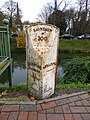
 Laughton milepost-Geograph-2258050-by-Ian-Paterson.jpg 1,536 × 2,048; 1.42 MB
-
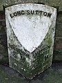
 Long Sutton 3 Spalding 16 - geograph.org.uk - 1186764.jpg 640 × 480; 86 KB
-
 Louth 9 Miles (geograph 4103219).jpg 768 × 1,024; 315 KB
-
 Main Road (B1177) near Dowsby (geograph 7013594).jpg 640 × 475; 63 KB
-
 Mile Post - geograph.org.uk - 961426.jpg 480 × 640; 90 KB
-
 Mile Stone, north of Langtoft village - geograph.org.uk - 623605.jpg 629 × 459; 189 KB
-
 Milepost (geograph 4010283).jpg 1,024 × 768; 240 KB
-
 Milepost (geograph 4010293).jpg 1,024 × 768; 315 KB
-
 Milepost (geograph 4010310).jpg 1,024 × 768; 296 KB
-
 Milepost (geograph 4375099).jpg 4,896 × 3,672; 6.43 MB
-
 Milepost (geograph 4503214).jpg 4,320 × 3,240; 5.44 MB
-
 Milepost (geograph 5229384).jpg 480 × 640; 105 KB
-
 Milepost along the Grantham Canal (geograph 5246648).jpg 640 × 800; 211 KB
-
 Milepost along the Grantham Canal towpath (geograph 5246650).jpg 800 × 624; 292 KB
-
 Milepost along the Grantham Canal towpath (geograph 5253140).jpg 600 × 800; 184 KB
-
 Milepost along the Grantham Canal towpath (geograph 5253388).jpg 648 × 800; 205 KB
-
 Milepost along the Grantham Canal towpath (geograph 5253640).jpg 743 × 800; 212 KB
-
 Milepost At Denton Wharf (geograph 4262023).jpg 4,000 × 3,000; 3.63 MB
-
 Milepost by A17 (geograph 5986954).jpg 1,600 × 667; 545 KB
-
 Milepost by the Road (geograph 5924110).jpg 6,032 × 4,014; 4.3 MB
-
 Milepost in context (geograph 4375047).jpg 4,896 × 3,672; 6.77 MB
-
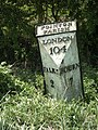
 Milepost London 91 Miles - geograph.org.uk - 15638.jpg 480 × 640; 84 KB
-
 Milepost next to the Grantham Canal (geograph 5253741).jpg 686 × 800; 251 KB
-
 Milepost on Grantham Road (geograph 4291182).jpg 1,280 × 1,280; 1.04 MB
-
 Milestone - geograph.org.uk - 1461339.jpg 640 × 480; 87 KB
-
 Milestone B1356 (geograph 6530341).jpg 480 × 640; 139 KB
-
 Milestone beside the B1081 1 mile from Stamford (geograph 4694581).jpg 683 × 1,024; 232 KB
-
 Milestone beside the B1172, Ash Holt - geograph.org.uk - 1373252.jpg 640 × 480; 118 KB
-
 Milestone in Osbournby (geograph 6054268).jpg 3,697 × 5,834; 4.74 MB
-
 Milestone marker on the Louth Canal (geograph 5638991).jpg 1,064 × 1,600; 963 KB
-
 Milestone marker on the Louth Canal (geograph 5638992).jpg 1,600 × 1,064; 1.22 MB
-
 Milestone near Heath Farm - geograph.org.uk - 2217918.jpg 640 × 426; 126 KB
-
 Milestone on Bourne Road, Langtoft (geograph 3862023).jpg 4,320 × 3,240; 5.54 MB
-
 Milestone on north side of Grantham Canal towpath (geograph 6279477).jpg 661 × 1,024; 248 KB
-
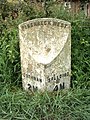
 Milestone on the Wisbech Road - geograph.org.uk - 915459.jpg 640 × 438; 216 KB
-
 Milestone, Elsea Park - geograph.org.uk - 523868.jpg 640 × 480; 59 KB
-
 Milestone, Grantham Rd, Sleaford (geograph 6675759).jpg 555 × 746; 290 KB
-
 Milestone, just northeast of Dunsby - geograph.org.uk - 936913.jpg 640 × 480; 148 KB
-
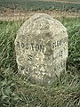
 Milestone, near Morton - geograph.org.uk - 643065.jpg 640 × 480; 63 KB
-
 Milestone, Pinchbeck (geograph 5384339).jpg 480 × 640; 100 KB
-
 Milestone- In Place (geograph 6126170).jpg 480 × 600; 384 KB
-
 Milestone- In Place (geograph 6126176).jpg 450 × 600; 309 KB
-
 Milestone- In Place (geograph 6126394).jpg 450 × 600; 307 KB
-
 Milestone- In Place (geograph 6126406).jpg 450 × 600; 269 KB
-
 Milestone- In Place (geograph 6126414).jpg 450 × 600; 314 KB
-
 Milestone- In Place (geograph 6126425).jpg 450 × 600; 338 KB
-
 Milestone- In Place (geograph 6126428).jpg 450 × 600; 283 KB
-
 Milestone- In Place (geograph 6126430).jpg 450 × 600; 338 KB
-
 Milestone- In Place (geograph 6126498).jpg 450 × 600; 347 KB
-
 Milestone- In Place (geograph 6126500).jpg 450 × 600; 327 KB
-
 Milestone- In Place (geograph 6126512).jpg 450 × 600; 356 KB
-
 Milestone- In Place (geograph 6126516).jpg 450 × 600; 295 KB
-
 Milestone- In Place (geograph 6126518).jpg 450 × 600; 287 KB
-
 Milestone- In Place (geograph 6126549).jpg 450 × 600; 266 KB
-

-
 My Alibi (geograph 5924148).jpg 4,014 × 6,032; 5.05 MB
-
 National Cycle Network Milepost (geograph 5253291).jpg 800 × 600; 203 KB
-
 National Cycle Network Milepost along the towpath (geograph 5583019).jpg 800 × 534; 170 KB
-
 National Cycle Network Milepost along the towpath (geograph 5583685).jpg 800 × 536; 188 KB
-
 Newstead Toll House (geograph 6114628).jpg 340 × 252; 89 KB
-

-
 Old AA sign (geograph 7112772).jpg 1,600 × 1,200; 276 KB
-
 Old AA sign (geograph 7112803).jpg 1,600 × 1,200; 273 KB
-
 Old AA sign (geograph 7112807).jpg 1,600 × 1,200; 282 KB
-
 Old AA sign (geograph 7138047).jpg 1,200 × 1,600; 338 KB
-
 Old AA Sign on Alvingham Road, Alvingham (geograph 6076489).jpg 503 × 451; 66 KB
-
 Old AA Sign on Church Lane in Haltham (geograph 6077200).jpg 615 × 529; 85 KB
-
 Old AA Sign on Main Street, Thoresway (geograph 6076503).jpg 1,249 × 1,085; 300 KB
-
 Old AA Sign on Manor Road, Northorpe (geograph 6094377).jpg 640 × 480; 311 KB
-

-
 Old Cast Iron Milepost (geograph 3511392).jpg 768 × 1,024; 346 KB
-
 Old Cast Iron Milepost (geograph 3511400).jpg 768 × 1,024; 416 KB
-
 Old Cast Iron Milepost (geograph 3511405).jpg 1,024 × 768; 272 KB
-
 Old Central Cross by Church Street, Skillington (geograph 6094055).jpg 720 × 960; 170 KB
-
 Old Central Cross by School Lane, Silk Willoughby (geograph 6051034).jpg 720 × 960; 119 KB
-
 Old Central Cross in North Rauceby (geograph 6038667).jpg 553 × 921; 139 KB
-
 Old Central Cross, Cliff Road, Wellingore (geograph 6035911).jpg 960 × 720; 160 KB
-
 Old Milemarker by the Grantham Canal, Harlaxton (geograph 6094736).jpg 480 × 720; 108 KB
-

-
 Old Milepost (geograph 3511374).jpg 768 × 1,024; 403 KB
-
 Old Milepost (geograph 3511377).jpg 1,024 × 768; 158 KB
-
 Old Milepost (geograph 3511384).jpg 768 × 1,024; 356 KB
-
 Old Milepost (geograph 3511387).jpg 1,024 × 768; 168 KB
-
 Old Milepost (geograph 3652517).jpg 768 × 1,024; 361 KB
-
 Old Milepost (geograph 3652541).jpg 768 × 1,024; 250 KB
-
 Old Milepost (geograph 3652560).jpg 768 × 1,024; 307 KB
-
 Old Milepost (geograph 3652570).jpg 768 × 1,024; 343 KB
-
 Old Milepost (geograph 3652588).jpg 768 × 1,024; 287 KB
-
 Old Milepost (geograph 4010273).jpg 768 × 1,024; 301 KB
-
 Old Milepost (geograph 4010289).jpg 768 × 1,024; 301 KB
-
 Old Milepost (geograph 4010305).jpg 768 × 1,024; 299 KB
-
 Old Milepost (geograph 4103225).jpg 1,024 × 768; 255 KB
-
 Old Milepost (geograph 6050164).jpg 373 × 640; 29 KB
-
 Old Milepost (geograph 6097838).jpg 438 × 640; 310 KB
-
 Old Milepost (geograph 6097974).jpg 450 × 600; 301 KB
-
 Old Milepost - geograph.org.uk - 1186397.jpg 480 × 640; 108 KB
-
 Old Milepost - geograph.org.uk - 1186467.jpg 480 × 640; 76 KB
-
 Old Milepost - geograph.org.uk - 1186574.jpg 480 × 640; 112 KB
-
 Old Milepost - geograph.org.uk - 1186738.jpg 480 × 640; 127 KB
-
 Old Milepost - geograph.org.uk - 1461354.jpg 640 × 480; 115 KB
-
 Old Milepost by Captain's Hill, Leasingham Parish (geograph 6044760).jpg 450 × 600; 314 KB
-

-

-

-
 Old Milepost by the A1175, Main Road, Uffington (geograph 6048040).jpg 404 × 600; 245 KB
-
 Old Milepost by the A16, Main Road, Wold Newton (geograph 5586685).jpg 576 × 712; 211 KB
-
 Old Milepost by the A17, Main Road, Fosdyke (geograph 5785214).jpg 683 × 1,024; 213 KB
-
 Old Milepost by the A17, Main Road, Fosdyke (geograph 5785225).jpg 683 × 1,024; 213 KB
-
 Old Milepost by the B1166, Stamford Road (geograph 6048184).jpg 450 × 600; 347 KB
-
 Old Milepost by the B1359, London Road, Long Sutton (geograph 6035412).jpg 801 × 1,200; 599 KB
-

-
 Old Milestone (geograph 3511450).jpg 768 × 1,024; 300 KB
-
 Old Milestone (geograph 3511453).jpg 1,024 × 768; 275 KB
-
 Old Milestone (geograph 3511494).jpg 768 × 1,024; 342 KB
-
 Old Milestone (geograph 3511496).jpg 1,024 × 768; 254 KB
-
 Old Milestone (geograph 3652620).jpg 768 × 1,024; 359 KB
-
 Old Milestone (geograph 3652628).jpg 1,024 × 768; 263 KB
-
 Old Milestone (geograph 3652648).jpg 1,024 × 766; 184 KB
-
 Old Milestone (geograph 3652707).jpg 768 × 1,024; 337 KB
-
 Old Milestone (geograph 3652708).jpg 1,024 × 768; 316 KB
-
 Old Milestone (geograph 6097902).jpg 517 × 800; 283 KB
-
 Old Milestone (geograph 6098425).jpg 450 × 600; 335 KB
-
 Old milestone (geograph 6739913).jpg 1,200 × 1,600; 528 KB
-
 Old Milestone - geograph.org.uk - 1186112.jpg 480 × 640; 143 KB
-
 Old Milestone - geograph.org.uk - 1186166.jpg 480 × 640; 153 KB
-
 Old Milestone - geograph.org.uk - 1186228.jpg 480 × 640; 123 KB
-
 Old Milestone - geograph.org.uk - 1186362.jpg 480 × 640; 157 KB
-
 Old Milestone - geograph.org.uk - 1186547.jpg 480 × 640; 127 KB
-
 Old Milestone - geograph.org.uk - 1189233.jpg 480 × 640; 126 KB
-
 Old Milestone - geograph.org.uk - 1189242.jpg 480 × 640; 142 KB
-
 Old Milestone - geograph.org.uk - 1189288.jpg 480 × 640; 146 KB
-
 Old Milestone - geograph.org.uk - 1192071.jpg 506 × 640; 135 KB
-
 Old milestone - geograph.org.uk - 1461307.jpg 640 × 480; 116 KB
-
 Old Milestone by High Street, Holbeach (geograph 6055865).jpg 480 × 640; 92 KB
-

-

-

-
 Old Milestone by the A631, Willingham Road (geograph 6102762).jpg 528 × 960; 134 KB
-

-

-

-

-

-

-
 Old milestone in Eastoft (geograph 4352937).jpg 3,888 × 5,184; 5.99 MB
-
 Old Milestone, B1359, Bridge Road (geograph 6729758).jpg 450 × 600; 359 KB
-
 Old Milestone, B1359, Bridge Road, by No. 67 (geograph 6729780).jpg 450 × 600; 281 KB
-

-
 Old Milestone, B1397, London Road, Parish of Kirton (geograph 6844519).jpg 4,951 × 3,300; 3.74 MB
-
 Old Milestone, B1397, London Road, Parish of Kirton (geograph 6844523).jpg 4,941 × 3,294; 3.97 MB
-
 Old Milestone, on an unclassified road off A52 (geograph 6728191).jpg 450 × 600; 316 KB
-
 Old Milestone, on Main Road (B1177) near Dowsby (geograph 7013593).jpg 800 × 600; 248 KB
-
 Old Milestone, on the A1073, N of St Guthlac (geograph 6729018).jpg 450 × 600; 314 KB
-

-

-
-
 Old Milestone, on the A151, Grimsthorpe (geograph 6728007).jpg 450 × 600; 334 KB
-

-

-

-
 Old Milestone, on the A151, N side of The Green (geograph 6728036).jpg 450 × 600; 350 KB
-
 Old Milestone, on the A151, near Sycamore Farm (geograph 6729079).jpg 450 × 600; 320 KB
-
 Old Milestone, on the A152, Quadring Road (geograph 6729058).jpg 450 × 600; 335 KB
-
 Old Milestone, on the A152, Quadring Road (geograph 6729067).jpg 450 × 600; 345 KB
-

-
 Old Milestone, on the A52, Abbey Lane (geograph 6728287).jpg 450 × 600; 296 KB
-
 Old Milestone, on the A52, Benington (geograph 6728727).jpg 450 × 600; 273 KB
-
 Old Milestone, on the A52, Boston Road (geograph 6728049).jpg 450 × 600; 315 KB
-

-
-

-
 Old Milestone, on the A52, by Inglenook (geograph 6728731).jpg 450 × 600; 276 KB
-

-

-


.jpg)
.jpg)

.jpg)
.jpg)

.jpg)
.jpg)
.jpg)
.jpg)
.jpg)
.jpg)

.jpg)
.jpg)


.jpg)
.jpg)
.jpg)

.jpg)


.jpg)
_near_Dowsby_(geograph_7013594).jpg)


.jpg)
.jpg)
.jpg)
.jpg)
.jpg)
.jpg)
.jpg)
.jpg)
.jpg)
.jpg)
.jpg)
.jpg)
.jpg)
.jpg)
.jpg)

.jpg)
.jpg)

.jpg)
.jpg)

.jpg)
.jpg)
.jpg)

.jpg)
.jpg)


.jpg)


.jpg)
.jpg)
.jpg)
.jpg)
.jpg)
.jpg)
.jpg)
.jpg)
.jpg)
.jpg)
.jpg)
.jpg)
.jpg)
.jpg)
.jpg)
.jpg)
.jpg)
.jpg)
.jpg)
.jpg)
.jpg)
.jpg)
.jpg)
.jpg)
.jpg)
.jpg)
.jpg)
.jpg)
.jpg)
.jpg)
.jpg)
.jpg)
.jpg)
.jpg)
.jpg)
.jpg)
.jpg)
.jpg)
.jpg)
.jpg)
.jpg)
.jpg)
.jpg)
.jpg)
.jpg)
.jpg)
.jpg)
.jpg)
.jpg)
.jpg)
.jpg)
.jpg)
.jpg)
.jpg)
.jpg)
.jpg)


.jpg)
.jpg)
.jpg)
.jpg)
.jpg)
.jpg)
.jpg)
.jpg)
.jpg)
.jpg)
.jpg)
.jpg)
.jpg)
.jpg)
.jpg)
.jpg)
.jpg)
.jpg)
.jpg)
.jpg)
.jpg)
.jpg)
.jpg)


.jpg)
.jpg)
.jpg)
.jpg)
.jpg)
.jpg)
.jpg)
.jpg)
.jpg)
.jpg)
.jpg)
.jpg)
.jpg)
.jpg)
.jpg)
.jpg)
.jpg)
.jpg)
_near_Dowsby_(geograph_7013593).jpg)
.jpg)
.jpg)
.jpg)
.jpg)
.jpg)
.jpg)
_(geograph_6728014).jpg)
.jpg)
.jpg)
.jpg)
.jpg)
.jpg)
.jpg)
.jpg)
.jpg)
.jpg)
_(geograph_6728051).jpg)
.jpg)
_(geograph_6727636).jpg)
.jpg)
.jpg)
.jpg)
.jpg)
.jpg)