Category:Milestones in County Durham
Jump to navigation
Jump to search
Ceremonial counties of England: Bedfordshire · Berkshire · Buckinghamshire · Cambridgeshire · Cheshire · Cornwall · Cumbria · Derbyshire · Devon · Dorset · Durham · East Riding of Yorkshire · East Sussex · Essex · Gloucestershire · Greater London · Greater Manchester · Hampshire · Herefordshire · Hertfordshire · Kent · Lancashire · Leicestershire · Lincolnshire · Merseyside · Norfolk · North Yorkshire · Northamptonshire · Northumberland · Nottinghamshire · Oxfordshire · Rutland · Shropshire · Somerset · South Yorkshire · Staffordshire · Suffolk · Surrey · Tyne and Wear · Warwickshire · West Midlands · West Sussex · West Yorkshire · Wiltshire · Worcestershire
City-counties: Bristol ·
Former historic counties:
Other former counties:
City-counties: Bristol ·
Former historic counties:
Other former counties:

Subcategories
This category has the following 3 subcategories, out of 3 total.
Media in category "Milestones in County Durham"
The following 186 files are in this category, out of 186 total.
-
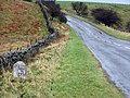
 Ancient Milestone, B6277 - geograph.org.uk - 1568368.jpg 640 × 427; 163 KB
-
 Cast iron milepost (2) (geograph 5721458).jpg 480 × 640; 117 KB
-
 Cast iron milepost (geograph 5721453).jpg 480 × 640; 110 KB
-
 Cast iron milepost on the B6295 north of Cowshill (geograph 5721522).jpg 480 × 640; 141 KB
-

-

-
 Dry stone wall with Badger Way Stoop (geograph 6095521).jpg 1,600 × 1,200; 570 KB
-
 Mile post at Heighington railway station (geograph 5422449).jpg 480 × 640; 232 KB
-
 Milepost on the A689 at the east end of Westgate (geograph 6200718).jpg 768 × 1,024; 363 KB
-
 Milepost on the A689 at the west end of St. John's Chapel (geograph 6057629).jpg 768 × 1,024; 326 KB
-

-
 Milepost on the A689 in Daddry Shield (geograph 5922300).jpg 768 × 1,024; 309 KB
-
 Milestone , B6282 - geograph.org.uk - 349898.jpg 640 × 479; 120 KB
-
 Milestone beside A67 (geograph 5604958).jpg 1,500 × 842; 1.12 MB
-
 Milestone by the A689 west of Stanhope (2) (geograph 6548434).jpg 1,024 × 1,024; 466 KB
-
 Milestone by the A689 west of Stanhope (3) (geograph 6548440).jpg 1,024 × 1,024; 448 KB
-
 Milestone by the A689 west of Stanhope (geograph 6548422).jpg 1,024 × 768; 417 KB
-
 Milestone near sun inn.jpg 1,536 × 2,048; 992 KB
-
 Milestone on Beldon Side (geograph 5242302).jpg 5,312 × 2,988; 7.4 MB
-
 Milestone on Peth Lane (geograph 4766146).jpg 3,983 × 2,655; 7.23 MB
-
 Millennium milepost (geograph 6603982).jpg 480 × 640; 143 KB
-
 Old Boundary Marker at Beamish Open Air Museum (geograph 6094040).jpg 555 × 960; 132 KB
-
 Old Boundary Marker at Beamish Open Air Museum (geograph 6094687).jpg 620 × 793; 240 KB
-

-

-

-

-

-

-

-

-

-

-
 Old Boundary Marker by North Road, Durham (geograph 6094254).jpg 480 × 640; 432 KB
-

-
-

-

-
 Old Boundary Marker by the A68, Tow Law parish (geograph 6048987).jpg 480 × 640; 387 KB
-

-

-

-

-
 Old Boundary Marker in Parkhead Station Tea Room (geograph 6072610).jpg 480 × 640; 242 KB
-

-

-

-

-

-
 Old Boundary Marker north of Stanhope (geograph 6094111).jpg 480 × 498; 182 KB
-
 Old Boundary Marker north of Stanhope (geograph 6663676).jpg 480 × 640; 147 KB
-

-

-
 Old Boundary Marker on Mickle Fell, Warcop parish (geograph 6055678).jpg 434 × 640; 325 KB
-
 Old Boundary Marker on Mickle Fell, Warcop Parish (geograph 6056554).jpg 460 × 640; 336 KB
-
 Old Boundary Marker on Mickle Fell, Warcop parish (geograph 6083786).jpg 555 × 618; 229 KB
-

-

-

-

-

-
 Old Boundary Stone near Fell Haven, Waskerley Way (geograph 6663839).jpg 480 × 640; 142 KB
-

-

-

-

-

-
 Old Bridge Marker on Redburn Bridge, Rook Hope (geograph 6094392).jpg 640 × 480; 291 KB
-

-

-
 Old Central Cross by Hall Road, Esh Parish (geograph 6043724).jpg 480 × 640; 377 KB
-

-
 Old Central Cross by The Green, Cleatlam Parish (geograph 6043367).jpg 640 × 492; 404 KB
-
 Old Central Cross by The Green, Egglescliffe (geograph 6056179).jpg 543 × 388; 139 KB
-
 Old Guide Stone B6310, facing Cut Throat Lane (geograph 6739751).jpg 768 × 1,024; 318 KB
-
 Old Guide Stone by the B6278, Eggleston Parish (geograph 6061504).jpg 540 × 960; 135 KB
-

-

-

-
 Old Guide Stone, facing the B6310 (geograph 6739758).jpg 768 × 1,024; 252 KB
-
 Old guidestone (geograph 6757748).jpg 1,200 × 1,600; 555 KB
-
 Old Milepost (geograph 6096294).jpg 481 × 625; 47 KB
-
 Old Milepost by Allan Street, Darlington (geograph 5790426).jpg 480 × 640; 91 KB
-
 Old Milepost by Blackwell Lane, Darlington (geograph 5790440).jpg 480 × 640; 99 KB
-
 Old Milepost by Stockton Road, Castle Eden (geograph 5624096).jpg 547 × 800; 136 KB
-
 Old Milepost by the A1150 in Great Burdon (geograph 6414958).jpg 480 × 640; 318 KB
-
 Old Milepost by the A67, Carlbury (geograph 5624051).jpg 539 × 800; 119 KB
-
 Old Milepost by the A67, High Coniscliffe (geograph 5624050).jpg 526 × 800; 148 KB
-
 Old Milepost by the A68 at Houghton Bank (geograph 6102776).jpg 409 × 640; 48 KB
-
 Old Milepost by the A689, Cowshill (geograph 5624046).jpg 540 × 960; 121 KB
-
 Old Milepost by the A689, Daddry Shield (geograph 5624119).jpg 521 × 800; 140 KB
-

-
 Old Milepost by the A689, Front Street, Stanhope (geograph 5624115).jpg 480 × 640; 320 KB
-
 Old Milepost by the A689, Front Street, Westgate (geograph 5624118).jpg 561 × 800; 175 KB
-
 Old Milepost by the A689, Hare Law (geograph 5624116).jpg 630 × 800; 194 KB
-

-

-
 Old Milepost by the A689, north of Brotherlee (geograph 5624117).jpg 531 × 800; 138 KB
-

-
 Old Milepost by the A689, west of Stanhope (geograph 5320284).jpg 480 × 640; 114 KB
-
 Old Milepost by the B6276, Laithkirk, Lunedale (geograph 6734397).jpg 1,010 × 1,362; 479 KB
-

-

-
 Old Milepost by the B6295, High Greenfield (geograph 5624047).jpg 540 × 800; 156 KB
-
 Old Milepost in Pierremont Crescent, Darlington (geograph 5319931).jpg 480 × 640; 102 KB
-

-

-
 Old Milestone by the A1150 in Great Burdon (geograph 6335718).jpg 480 × 640; 334 KB
-

-
 Old Milestone by the A66 east of Bowes (geograph 6102084).jpg 518 × 800; 118 KB
-
-
-
 Old Milestone by the A67, Darlington Road (geograph 5624057).jpg 546 × 800; 141 KB
-

-

-
 Old Milestone by the A67, opposite Greystone Hall (geograph 5624053).jpg 551 × 800; 186 KB
-
 Old Milestone by the A67, west of Tees Bridge (geograph 5624054).jpg 539 × 800; 144 KB
-
 Old Milestone by the A67, West Whorley Hill (geograph 5624055).jpg 519 × 800; 171 KB
-

-

-

-
 Old Milestone by the A68, north of Witton-le-Wear (geograph 5624100).jpg 519 × 800; 129 KB
-
 Old Milestone by the A68, north west of Fir Tree (geograph 5624102).jpg 558 × 800; 111 KB
-

-
 Old Milestone by the A68, south of Allensford (geograph 5624110).jpg 552 × 800; 129 KB
-
 Old Milestone by the A68, south of Castleside (geograph 5624109).jpg 552 × 800; 130 KB
-

-
 Old Milestone by the A68, south of Fir Tree (geograph 5624101).jpg 551 × 800; 153 KB
-

-

-

-

-

-

-

-

-
 Old Milestone by the A688, north of Staindrop (geograph 5624068).jpg 573 × 512; 68 KB
-
 Old Milestone by the A688, north of Wackerfield (geograph 5624066).jpg 531 × 800; 151 KB
-

-
 Old Milestone by the A688, Staindrop (geograph 5624069).jpg 433 × 545; 50 KB
-
 Old Milestone by the B6274, north of Winston (geograph 5624094).jpg 585 × 485; 72 KB
-
 Old Milestone by the B6274, south of Staindrop (geograph 5624095).jpg 536 × 800; 177 KB
-
 Old Milestone by the B6274, Winston (geograph 5624093).jpg 560 × 800; 149 KB
-

-
 Old Milestone by the B6277, Greenhills (geograph 5624041).jpg 550 × 800; 164 KB
-

-
 Old Milestone by the B6277, Harwood Common (geograph 5624039).jpg 507 × 800; 152 KB
-
 Old Milestone by the B6277, Rough Rigg (geograph 5624040).jpg 551 × 800; 146 KB
-

-

-

-

-

-
-

-

-
 Old Milestone by the B6282, Egglesburn (geograph 5624088).jpg 549 × 800; 151 KB
-
 Old Milestone by the B6282, Eggleston (geograph 5624089).jpg 532 × 800; 137 KB
-

-

-

-

-

-
 Old Milestone by the B6296, Low Redgate Bank (geograph 5624083).jpg 540 × 960; 124 KB
-
 Old Milestone by the B6296, north east of Satley (geograph 5624081).jpg 517 × 800; 146 KB
-
 Old Milestone by the B6296, south west of Satley (geograph 5624082).jpg 531 × 800; 132 KB
-

-

-
 Old Milestone by The Street, Bowes (geograph 6048099).jpg 541 × 800; 128 KB
-
 Old milestone on the B6296 (geograph 6916588).jpg 3,283 × 2,699; 3.73 MB
-

-

-
 Old Milestone, B1264, Yarm (geograph 7125791).jpg 768 × 1,024; 392 KB
-
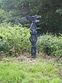
 Old Wayside Cross - moved (geograph 6056483).jpg 480 × 640; 366 KB
-

-

-

-

-

-
 Road on Beldon Side (geograph 5924251).jpg 2,000 × 1,500; 2.51 MB
-
 Roman Milestone, Chapter Library Durham (geograph 7040505).jpg 768 × 1,024; 242 KB
-
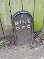
 Milepost - geograph.org.uk - 21812.jpg 640 × 480; 96 KB
-
-
 Milestone near the bridge over Espy Sike - geograph.org.uk - 684885.jpg 480 × 640; 120 KB
-

-
 Milestone, Baybridge to Riddlehamhope - geograph.org.uk - 77504.jpg 640 × 427; 167 KB

_(geograph_5721458).jpg)
.jpg)
.jpg)
.jpg)
.jpg)
.jpg)
.jpg)
.jpg)
.jpg)
.jpg)
.jpg)

.jpg)
_(geograph_6548434).jpg)
_(geograph_6548440).jpg)
.jpg)

.jpg)
.jpg)
.jpg)
.jpg)
.jpg)
.jpg)
.jpg)
.jpg)
.jpg)
.jpg)
.jpg)
.jpg)
.jpg)
.jpg)
.jpg)
.jpg)
.jpg)
.jpg)
.jpg)
.jpg)
.jpg)
.jpg)
.jpg)
.jpg)
.jpg)
.jpg)
.jpg)
.jpg)
.jpg)
.jpg)
.jpg)
.jpg)
.jpg)
.jpg)
.jpg)
.jpg)
.jpg)
.jpg)
.jpg)
.jpg)
.jpg)
.jpg)
.jpg)
.jpg)
.jpg)
.jpg)
.jpg)
.jpg)
.jpg)
.jpg)
.jpg)
.jpg)
.jpg)
.jpg)
.jpg)
.jpg)
.jpg)
.jpg)
.jpg)
.jpg)
.jpg)
.jpg)
.jpg)
.jpg)
.jpg)
.jpg)
.jpg)
.jpg)
.jpg)
.jpg)
.jpg)
.jpg)
.jpg)
.jpg)
.jpg)
.jpg)
.jpg)
.jpg)
.jpg)
.jpg)
.jpg)
.jpg)
.jpg)
.jpg)
.jpg)
.jpg)
.jpg)
_by_the_A67,_Bridgegate,_Barnard_Castle_(geograph_6629260).jpg)
_by_the_A67,_Bridgegate,_Barnard_Castle_(geograph_6629259).jpg)
.jpg)
.jpg)
.jpg)
.jpg)
.jpg)
.jpg)
.jpg)
.jpg)
.jpg)
.jpg)
.jpg)
.jpg)
.jpg)
.jpg)
.jpg)
.jpg)
.jpg)
.jpg)
.jpg)
.jpg)
.jpg)
.jpg)
.jpg)
.jpg)
.jpg)
.jpg)
.jpg)
.jpg)
.jpg)
.jpg)
.jpg)
.jpg)
.jpg)
.jpg)
.jpg)
.jpg)
.jpg)
.jpg)
.jpg)
.jpg)
.jpg)
.jpg)
.jpg)
.jpg)
.jpg)
.jpg)
.jpg)
.jpg)
.jpg)
.jpg)
.jpg)
.jpg)
.jpg)
.jpg)
.jpg)
.jpg)
.jpg)
.jpg)
.jpg)
.jpg)
.jpg)
.jpg)
.jpg)
.jpg)
.jpg)
.jpg)
.jpg)
.jpg)
.jpg)
.jpg)
.jpg)
.jpg)
.jpg)
.jpg)


_-_geograph.org.uk_-_709767.jpg)
