Category:Mid Calder (civil parish)
Jump to navigation
Jump to search
Scottish parish in West Lothian, Scotland, UK  | |||||
| Upload media | |||||
| Instance of | |||||
|---|---|---|---|---|---|
| Part of |
| ||||
| Named after | |||||
| Location |
| ||||
| Population |
| ||||
| Area |
| ||||
 | |||||
Subcategories
This category has only the following subcategory.
L
Media in category "Mid Calder (civil parish)"
The following 200 files are in this category, out of 649 total.
(previous page) (next page)-
 11 - 17 Bank Street - geograph.org.uk - 4908635.jpg 640 × 427; 300 KB
-
 9th West Lothian (Dedridge) Scout Group - geograph.org.uk - 4473378.jpg 3,264 × 2,448; 2.77 MB
-
 A thunderstorm over Camilty - geograph.org.uk - 3005806.jpg 640 × 480; 254 KB
-

-
 A71, Bankton Road - geograph.org.uk - 2109958.jpg 640 × 480; 62 KB
-
 Abbotsford Rise - geograph.org.uk - 4937564.jpg 800 × 600; 264 KB
-
 Above the Bridge - geograph.org.uk - 5690512.jpg 640 × 427; 354 KB
-
 Access to Pumpherston Farm - geograph.org.uk - 5198421.jpg 640 × 427; 400 KB
-
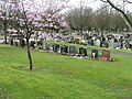
 Adambrae cemetery - geograph.org.uk - 2109605.jpg 640 × 480; 88 KB
-
 Adambrae Cemetery at Livingston - geograph.org.uk - 2346282.jpg 2,048 × 1,536; 2.44 MB
-
 Alba Business Park from the air - geograph.org.uk - 3722461.jpg 640 × 480; 186 KB
-
 Alba Business Park from the air - geograph.org.uk - 4050813.jpg 640 × 480; 160 KB
-
 Alba Business Park from the air - geograph.org.uk - 4277899.jpg 640 × 480; 188 KB
-
 Alderston Doocot - geograph.org.uk - 5686218.jpg 480 × 640; 494 KB
-
 Alderston House - geograph.org.uk - 5686223.jpg 640 × 427; 348 KB
-
 Alderstone Road, Livingstone - geograph.org.uk - 2686467.jpg 640 × 480; 86 KB
-
 Allotments at Camilty - geograph.org.uk - 2731481.jpg 3,264 × 2,448; 5.38 MB
-
 Almond Park - geograph.org.uk - 3725058.jpg 640 × 480; 241 KB
-
 Almond Valley Bridge - geograph.org.uk - 4001717.jpg 640 × 480; 253 KB
-

-
 Almondell ^ Calderwood Country Park - geograph.org.uk - 5305861.jpg 2,598 × 1,766; 1.26 MB
-
 Almondvale and Dedridge - geograph.org.uk - 3517342.jpg 3,264 × 2,448; 3.35 MB
-
 Almondvale at Livingston - geograph.org.uk - 5551508.jpg 3,264 × 2,448; 3.22 MB
-
 Almondvale Avenue - geograph.org.uk - 4010655.jpg 640 × 480; 234 KB
-
 Almondvale from the air - geograph.org.uk - 2953292.jpg 640 × 480; 164 KB
-
 Almondvale Road - geograph.org.uk - 4010676.jpg 640 × 480; 227 KB
-
 Almondvale Shopping Centre - geograph.org.uk - 4001643.jpg 640 × 480; 266 KB
-
 Almondvale Shopping Centre - geograph.org.uk - 5198835.jpg 640 × 427; 361 KB
-
 Almondvale shopping centre from the air - geograph.org.uk - 6269210.jpg 1,024 × 768; 411 KB
-
 Almondvale Stadium from the air - geograph.org.uk - 4050807.jpg 640 × 366; 116 KB
-
 Almondvale Stadium from the air - geograph.org.uk - 4050809.jpg 640 × 480; 140 KB
-
 Almondvale Stadium from the air - geograph.org.uk - 5799298.jpg 1,024 × 768; 318 KB
-
 Almondvale Stadium, Livingston - geograph.org.uk - 3717515.jpg 1,024 × 768; 158 KB
-
 Almondvale, Livingston - geograph.org.uk - 3517334.jpg 3,264 × 2,448; 3.4 MB
-
 Almost gone - geograph.org.uk - 2295280.jpg 640 × 480; 75 KB
-
 Ambrose Rise - geograph.org.uk - 4937580.jpg 800 × 600; 335 KB
-
 Ambrose Rise - geograph.org.uk - 4937668.jpg 800 × 600; 178 KB
-
 An Ugly Milk-cap - geograph.org.uk - 2095158.jpg 1,024 × 768; 229 KB
-
 An Unexplained Stone Post in Adambrae Burn - geograph.org.uk - 6530912.jpg 576 × 1,024; 232 KB
-
 Ancient track in Calder Woods - geograph.org.uk - 2061330.jpg 1,024 × 768; 247 KB
-
 Angry River Almond - geograph.org.uk - 3157229.jpg 2,048 × 1,152; 790 KB
-
 Approaching Cauldstane Slap - geograph.org.uk - 5466199.jpg 1,600 × 1,060; 599 KB
-
 Aqueduct - geograph.org.uk - 5198684.jpg 427 × 640; 507 KB
-
 Aqueduct from Viaduct - geograph.org.uk - 5198666.jpg 427 × 640; 472 KB
-
 Archways leading to bridge over the Almond - geograph.org.uk - 2627821.jpg 1,196 × 1,600; 272 KB
-
 At the Top of the Steps - geograph.org.uk - 5198414.jpg 427 × 640; 409 KB
-
 Autumn Woods - geograph.org.uk - 5198467.jpg 427 × 640; 594 KB
-
 Baad Park Burn and Auchinoon Hill - geograph.org.uk - 6176709.jpg 1,600 × 1,060; 410 KB
-
 Baad Park Burn and East Cairn Hill - geograph.org.uk - 6176703.jpg 1,600 × 1,060; 502 KB
-
 Bank by the Track - geograph.org.uk - 5198425.jpg 640 × 427; 462 KB
-
 Bank of Cowslips - geograph.org.uk - 4473363.jpg 3,264 × 2,448; 6.54 MB
-
 Bank Street - geograph.org.uk - 4908622.jpg 640 × 427; 316 KB
-
 Bankton Avenue - geograph.org.uk - 4910076.jpg 640 × 427; 262 KB
-
 Bankton Lane - geograph.org.uk - 3742169.jpg 640 × 480; 308 KB
-
 Bankton Mains Path - geograph.org.uk - 4473391.jpg 3,264 × 2,448; 5.22 MB
-

-
 Bellsquarry School - geograph.org.uk - 5686240.jpg 640 × 427; 318 KB
-
 Bents Burn - geograph.org.uk - 6323618.jpg 640 × 427; 319 KB
-
 Beside the Burnside Path - geograph.org.uk - 4936576.jpg 800 × 600; 230 KB
-
 Big blue building - geograph.org.uk - 2675173.jpg 640 × 480; 265 KB
-
 Big Hidden Bankton Mains Park - geograph.org.uk - 6529476.jpg 1,024 × 576; 110 KB
-
 Biodiversity Site - geograph.org.uk - 4908530.jpg 640 × 427; 380 KB
-
 Birchwood Gardens, Bellsquarry - geograph.org.uk - 2686458.jpg 640 × 480; 66 KB
-
 Bird Hide, Harperrig Reservoir - geograph.org.uk - 6176194.jpg 1,600 × 1,060; 386 KB
-
 Birny Knowe from the air - geograph.org.uk - 3301493.jpg 640 × 480; 140 KB
-
 Black Bull Inn - geograph.org.uk - 4908662.jpg 640 × 353; 205 KB
-
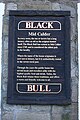 Black Bull Sign - geograph.org.uk - 5198374.jpg 427 × 640; 413 KB
-
 Black Hill from the air - geograph.org.uk - 3445572.jpg 640 × 480; 96 KB
-
 Blackhall Farm - geograph.org.uk - 2295381.jpg 640 × 480; 54 KB
-
 Blocks, Quentin Rise - geograph.org.uk - 4937729.jpg 800 × 600; 221 KB
-
 Boardwalk footpath - geograph.org.uk - 2295333.jpg 640 × 480; 123 KB
-
 Boundary fence south of West Cairn Hill - geograph.org.uk - 5467364.jpg 1,600 × 1,060; 433 KB
-
 Breeze block hut, Harperrig Reservoir - geograph.org.uk - 6176579.jpg 1,600 × 1,060; 406 KB
-
 Bridge at Balgreen - geograph.org.uk - 2346322.jpg 2,048 × 1,536; 2.86 MB
-
 Bridge House and Linhouse Water - geograph.org.uk - 4908614.jpg 640 × 480; 449 KB
-

-
 Bridge over the Linhouse Water at Midcalder - geograph.org.uk - 2061354.jpg 1,024 × 768; 191 KB
-
 Bridge, Howden South Road - geograph.org.uk - 4303187.jpg 800 × 600; 379 KB
-
 Bridgend, Mid Calder - geograph.org.uk - 3259336.jpg 1,446 × 1,029; 1.48 MB
-

-
 Broken Weir - geograph.org.uk - 4908606.jpg 640 × 480; 501 KB
-
 Brookbank - geograph.org.uk - 6322959.jpg 640 × 427; 403 KB
-
 Brucefield Industrial Estate - geograph.org.uk - 2837101.jpg 3,264 × 2,448; 4.77 MB
-
 Brucefield Industrial Estate - geograph.org.uk - 3176620.jpg 3,264 × 2,448; 3.07 MB
-
 Brucefield Industrial Park - geograph.org.uk - 2837103.jpg 3,264 × 2,448; 4.46 MB
-
 Brucefield Industrial Park - geograph.org.uk - 4001669.jpg 640 × 480; 293 KB
-
 Brucefield Industrial Park from the air - geograph.org.uk - 5274211.jpg 640 × 480; 166 KB
-
 Brucefield Industrial Park, Livingston - geograph.org.uk - 4302261.jpg 800 × 600; 454 KB
-
 Brucefield Park West - geograph.org.uk - 2837100.jpg 3,264 × 2,448; 4.45 MB
-
 Burnbank from near Blackhall - geograph.org.uk - 2346309.jpg 2,048 × 1,536; 2.35 MB
-
 Cairn on Colzium Hill - geograph.org.uk - 5467369.jpg 1,600 × 1,060; 438 KB
-
 Cairn on East Cairn Hill - geograph.org.uk - 6420267.jpg 1,600 × 1,060; 403 KB
-
 Cairns Castle - geograph.org.uk - 2812244.jpg 3,264 × 2,448; 5.49 MB
-
 Cairns Castle - geograph.org.uk - 5690994.jpg 640 × 473; 376 KB
-
 Cairns Castle Bridge - geograph.org.uk - 5690530.jpg 640 × 427; 397 KB
-
 Cairns House and Cairns Castle - geograph.org.uk - 2215766.jpg 2,048 × 1,536; 2.02 MB
-
 Cairns House and Tower - geograph.org.uk - 5690997.jpg 640 × 427; 331 KB
-
 Cairns House beside Harperrig Reservoir - geograph.org.uk - 4847445.jpg 1,024 × 682; 198 KB
-
 Cairns House View - geograph.org.uk - 3697401.jpg 640 × 449; 88 KB
-
 Cairns Tower - geograph.org.uk - 5690525.jpg 480 × 640; 584 KB
-
 Calder House - geograph.org.uk - 2061472.jpg 1,024 × 768; 180 KB
-
 Calder Road - geograph.org.uk - 2109986.jpg 640 × 480; 96 KB
-
 Calder Road - geograph.org.uk - 4302260.jpg 800 × 600; 418 KB
-
 Calder Wood from the air - geograph.org.uk - 6002788.jpg 1,024 × 768; 500 KB
-
 Calder Wood from the air - geograph.org.uk - 6003371.jpg 768 × 1,024; 469 KB
-
 Calder Woods - geograph.org.uk - 5931857.jpg 3,264 × 2,448; 4.25 MB
-
 Calder Woods and Mid Calder - geograph.org.uk - 3176640.jpg 3,264 × 2,448; 3.26 MB
-
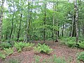
 Camilty Forest - geograph.org.uk - 2972961.jpg 640 × 480; 107 KB
-
 Camilty Forest Road - geograph.org.uk - 2972960.jpg 640 × 480; 108 KB
-
 Camilty Plantation - geograph.org.uk - 2215673.jpg 2,048 × 1,536; 2 MB
-
 Camilty Plantation - geograph.org.uk - 3005837.jpg 640 × 480; 277 KB
-
 Camilty Plantation - geograph.org.uk - 3005847.jpg 640 × 480; 231 KB
-

-
 Camilty Water - geograph.org.uk - 2295397.jpg 640 × 480; 118 KB
-
 Camilty Water near Blackhall - geograph.org.uk - 2837142.jpg 3,264 × 2,448; 4.39 MB
-
 Camp Viaduct - geograph.org.uk - 5198669.jpg 640 × 427; 571 KB
-
 Camp Viaduct - geograph.org.uk - 5198681.jpg 427 × 640; 515 KB
-
 Campbridge Park pool - geograph.org.uk - 4473368.jpg 3,264 × 2,448; 6.02 MB
-
 Camps Viaduct - geograph.org.uk - 5198661.jpg 640 × 427; 457 KB
-
 Camps Viaduct - geograph.org.uk - 5198671.jpg 427 × 640; 491 KB
-
 Canal Feeder - geograph.org.uk - 5198407.jpg 427 × 640; 528 KB
-
 Car park, Owen Square - geograph.org.uk - 4936567.jpg 800 × 600; 186 KB
-
 Carpark entrance - geograph.org.uk - 2109656.jpg 640 × 480; 90 KB
-
 Castle Greg - geograph.org.uk - 6323588.jpg 640 × 427; 429 KB
-
 Cattle grid on the road to West Cairns - geograph.org.uk - 2215691.jpg 2,048 × 1,536; 1.72 MB
-
 CCTV, Camilty - geograph.org.uk - 3005817.jpg 480 × 640; 55 KB
-
 Cedric Rise, Livingston - geograph.org.uk - 4937596.jpg 800 × 600; 235 KB
-
 Central Livingston from the air - geograph.org.uk - 6269213.jpg 1,024 × 768; 459 KB
-
 Central Scotland Forest - geograph.org.uk - 2731474.jpg 3,264 × 2,448; 5.14 MB
-
 Chicken Farm - geograph.org.uk - 5198448.jpg 640 × 427; 438 KB
-
 Chicken Farm - geograph.org.uk - 5198465.jpg 640 × 427; 581 KB
-
 Christmas in Murieston - geograph.org.uk - 1905667.jpg 1,024 × 683; 250 KB
-
 Christmas Trees - geograph.org.uk - 6323627.jpg 640 × 427; 394 KB
-
 Clapperton Hall - geograph.org.uk - 5198441.jpg 640 × 427; 325 KB
-
 Clear felled area, Camilty - geograph.org.uk - 3005850.jpg 640 × 480; 238 KB
-
 Clearfell in Camilty Plantation, near Harburn - geograph.org.uk - 4847431.jpg 1,024 × 682; 208 KB
-
 Clement Rise - geograph.org.uk - 4936605.jpg 800 × 600; 257 KB
-
 Coal Sheds - geograph.org.uk - 5198812.jpg 640 × 427; 355 KB
-
 Coal Sheds - geograph.org.uk - 5198813.jpg 640 × 427; 406 KB
-
 Coal Sheds - geograph.org.uk - 5198828.jpg 640 × 427; 333 KB
-
 Coal Sheds - geograph.org.uk - 5198833.jpg 425 × 640; 285 KB
-
 Cochrane Square - geograph.org.uk - 5686245.jpg 640 × 427; 293 KB
-
 Collapsed Bridge to Tiny Island in Pond - geograph.org.uk - 6490897.jpg 1,024 × 576; 144 KB
-
 Colzium from the air - geograph.org.uk - 4278023.jpg 640 × 480; 122 KB
-
 Colzium from the air - geograph.org.uk - 4278032.jpg 640 × 480; 94 KB
-
 Confluence of the River Almond and Linhouse Water - geograph.org.uk - 3101279.jpg 1,928 × 1,372; 2.44 MB
-
 Construction Site - geograph.org.uk - 4910066.jpg 640 × 480; 382 KB
-
 Cousland Road - geograph.org.uk - 1980088.jpg 640 × 480; 69 KB
-
 Covered Walkway Almondell Park - geograph.org.uk - 2161907.jpg 1,536 × 1,152; 982 KB
-
 Cowslips at Campbridge Park - geograph.org.uk - 4473279.jpg 3,264 × 2,448; 5.25 MB
-
 Craigs Strip - geograph.org.uk - 3719741.jpg 640 × 480; 334 KB
-
 Craigshill East Road - geograph.org.uk - 3815646.jpg 640 × 426; 224 KB
-
 Craigshill from the air - geograph.org.uk - 2953283.jpg 640 × 480; 180 KB
-
 Craigshill from the air - geograph.org.uk - 3300958.jpg 640 × 480; 165 KB
-
 Craigshill from the air - geograph.org.uk - 3722446.jpg 640 × 480; 231 KB
-
 Craigshill from the air - geograph.org.uk - 4009300.jpg 640 × 401; 148 KB
-
 Craigshill from the air - geograph.org.uk - 4050805.jpg 640 × 480; 200 KB
-
 Craigshill from the air - geograph.org.uk - 5274420.jpg 640 × 397; 136 KB
-
 Craigshill from the air - geograph.org.uk - 5274425.jpg 640 × 480; 154 KB
-
 Craigshill High School playing fields - geograph.org.uk - 3725925.jpg 640 × 480; 288 KB
-
 Craigwood Leisure Centre - geograph.org.uk - 1807852.jpg 1,024 × 768; 102 KB
-
 Cross Borders Drove Road ('Thieves Road') at Cauldstane Slap - geograph.org.uk - 5856394.jpg 3,776 × 2,520; 3.38 MB
-
 Decorative roundabout at Livingston - geograph.org.uk - 2346294.jpg 2,048 × 1,536; 1.34 MB
-
 Dedridge Burn and Plantation - geograph.org.uk - 4303179.jpg 800 × 600; 535 KB
-
 Dedridge Burn and Plantation - geograph.org.uk - 4303183.jpg 800 × 600; 546 KB
-
 Dedridge Burn and Plantation - geograph.org.uk - 4937681.jpg 800 × 600; 341 KB
-
 Dedridge Burn Plantation - geograph.org.uk - 4001702.jpg 640 × 480; 349 KB
-
 Dedridge Burn Plantation - geograph.org.uk - 4001709.jpg 640 × 480; 348 KB
-
 Dedridge Burn Plantation - geograph.org.uk - 4937679.jpg 800 × 600; 343 KB
-
 Dedridge Health Centre - geograph.org.uk - 2821668.jpg 640 × 360; 179 KB
-
 Dedridge Strip - geograph.org.uk - 4001649.jpg 640 × 480; 349 KB
-
 Dedridge West Road - geograph.org.uk - 3743469.jpg 640 × 480; 254 KB
-
 Demolished site - geograph.org.uk - 4040747.jpg 640 × 480; 91 KB
-
 Double Plug Socket on a Post in Wooded Area - geograph.org.uk - 6501446.jpg 576 × 1,024; 259 KB
-
 Drain at Nether Williamson - geograph.org.uk - 2837158.jpg 3,264 × 2,448; 6.22 MB
-
 Drainage Ditch - geograph.org.uk - 5687215.jpg 640 × 427; 371 KB
-
 Dumb Dumpers - geograph.org.uk - 6323579.jpg 640 × 427; 459 KB
-
 East Cairn Hill - geograph.org.uk - 4293879.jpg 3,818 × 3,456; 3.85 MB
-
 East Cairn Hill - geograph.org.uk - 4293891.jpg 4,608 × 3,456; 5.06 MB
-
 East Cairn Hill ahead - geograph.org.uk - 6176638.jpg 1,600 × 1,060; 388 KB
-
 East Cairn Hill Ascent - geograph.org.uk - 4298625.jpg 1,600 × 1,200; 522 KB
-
 East Cairn Hill from below West Cairn Hill - geograph.org.uk - 6478129.jpg 1,799 × 1,199; 329 KB
-
 East Cairn Hill viewed across Cauldstane Slap - geograph.org.uk - 4293211.jpg 4,608 × 3,456; 4.65 MB
-
 East Calder from the air - geograph.org.uk - 3417163.jpg 640 × 480; 159 KB
-
 East Calder Sewage Works - geograph.org.uk - 3176647.jpg 3,264 × 2,448; 3.19 MB
-
 East Lodge and Gateway - geograph.org.uk - 4910032.jpg 640 × 427; 400 KB
-
 Eastbound Platform at Livingston South Station - geograph.org.uk - 5855236.jpg 2,784 × 1,568; 2.06 MB
-
 Edge of conifer plantation - geograph.org.uk - 2295433.jpg 640 × 480; 74 KB
-
 Edinburgh-Carlisle line - geograph.org.uk - 2295366.jpg 640 × 480; 57 KB
-

-

-
 Entrance to Campbridge Park - geograph.org.uk - 4473277.jpg 3,264 × 2,448; 5.43 MB
-
 Entrance to Murieston Trail - geograph.org.uk - 2295312.jpg 640 × 480; 131 KB
-
 Entrance, Balgreen - geograph.org.uk - 2295352.jpg 640 × 480; 63 KB
-
 Eurofins Building - geograph.org.uk - 5686250.jpg 640 × 427; 276 KB
-
 Evening camp - geograph.org.uk - 3264647.jpg 800 × 600; 66 KB
-
 Fairly Inaccessible Pond just off Adambrae Road - geograph.org.uk - 6530911.jpg 1,024 × 576; 255 KB
-
 Falconer Rise, Livingston - geograph.org.uk - 4936581.jpg 800 × 600; 180 KB
-
 Farmland at Gavieside from the air - geograph.org.uk - 6157858.jpg 1,024 × 768; 346 KB
-
 Felled Forest - geograph.org.uk - 6323573.jpg 640 × 427; 432 KB

_Scout_Group_-_geograph.org.uk_-_4473378.jpg)


_at_Cauldstane_Slap_-_geograph.org.uk_-_5856394.jpg)


&filefrom=Field+Drain+-+geograph.org.uk+-+5690516.jpg#mw-category-media)