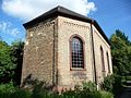
Category:Mennonitenkirche (Limburgerhof)
Jump to navigation
Jump to search
Look also at / Siehe auch:
Category:Mennonite church hall Kohlhof (Mennonitisches Gemeindehaus Kohlhof)
| Object location | | View all coordinates using: OpenStreetMap |
|---|
| Upload media | |||||
| Instance of | |||||
|---|---|---|---|---|---|
| Location | Limburgerhof, Rhein-Pfalz, Rhineland-Palatinate, Germany | ||||
| Heritage designation | |||||
 | |||||
Media in category "Mennonitenkirche (Limburgerhof)"
The following 9 files are in this category, out of 9 total.
-
 Kohlhof 10.jpg 3,072 × 2,304; 3.41 MB
-
 Kohlhof Mennonitenkirche 1.JPG 1,891 × 2,055; 860 KB
-
 Kohlhof Mennonitenkirche 2.JPG 1,386 × 1,197; 432 KB
-
 Mennonitenkirche (Limburgerhof) 01.jpg 2,304 × 3,072; 3.34 MB
-
 Mennonitenkirche (Limburgerhof) 02.jpg 2,304 × 3,072; 3.64 MB
-
 Mennonitenkirche (Limburgerhof) 03.jpg 2,304 × 3,072; 3.43 MB
-
 Mennonitenkirche (Limburgerhof) 04.jpg 2,304 × 3,072; 3.37 MB
-
 Mennonitenkirche (Limburgerhof) 05.jpg 2,304 × 3,072; 3.33 MB
-
 Mennonitenkirche (Limburgerhof) 06.jpg 3,072 × 2,304; 3.48 MB


_01.jpg)
_02.jpg)
_03.jpg)
_04.jpg)
_05.jpg)
_06.jpg)