Category:Mennonite church hall Kohlhof
Jump to navigation
Jump to search
Look also at / Siehe auch: Category:Mennonitenkirche (Limburgerhof) Mennonite church Kohlhof in Limburgerhof-Kohlhof
| Object location | | View all coordinates using: OpenStreetMap |
|---|
Media in category "Mennonite church hall Kohlhof"
The following 4 files are in this category, out of 4 total.
-
 Gemeindehaus Kohlhof Ansicht.JPG 1,024 × 768; 226 KB
-
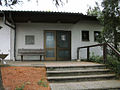 Gemeindehaus Kohlhof Eingang.JPG 1,024 × 768; 157 KB
-
 Gemeindehaus Kohlhof Jeremia 29,11.JPG 1,024 × 768; 127 KB
-
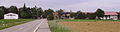 Kohlhof Limburgerhof.JPG 1,926 × 512; 191 KB


