Category:May 2010 in Kent
Jump to navigation
Jump to search
Deutsch: Bilder, die im Mai 2010 in Kent aufgenommen worden sind. Bitte beachten Sie, dass dies weder das Datum des Uploads noch das Datum des Scannens eines Fotos ist.
English: Images/pictures taken in Kent during May 2010. Note this is not the date of the upload, nor the date a photo was scanned.
Español: Fotografías o imágenes tomadas en Kent durante mayo 2010. No es la fecha de subida ni escaneo, sino la fecha en que las fotografías o imágenes se crearon.
Esperanto: Bildoj faritaj en Kent en majo 2010. Tio ne estas la dato, kiam la bildoj estis alŝutitaj aŭ skanitaj.
Français : Photographies ou images prises en Kent durant mai 2010. Ce n'est pas la date du téléchargement ou du scan.
Galego: Fotografías ou imaxes tomadas en Kent durante maio 2010. Non é a data de subida nin escaneamento, senón a data na que se crearon as fotografías ou imaxes.
Italiano: Fotografie o immagini scattate a Kent nel maggio 2010. Nota bene: la data non si riferisce né a quella di upload né a quella in cui la foto è stata digitalizzata.
Norsk bokmål: Bilder tatt i Kent i løpet av mai 2010. Merk at dette ikke er datoen for opplasting, eller når et bilde har blitt skannet.
Norsk nynorsk: Bilete teke i Kent i løpet av mai 2010. Merk at dette ikkje er datoen for opplasting, eller når eit bilete har vorte skanna.
Русский: Изображения, сделанные в Kent в течение май 2010 (не дата загрузки изображения).
Українська: Зображення, зроблені в Kent протягом травень 2010. Зауважте, що це не дата завантаження чи дата сканування фотографії.
| May 2009 | ← | May 2010 | → | May 2011 | |||||||
| Jan | Feb | Mar | Apr | May | Jun | Jul | Aug | Sep | Oct | Nov | Dec |
| 114 | 137 | 391 | 154 | 47 | 135 | 61 | 332 | 147 | 176 | 52 | 91 |
|---|---|---|---|---|---|---|---|---|---|---|---|
Subcategories
This category has the following 2 subcategories, out of 2 total.
Media in category "May 2010 in Kent"
The following 45 files are in this category, out of 45 total.
-
 Crop Spraying - geograph.org.uk - 1843977.jpg 1,024 × 768; 228 KB
-
 395003 at ebbsfleet.jpg 1,024 × 768; 411 KB
-
 All Saints Church, Lydd - geograph.org.uk - 1873376.jpg 1,024 × 633; 142 KB
-
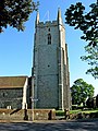
 All Saints Parish Church (1) - geograph.org.uk - 2048341.jpg 600 × 800; 159 KB
-
 All Saints Parish Church (2) - geograph.org.uk - 2048354.jpg 800 × 581; 133 KB
-
 All Saints Parish Church (3) - geograph.org.uk - 2048393.jpg 600 × 800; 165 KB
-
 Bench, Sissinghurst.jpg 3,264 × 2,448; 2.64 MB
-
 Bluebells at Ashenbank Wood - panoramio.jpg 4,288 × 2,848; 9.31 MB
-
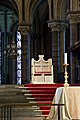 Canterburycathedralthrone.jpg 2,592 × 3,888; 8.37 MB
-
 Case MX150 tractor and Water Pipe - geograph.org.uk - 1881380.jpg 1,024 × 683; 214 KB
-
 College Avenue off York Avenue - geograph.org.uk - 2130071.jpg 640 × 430; 138 KB
-
 Dartford War Memorial - front.jpg 2,176 × 3,776; 2.17 MB
-
 Dover Castle panoply - geograph.org.uk - 1894135.jpg 2,501 × 1,266; 1.5 MB
-
 Dover Eastern Docks - geograph.org.uk - 1942547.jpg 640 × 480; 51 KB
-

-
 Edward VII postbox, Coronation Square - geograph.org.uk - 2047842.jpg 557 × 800; 125 KB
-
 Footpath off North Farm Rd - geograph.org.uk - 1927403.jpg 640 × 430; 156 KB
-
 Forge Farm - geograph.org.uk - 1947627.jpg 640 × 430; 50 KB
-
 Frederick Rd off York Avenue - geograph.org.uk - 2130114.jpg 640 × 430; 136 KB
-
 Hawkhurst Allotments - geograph.org.uk - 1855485.jpg 3,072 × 2,304; 1.32 MB
-
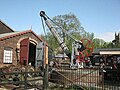 Hawkhurst yard crane.JPG 1,600 × 1,200; 333 KB
-
 Irrigation equipment - geograph.org.uk - 1881393.jpg 1,024 × 683; 196 KB
-
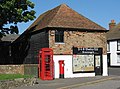 J ^ G Woolley Ltd., 1 Coronation Square - geograph.org.uk - 2047813.jpg 800 × 591; 135 KB
-

-
 Lydd Butchers, 8 High Street - geograph.org.uk - 1999132.jpg 800 × 608; 152 KB
-

-
 Lydd Fire Station, High Street - geograph.org.uk - 1999613.jpg 800 × 602; 107 KB
-
 Lydd High Street - geograph.org.uk - 1885182.jpg 1,024 × 768; 222 KB
-

-
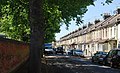
 North Farm Rd, High Brooms - geograph.org.uk - 1927400.jpg 640 × 430; 117 KB
-
 Pump and Water Sprayer - geograph.org.uk - 1881412.jpg 8,243 × 2,441; 7.2 MB
-
 Railway Bridge, Sandhurst Rd - geograph.org.uk - 1927407.jpg 640 × 430; 153 KB
-
 Ramsgate Station, 2010 geograph-3973703-by-Ben-Brooksbank.jpg 2,335 × 1,230; 4.23 MB
-
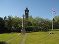 Sandhurst War Memorial - gegoraph.org.uk - 1874950.jpg 3,072 × 2,304; 1.77 MB
-
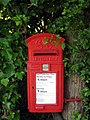 Skullsgate Postbox - geograph.org.uk - 1875640.jpg 768 × 1,024; 245 KB
-
 St John Ambulance Station, Silverdale Rd - geograph.org.uk - 1927415.jpg 640 × 430; 138 KB
-
 The end of York Avenue - geograph.org.uk - 2130137.jpg 640 × 430; 147 KB
-
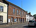 The Guildhall, 13 High Street - geograph.org.uk - 2048230.jpg 800 × 625; 150 KB
-
 The Romney, Hythe & Dymchurch Railway 21.jpg 4,000 × 3,000; 1.76 MB
-
 Upper Chapel in the Keep of Dover Castle - geograph.org.uk - 1906014.jpg 768 × 1,024; 165 KB
-
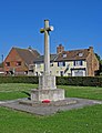 War Memorial, Park Street - geograph.org.uk - 2047875.jpg 2,204 × 2,874; 552 KB
-
 York Avenue - geograph.org.uk - 2130053.jpg 640 × 430; 152 KB
-
 York Avenue - geograph.org.uk - 2130072.jpg 640 × 430; 142 KB
-
 York Avenue - geograph.org.uk - 2130104.jpg 640 × 430; 163 KB
-
 York Avenue - geograph.org.uk - 2130129.jpg 640 × 392; 111 KB


_-_geograph.org.uk_-_2048341.jpg)
_-_geograph.org.uk_-_2048354.jpg)
_-_geograph.org.uk_-_2048393.jpg)


,_Coronation_Square_-_geograph.org.uk_-_2047848.jpg)


