Category:August 2010 in Kent
Jump to navigation
Jump to search
Deutsch: Bilder, die im August 2010 in Kent aufgenommen worden sind. Bitte beachten Sie, dass dies weder das Datum des Uploads noch das Datum des Scannens eines Fotos ist.
English: Images/pictures taken in Kent during August 2010. Note this is not the date of the upload, nor the date a photo was scanned.
Español: Fotografías o imágenes tomadas en Kent durante agosto 2010. No es la fecha de subida ni escaneo, sino la fecha en que las fotografías o imágenes se crearon.
Esperanto: Bildoj faritaj en Kent en aŭgusto 2010. Tio ne estas la dato, kiam la bildoj estis alŝutitaj aŭ skanitaj.
Français : Photographies ou images prises en Kent durant août 2010. Ce n'est pas la date du téléchargement ou du scan.
Galego: Fotografías ou imaxes tomadas en Kent durante agosto 2010. Non é a data de subida nin escaneamento, senón a data na que se crearon as fotografías ou imaxes.
Italiano: Fotografie o immagini scattate a Kent nel agosto 2010. Nota bene: la data non si riferisce né a quella di upload né a quella in cui la foto è stata digitalizzata.
Norsk bokmål: Bilder tatt i Kent i løpet av august 2010. Merk at dette ikke er datoen for opplasting, eller når et bilde har blitt skannet.
Norsk nynorsk: Bilete teke i Kent i løpet av august 2010. Merk at dette ikkje er datoen for opplasting, eller når eit bilete har vorte skanna.
Русский: Изображения, сделанные в Kent в течение август 2010 (не дата загрузки изображения).
Українська: Зображення, зроблені в Kent протягом серпень 2010. Зауважте, що це не дата завантаження чи дата сканування фотографії.
| August 2009 | ← | August 2010 | → | August 2011 | |||||||
| Jan | Feb | Mar | Apr | May | Jun | Jul | Aug | Sep | Oct | Nov | Dec |
| 120 | 137 | 395 | 154 | 47 | 136 | 61 | 332 | 148 | 178 | 52 | 91 |
|---|---|---|---|---|---|---|---|---|---|---|---|
Subcategories
This category has the following 4 subcategories, out of 4 total.
Media in category "August 2010 in Kent"
The following 200 files are in this category, out of 328 total.
(previous page) (next page)-
 15 Market Street Sandwich 1 (4905817296).jpg 2,880 × 3,030; 3.92 MB
-
 15 Market Street Sandwich 2 (4905820882).jpg 4,290 × 3,084; 5.45 MB
-
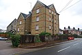
 18 Dunstan Rd - geograph.org.uk - 2135465.jpg 640 × 430; 137 KB
-
 18 Dunstan Rd - geograph.org.uk - 2228790.jpg 640 × 430; 119 KB
-

-
 8 Palace Street Canterbury 1 (4901603285).jpg 3,040 × 4,416; 5.74 MB
-
 8 Palace Street Canterbury 2 (4901599259).jpg 2,520 × 4,624; 5.09 MB
-
 8 Palace Street Canterbury detail 1 (4902181140).jpg 3,168 × 4,752; 6.79 MB
-
 A horologists, Stephen's Rd - geograph.org.uk - 2228746.jpg 640 × 430; 123 KB
-
 A228, Pembury - geograph.org.uk - 2233392.jpg 640 × 347; 69 KB
-
 Abbey Court Medical Centre - geograph.org.uk - 2119982.jpg 640 × 430; 134 KB
-
-
 All Saints Lane Canterbury (4904478304).jpg 4,554 × 3,168; 6.12 MB
-
 Alley to Skinners from Camden Rd - geograph.org.uk - 2235300.jpg 640 × 430; 120 KB
-
 Alleyway to The Grove - geograph.org.uk - 2133881.jpg 640 × 430; 161 KB
-
 Allotments near Lakeman Way - geograph.org.uk - 2086375.jpg 640 × 430; 139 KB
-
 Allotments, Lakeman Way - geograph.org.uk - 2086376.jpg 640 × 430; 146 KB
-
 An old advert, Stephen's Rd - geograph.org.uk - 2239952.jpg 640 × 430; 132 KB
-
 Back entrance to Royal Victoria Place - geograph.org.uk - 2235305.jpg 640 × 430; 164 KB
-

-
 Beach hut (4904028263).jpg 3,110 × 4,392; 6.44 MB
-
 Beach Huts 1 (4904019069).jpg 4,494 × 2,694; 6.18 MB
-
 Beach Huts 1a (4904614224).jpg 4,686 × 2,874; 7.66 MB
-
 Beach Huts Folkestone.jpg 3,648 × 2,376; 1.24 MB
-
 Belgium F-16s at Manston.jpg 3,867 × 1,759; 2.68 MB
-
 Beulah Rd - geograph.org.uk - 2229909.jpg 640 × 430; 132 KB
-
 Bishops Down - geograph.org.uk - 2122852.jpg 640 × 430; 142 KB
-
 Black Prince Tomb (4904432694).jpg 4,026 × 2,694; 4.91 MB
-
 Blacks, Monson Rd - geograph.org.uk - 2230534.jpg 640 × 430; 133 KB
-
 Boeing 747 N309TD at Manston.jpg 4,053 × 2,403; 3.49 MB
-
 Bracken Cottage and Pond - geograph.org.uk - 2122892.jpg 640 × 430; 174 KB
-
 Brick Wall (4905255573).jpg 4,752 × 3,168; 13.49 MB
-

-
 Burgate Antiques Centre Canterbury 2 (4901775790).jpg 4,690 × 3,036; 6.19 MB
-
 By the side of the Pembury Bypass - geograph.org.uk - 2233321.jpg 640 × 430; 103 KB
-
 Camden Food Bazaar, Camden Rd - geograph.org.uk - 2237042.jpg 640 × 430; 126 KB
-

-
 Camden Road car park - geograph.org.uk - 2229920.jpg 640 × 430; 141 KB
-
 Camden Square - geograph.org.uk - 2235304.jpg 640 × 430; 166 KB
-
 Canterbury Cathedral 1 (4901928321).jpg 3,969 × 4,576; 8.47 MB
-
 Canterbury Cathedral 10 (4904426950).jpg 4,224 × 3,168; 8.83 MB
-
 Canterbury Cathedral 2 (4901946927).jpg 3,101 × 4,633; 6.28 MB
-
 Canterbury Cathedral 3 (4901938377).jpg 2,864 × 4,720; 5.82 MB
-
 Canterbury Cathedral 4 (4901957939).jpg 2,816 × 4,752; 5.63 MB
-
 Canterbury Cathedral 5 (4904362454).jpg 4,544 × 3,072; 6.63 MB
-
 Canterbury Cathedral 6 (4904370706).jpg 3,008 × 4,752; 7.36 MB
-
 Canterbury Cathedral 7 (4904367332).jpg 4,656 × 3,168; 11.17 MB
-
 Canterbury Cathedral 8 (4904359162).jpg 3,080 × 4,616; 7.48 MB
-
 Canterbury Cathedral 9 (4903759753).jpg 2,816 × 4,176; 6.49 MB
-
 Canterbury Cathedral Cloister Ceiling (4904341520).jpg 4,752 × 3,168; 9.54 MB
-
 Canterbury Cathedral Cloister Ceiling 2 (4904355494).jpg 2,771 × 2,671; 4.74 MB
-
 Canterbury Cathedral Cloister Ceiling 3 (4904353196).jpg 3,030 × 4,262; 8.27 MB
-
 Canterbury Cathedral Cloisters (4904346090).jpg 3,168 × 4,752; 9.06 MB
-
 Canterbury Cathedral Visiters Centre (4904586774).jpg 2,968 × 4,528; 6.38 MB
-
 Canterbury Cathedral Visiters Centre Roof (4903998843).jpg 2,814 × 1,335; 2.74 MB
-
 Car park, Tunbridge Wells Common - geograph.org.uk - 2122925.jpg 640 × 430; 144 KB
-
 Cathedral Altar (4903695061).jpg 3,168 × 4,752; 10.79 MB
-
 Cathedral Ceiling 1 (4903677021).jpg 3,210 × 4,677; 8.93 MB
-
 Cathedral Ceiling 2 (4904254104).jpg 3,168 × 4,752; 6.68 MB
-
 Cathedral Ceiling 3 (4904256812).jpg 3,061 × 4,441; 6.7 MB
-
 Cathedral Ceiling 4 (4903670571).jpg 3,024 × 4,662; 7.52 MB
-
 Cathedral Ceiling 5 (4904262638).jpg 4,400 × 3,160; 6.24 MB
-
 Cathedral Ceiling 6 (4903680229).jpg 4,752 × 3,168; 7.66 MB
-
 Cathedral Ceiling 7 (4904271984).jpg 4,752 × 3,168; 6.23 MB
-
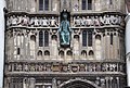
 Cathedral Entrance (4903698049).jpg 3,064 × 4,752; 6.5 MB
-
 Cathedral Entrance Ceiling (4904275534).jpg 4,752 × 3,168; 7.6 MB
-
 Cathedral Palace 3 (4903747367).jpg 4,398 × 2,778; 7.9 MB
-
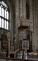 Cathedral Pulpit (4903702611).jpg 2,872 × 4,536; 5.92 MB
-
 Centenary Viewing Spot, Tunbridge Wells - geograph.org.uk - 2120014.jpg 640 × 430; 134 KB
-
 Chatham railway station geograph-2045914-by-Stacey-Harris.jpg 2,048 × 1,536; 1.05 MB
-
 Christchurch Gateway Canterbury 2 (4902670782).jpg 4,581 × 3,097; 8.21 MB
-
 Church of St Peter Sandwich 1 (4905245641).jpg 4,518 × 3,168; 9.97 MB
-
 Church of St Peter Sandwich 2 (4905238815).jpg 4,494 × 3,168; 9.99 MB
-
 Church of the Holy Cross Canterbury (4904565325).jpg 3,084 × 2,892; 3.52 MB
-
 Claridge House, Upper Grosvenor Rd - geograph.org.uk - 2228778.jpg 640 × 430; 134 KB
-
 Conquest House Canterbury (4901845114).jpg 3,120 × 3,704; 5.73 MB
-
 Converted Villa, Quarry Rd - geograph.org.uk - 2237745.jpg 640 × 430; 123 KB
-

-
 Crystal Palace, Camden Rd - geograph.org.uk - 2235309.jpg 640 × 430; 119 KB
-
 Cumberland Walk - geograph.org.uk - 2126959.jpg 640 × 430; 157 KB
-
 Dairy Crest Dairy, St John's Rd - geograph.org.uk - 2119963.jpg 640 × 430; 121 KB
-
 DC-10 5X-JOE at Manston.jpg 4,026 × 2,538; 5.43 MB
-
 DC-8 in storage or ready for scrap at Manston.jpg 4,572 × 2,490; 5.75 MB
-
 Deal Beach 1 (4904670659).jpg 4,590 × 2,873; 7.49 MB
-
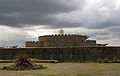 Deal Castle (1).jpg 4,200 × 2,658; 5.89 MB
-
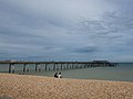 Deal Pier - geograph.org.uk - 2029655.jpg 3,488 × 2,616; 2.14 MB
-
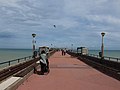 Deal Pier - geograph.org.uk - 2029665.jpg 3,488 × 2,616; 2.08 MB
-
 Deal Pier - geograph.org.uk - 2029671.jpg 3,488 × 2,616; 2.22 MB
-
 Dickens House Broadstairs.jpg 4,164 × 3,090; 7.39 MB
-
 Doorway 41-45 Palace Street Canterbury (4901564107).jpg 3,117 × 3,889; 7.27 MB
-
 Dover Castle - geograph.org.uk - 2028013.jpg 3,098 × 2,123; 1.74 MB
-
 Dover Eastern Docks - geograph.org.uk - 2028016.jpg 3,488 × 2,616; 2.21 MB
-
 Dover Eastern Docks - geograph.org.uk - 2028043.jpg 3,488 × 2,616; 2.16 MB
-
 Drinking Fountain, Camden Rd - geograph.org.uk - 2135359.jpg 640 × 430; 151 KB
-
 Duke of York, The Pantiles - geograph.org.uk - 2126938.jpg 640 × 430; 145 KB
-
 Ely Court - geograph.org.uk - 2235284.jpg 640 × 430; 141 KB
-
 Ely Court, Royal Victoria Place - geograph.org.uk - 2134962.jpg 640 × 430; 131 KB
-
 Entrance to Calverley Park - geograph.org.uk - 2134836.jpg 640 × 382; 109 KB
-
 Faversham Creek during a high tide - geograph.org.uk - 2100443.jpg 640 × 480; 138 KB
-
 Fegans, St James's Rd - geograph.org.uk - 2238862.jpg 640 × 430; 131 KB
-
 Fishmarket, The Pantiles - geograph.org.uk - 2126918.jpg 640 × 430; 181 KB
-
 Flats, Quarry Rd - geograph.org.uk - 2229878.jpg 640 × 430; 132 KB
-
 Floor Canterbury Cathedral (4903840903).jpg 4,638 × 1,962; 6.79 MB
-
 Footpath off St Michael's Rd - geograph.org.uk - 2239970.jpg 640 × 375; 96 KB
-
 Footpath to St John's Primary School - geograph.org.uk - 2086378.jpg 640 × 430; 140 KB
-
 Footpath to St Michael's Rd - geograph.org.uk - 2086369.jpg 640 × 430; 148 KB
-
 Footpath to St Michael's Rd - geograph.org.uk - 2086384.jpg 640 × 430; 162 KB
-
 Footpath to St Michael's Rd - geograph.org.uk - 2086386.jpg 640 × 430; 170 KB
-
 Footpath to St Michael's Rd - geograph.org.uk - 2086387.jpg 640 × 430; 125 KB
-
 Former Stables, Duke of York's Rd - geograph.org.uk - 2125741.jpg 640 × 430; 114 KB
-
 Gasholder, High Brooms - geograph.org.uk - 2086249.jpg 640 × 430; 126 KB
-
 George Whitfield Memorial - geograph.org.uk - 2119984.jpg 640 × 430; 163 KB
-
 Gorse and Bracken Cottage - geograph.org.uk - 2122897.jpg 640 × 430; 99 KB
-
 Grand Hotel Folkestone 1 (4910360489).jpg 4,182 × 3,126; 7.34 MB
-
 Grand Hotel Folkestone 2 (4910957412).jpg 3,144 × 3,078; 6.05 MB
-
 Grosvenor Bridge - geograph.org.uk - 2135461.jpg 640 × 430; 135 KB
-
 Grosvenor Bridge - geograph.org.uk - 2228827.jpg 640 × 430; 111 KB
-
 Grosvenor Bridge - geograph.org.uk - 2238866.jpg 640 × 430; 124 KB
-
 Grosvenor Bridge - geograph.org.uk - 2238867.jpg 640 × 430; 132 KB
-
 Grove Tavern, Little Mount Sion - geograph.org.uk - 2133876.jpg 430 × 640; 91 KB
-
 Guildhall Sandwich (4906558345).jpg 4,230 × 2,370; 4.35 MB
-
 Hasletts Close - geograph.org.uk - 2228771.jpg 640 × 430; 138 KB
-
 Hawkshead, Calverley Rd - geograph.org.uk - 2235274.jpg 640 × 430; 128 KB
-
 Helicopter at Manston.jpg 4,752 × 3,168; 7.99 MB
-
 Hot Pot Cafe, Camden Rd - geograph.org.uk - 2135315.jpg 640 × 430; 124 KB
-
 Hot Pot Cafe, Camden Rd - geograph.org.uk - 2237057.jpg 640 × 430; 129 KB
-
 Hungershall Park looking west - geograph.org.uk - 2122902.jpg 640 × 430; 157 KB
-
 Hungershall Park, Tunbridge Wells Common - geograph.org.uk - 2122904.jpg 640 × 430; 174 KB
-
 Hurricane at Manston (1).jpg 4,752 × 3,168; 7.82 MB
-
 Hurricane at Manston.jpg 4,752 × 3,168; 5.82 MB
-
 Il Vesuvio, Camden Rd - geograph.org.uk - 2229949.jpg 640 × 430; 130 KB
-
 In Skin, Camden Rd - geograph.org.uk - 2135234.jpg 640 × 430; 125 KB
-
 Jaguar at Manston (1).jpg 4,296 × 2,244; 5.85 MB
-
 Jaguar at Manston.jpg 4,746 × 2,598; 6.51 MB
-
 Jaks, Camden Rd - geograph.org.uk - 2135095.jpg 640 × 430; 131 KB
-
 Job Centre, Tunbridge Wells - geograph.org.uk - 2119985.jpg 640 × 430; 130 KB
-
 John Rd off St John's Rd - geograph.org.uk - 2119968.jpg 640 × 430; 125 KB
-

-
 Kelsey Arms - geograph.org.uk - 2119962.jpg 640 × 430; 123 KB
-
 Keston Lodge - geograph.org.uk - 2134866.jpg 640 × 430; 127 KB
-
 Kingfisher House, Quarry Rd - geograph.org.uk - 2237741.jpg 640 × 430; 125 KB
-
 Kingswood Rd - geograph.org.uk - 2233402.jpg 640 × 430; 110 KB
-
 Flower 3 (4907947322).jpg 1,728 × 2,640; 3.38 MB
-
 Lakeman Way - geograph.org.uk - 2086363.jpg 640 × 430; 120 KB
-
 Lakeman Way - geograph.org.uk - 2086367.jpg 640 × 430; 126 KB
-
 Langton Rd (A264) - geograph.org.uk - 2122863.jpg 640 × 430; 140 KB
-
 Looking to Camden Square - geograph.org.uk - 2230009.jpg 640 × 430; 142 KB
-
 Lower Walk, The Pantiles - geograph.org.uk - 2126910.jpg 640 × 430; 138 KB
-
 Macroglossum stellatarum (4905289137).jpg 2,262 × 1,764; 1.9 MB
-
 Macroglossum stellatarum (4905876604).jpg 1,458 × 1,830; 1.34 MB
-
 Marketing Suite, Quarry Rd - geograph.org.uk - 2238860.jpg 640 × 430; 123 KB
-
 Martello Tower no 24, Dymchurch - geograph.org.uk - 2063062.jpg 947 × 710; 179 KB
-
 Martello Tower no 25, Dymchurch - geograph.org.uk - 2063080.jpg 973 × 730; 184 KB
-
 Mayo House - geograph.org.uk - 2120024.jpg 640 × 430; 141 KB
-
 Mereworth Motors, Somerset Rd - geograph.org.uk - 2119958.jpg 640 × 430; 112 KB
-
 Merrion Close - geograph.org.uk - 2086339.jpg 640 × 430; 117 KB
-
 Merrion Way - geograph.org.uk - 2086350.jpg 640 × 430; 112 KB
-
 Mini-roundabout, Bishops Down - geograph.org.uk - 2122855.jpg 640 × 430; 138 KB
-
 Molyneux Place - geograph.org.uk - 2120059.jpg 640 × 430; 119 KB
-
 Monarch Amusements, Camden Rd - geograph.org.uk - 2135083.jpg 640 × 430; 125 KB
-
 Money Shop, Camden Rd - geograph.org.uk - 2135292.jpg 640 × 430; 127 KB
-
 Money Shop, Camden Rd - geograph.org.uk - 2237021.jpg 640 × 430; 129 KB
-
 Monson Way - geograph.org.uk - 2230544.jpg 640 × 430; 141 KB
-
 Mooli, Calverley Rd - geograph.org.uk - 2134936.jpg 640 × 430; 134 KB
-
 Mount Ephraim House - geograph.org.uk - 2122842.jpg 640 × 430; 135 KB
-
 Mount Pleasant - geograph.org.uk - 2230540.jpg 640 × 430; 132 KB
-
 Mountfield Rd - geograph.org.uk - 2134750.jpg 640 × 430; 143 KB
-
 Multi-storey car park, Royal Arcade - geograph.org.uk - 2134754.jpg 640 × 430; 132 KB
-
 N952CA Boeing 747-428 at Manston (4907119260).jpg 4,566 × 2,496; 4.75 MB
-
 Nevill Park - geograph.org.uk - 2122889.jpg 640 × 430; 123 KB
-
 New build by Grosvenor Bridge - geograph.org.uk - 2228819.jpg 640 × 430; 136 KB
-

-
 New development by Grosvenor Bridge - geograph.org.uk - 2238872.jpg 640 × 430; 113 KB
-

-

-
 New Romney Station (4910201175).jpg 3,942 × 3,168; 6.86 MB
-
 New Romney station - geograph.org.uk - 2062184.jpg 922 × 691; 187 KB
-
 Next, Royal Victoria Place, Camden Rd - geograph.org.uk - 2135069.jpg 640 × 430; 145 KB
-
 No1 fish and Chip Shop, Camden Rd - geograph.org.uk - 2237730.jpg 640 × 430; 129 KB
-
 North Farm Close - geograph.org.uk - 2086248.jpg 640 × 430; 122 KB
-
 North Farm Rd - geograph.org.uk - 2086251.jpg 640 × 430; 139 KB
-
 Number 1, Camden Rd - geograph.org.uk - 2135355.jpg 640 × 430; 132 KB
-
 Old Kings School Shop Canterbury 2 (4901784008).jpg 2,871 × 4,086; 6.49 MB
-
 Online Auctions, Camden Rd - geograph.org.uk - 2237031.jpg 640 × 430; 134 KB
-
 Ospringe Rd, Faversham - geograph.org.uk - 2050197.jpg 3,072 × 2,304; 2.24 MB
-
 Passageway off Camden Square - geograph.org.uk - 2235308.jpg 640 × 430; 148 KB
-
 Pheasant Canterbury Cathedral (4904475012).jpg 2,532 × 2,676; 4.69 MB
-

-
 Platforms at Dover Priory Station - geograph.org.uk - 2024200.jpg 3,488 × 2,616; 2.23 MB
-
 Port of Dover - geograph.org.uk - 2028006.jpg 3,488 × 2,616; 2.2 MB
-
 Postbox, Camden Rd - geograph.org.uk - 2236988.jpg 640 × 430; 126 KB
-
 Preedee Thai Cuisine, Camden Rd - geograph.org.uk - 2135331.jpg 640 × 430; 126 KB
-
 Preedee Thai Cuisine, Camden Rd - geograph.org.uk - 2237059.jpg 640 × 371; 79 KB
-
 Prince of Wales - geograph.org.uk - 2235292.jpg 640 × 430; 136 KB
-
 Prince of Wales, Camden Rd - geograph.org.uk - 2135006.jpg 640 × 430; 128 KB
-
 Pub Sign - The Beau Nash - geograph.org.uk - 2120002.jpg 640 × 430; 143 KB
-
 Purple (4907331497).jpg 4,104 × 3,162; 7.42 MB
-
 Purple 2 (4907352059).jpg 2,574 × 2,490; 3.09 MB
-
 Railway bridge, Sandhurst Rd - geograph.org.uk - 2086256.jpg 640 × 430; 156 KB
-
 RH^DR Engine No. 12 "John Southland" - geograph.org.uk - 2242350.jpg 2,272 × 1,704; 881 KB
.jpg)
.jpg)


.jpg)
.jpg)
.jpg)


.jpg)


.jpg)
.jpg)
.jpg)


.jpg)


.jpg)

.jpg)


.jpg)
.jpg)
.jpg)
.jpg)
.jpg)
.jpg)
.jpg)
.jpg)
.jpg)
.jpg)
.jpg)
.jpg)
.jpg)
.jpg)
.jpg)
.jpg)

.jpg)
.jpg)
.jpg)
.jpg)
.jpg)
.jpg)
.jpg)
.jpg)
.jpg)
.jpg)
.jpg)
.jpg)


.jpg)
.jpg)
.jpg)
.jpg)

.jpg)


.jpg)
.jpg)


.jpg)


.jpg)


.jpg)
.jpg)


.jpg)


.jpg)


.jpg)


.jpg)


_-_geograph.org.uk_-_2122863.jpg)


.jpg)
.jpg)


.jpg)


.jpg)


.jpg)


.jpg)


.jpg)
.jpg)

