Category:May 2009 in the Scottish Borders
Jump to navigation
Jump to search
Council areas (municipalities) of Scotland: Aberdeenshire · Argyll and Bute · Dumfries and Galloway · Edinburgh · Fife · Glasgow · Highland · Moray · Scottish Borders · Stirling · West Lothian
Deutsch: Bilder, die im Mai 2009 in the Scottish Borders aufgenommen worden sind. Bitte beachten Sie, dass dies weder das Datum des Uploads noch das Datum des Scannens eines Fotos ist.
English: Images/pictures taken in the Scottish Borders during May 2009. Note this is not the date of the upload, nor the date a photo was scanned.
Español: Fotografías o imágenes tomadas en the Scottish Borders durante mayo 2009. No es la fecha de subida ni escaneo, sino la fecha en que las fotografías o imágenes se crearon.
Esperanto: Bildoj faritaj en the Scottish Borders en majo 2009. Tio ne estas la dato, kiam la bildoj estis alŝutitaj aŭ skanitaj.
Français : Photographies ou images prises en the Scottish Borders durant mai 2009. Ce n'est pas la date du téléchargement ou du scan.
Galego: Fotografías ou imaxes tomadas en the Scottish Borders durante maio 2009. Non é a data de subida nin escaneamento, senón a data na que se crearon as fotografías ou imaxes.
Italiano: Fotografie o immagini scattate a the Scottish Borders nel maggio 2009. Nota bene: la data non si riferisce né a quella di upload né a quella in cui la foto è stata digitalizzata.
Norsk bokmål: Bilder tatt i the Scottish Borders i løpet av mai 2009. Merk at dette ikke er datoen for opplasting, eller når et bilde har blitt skannet.
Norsk nynorsk: Bilete teke i the Scottish Borders i løpet av mai 2009. Merk at dette ikkje er datoen for opplasting, eller når eit bilete har vorte skanna.
Русский: Изображения, сделанные в the Scottish Borders в течение май 2009 (не дата загрузки изображения).
Українська: Зображення, зроблені в the Scottish Borders протягом травень 2009. Зауважте, що це не дата завантаження чи дата сканування фотографії.
| May 2008 | ← | May 2009 | → | May 2010 | |||||||
| Jan | Feb | Mar | Apr | May | Jun | Jul | Aug | Sep | Oct | Nov | Dec |
| 18 | 12 | 0 | 28 | 31 | 34 | 57 | 26 | 18 | 49 | 0 | 24 |
|---|---|---|---|---|---|---|---|---|---|---|---|
Media in category "May 2009 in the Scottish Borders"
The following 31 files are in this category, out of 31 total.
-
 A country road at Chatto - geograph.org.uk - 1304802.jpg 640 × 406; 119 KB
-
 A country road in the Western Cheviots - geograph.org.uk - 1379655.jpg 640 × 427; 151 KB
-
 A country road on Whitton Edge - geograph.org.uk - 1308547.jpg 640 × 411; 148 KB
-
 Approaching Hownam from the southwest - geograph.org.uk - 1388771.jpg 640 × 411; 124 KB
-
 Beware of sheep - geograph.org.uk - 1304806.jpg 640 × 383; 142 KB
-
 Cattle at Threstle Bog - geograph.org.uk - 1376292.jpg 640 × 458; 140 KB
-
 Chatto Craig - geograph.org.uk - 1320434.jpg 640 × 427; 136 KB
-
 Chatto Craig - geograph.org.uk - 1322260.jpg 640 × 320; 219 KB
-
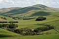 Chatto from Chatto Craig - geograph.org.uk - 1322253.jpg 640 × 427; 148 KB
-
 Crosscleuch Farm - geograph.org.uk - 1304160.jpg 640 × 427; 154 KB
-
 Estate Cottages at Simprim - geograph.org.uk - 1291760.jpg 640 × 358; 173 KB
-
 Horsecastle Bay - geograph.org.uk - 1286304.jpg 640 × 480; 81 KB
-
 Loch of the Lowes from Riskinhope Rig - geograph.org.uk - 1304144.jpg 427 × 640; 152 KB
-
 Meander in Kale Water - geograph.org.uk - 1322020.jpg 640 × 480; 130 KB
-
 Nether Hindhope Farm - geograph.org.uk - 1306215.jpg 640 × 427; 124 KB
-
 On The Old Railway Line At Galashiels - geograph.org.uk - 1291652.jpg 640 × 426; 175 KB
-
 Pennymuir Bridge - geograph.org.uk - 1320491.jpg 427 × 640; 144 KB
-
 Pennymuir Hall - geograph.org.uk - 1320402.jpg 640 × 427; 156 KB
-
 Pettico Wick Bay - geograph.org.uk - 1286381.jpg 640 × 480; 80 KB
-
 Sheep at Threstle Bog - geograph.org.uk - 1322320.jpg 640 × 386; 128 KB
-
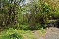
 Sheepfold in the trees - geograph.org.uk - 1291684.jpg 640 × 424; 115 KB
-
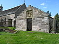 The burial vault of the Kers of Chatto - geograph.org.uk - 1316463.jpg 640 × 480; 102 KB
-
 The Crosscleuch Burn - geograph.org.uk - 1361912.jpg 640 × 427; 143 KB
-
 The gents at Pennymuir - geograph.org.uk - 1320416.jpg 637 × 414; 144 KB
-
 The hill fort on Chatto Craig - geograph.org.uk - 1379661.jpg 640 × 427; 143 KB
-
 The Jetty, Pettico Wick - geograph.org.uk - 1286373.jpg 640 × 480; 64 KB
-
 The Jetty, Pettico Wick - geograph.org.uk - 1286379.jpg 640 × 480; 75 KB
-
 The Kale Water - geograph.org.uk - 1366113.jpg 640 × 427; 160 KB
-
 The remains of Simprim Church - geograph.org.uk - 1297175.jpg 640 × 427; 119 KB
-
 West Mains Farm sign - geograph.org.uk - 1304701.jpg 427 × 640; 119 KB
-
 Whitton Loch - geograph.org.uk - 1388767.jpg 640 × 427; 144 KB


