Category:June 2009 in the Scottish Borders
Jump to navigation
Jump to search
Council areas (municipalities) of Scotland: Aberdeen · Aberdeenshire · Angus · Argyll and Bute · Edinburgh · Fife · Glasgow · Highland · Inverclyde · Moray · North Ayrshire · Perth and Kinross · Renfrewshire · Scottish Borders · South Lanarkshire · Stirling ·
Deutsch: Bilder, die im Juni 2009 in the Scottish Borders aufgenommen worden sind. Bitte beachten Sie, dass dies weder das Datum des Uploads noch das Datum des Scannens eines Fotos ist.
English: Images/pictures taken in the Scottish Borders during June 2009. Note this is not the date of the upload, nor the date a photo was scanned.
Español: Fotografías o imágenes tomadas en the Scottish Borders durante junio 2009. No es la fecha de subida ni escaneo, sino la fecha en que las fotografías o imágenes se crearon.
Esperanto: Bildoj faritaj en the Scottish Borders en junio 2009. Tio ne estas la dato, kiam la bildoj estis alŝutitaj aŭ skanitaj.
Français : Photographies ou images prises en the Scottish Borders durant juin 2009. Ce n'est pas la date du téléchargement ou du scan.
Galego: Fotografías ou imaxes tomadas en the Scottish Borders durante xuño 2009. Non é a data de subida nin escaneamento, senón a data na que se crearon as fotografías ou imaxes.
Italiano: Fotografie o immagini scattate a the Scottish Borders nel giugno 2009. Nota bene: la data non si riferisce né a quella di upload né a quella in cui la foto è stata digitalizzata.
Norsk bokmål: Bilder tatt i the Scottish Borders i løpet av juni 2009. Merk at dette ikke er datoen for opplasting, eller når et bilde har blitt skannet.
Norsk nynorsk: Bilete teke i the Scottish Borders i løpet av juni 2009. Merk at dette ikkje er datoen for opplasting, eller når eit bilete har vorte skanna.
Русский: Изображения, сделанные в the Scottish Borders в течение июнь 2009 (не дата загрузки изображения).
Українська: Зображення, зроблені в the Scottish Borders протягом червень 2009. Зауважте, що це не дата завантаження чи дата сканування фотографії.
| June 2008 | ← | June 2009 | → | June 2010 | |||||||
| Jan | Feb | Mar | Apr | May | Jun | Jul | Aug | Sep | Oct | Nov | Dec |
| 18 | 12 | 0 | 28 | 31 | 34 | 57 | 26 | 18 | 49 | 0 | 24 |
|---|---|---|---|---|---|---|---|---|---|---|---|
Media in category "June 2009 in the Scottish Borders"
The following 34 files are in this category, out of 34 total.
-
 A barley field at Brotherstone Hill - geograph.org.uk - 1375031.jpg 640 × 427; 155 KB
-

-
 A farm track near Mainhill - geograph.org.uk - 1356630.jpg 640 × 435; 131 KB
-
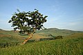 A hawthorn tree on Morebattle Hill - geograph.org.uk - 1380879.jpg 640 × 427; 128 KB
-
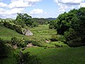
 A hill fort on Morebattle Hill - geograph.org.uk - 1380883.jpg 640 × 427; 165 KB
-
 Braided hollow-ways on The Street - geograph.org.uk - 1374210.jpg 640 × 480; 73 KB
-
 Cessford Burn - geograph.org.uk - 1438810.jpg 640 × 480; 133 KB
-
 Coldingham bay - geograph.org.uk - 1379647.jpg 640 × 480; 80 KB
-
 Corbet Tower - geograph.org.uk - 1380798.jpg 427 × 640; 129 KB
-
 Crookedshaws Hill - geograph.org.uk - 1438828.jpg 640 × 480; 132 KB
-

-
 Dryad's Saddle (Polyporus squamosus) - geograph.org.uk - 1375047.jpg 427 × 640; 126 KB
-
 Dryad's Saddle (Polyporus squamosus) - geograph.org.uk - 1375065.jpg 427 × 640; 131 KB
-

-
 Hillside below Grubbit Law - geograph.org.uk - 1438820.jpg 640 × 480; 120 KB
-
 Hownam Grange Farm - geograph.org.uk - 1380929.jpg 640 × 425; 188 KB
-
 Hownam Rings - geograph.org.uk - 1373490.jpg 640 × 360; 55 KB
-
 Hownam Rings - geograph.org.uk - 1373570.jpg 640 × 360; 53 KB
-
 Hownam Rings - geograph.org.uk - 1373582.jpg 640 × 360; 51 KB
-

-
 Loch Eddy from Deuchar Rig - geograph.org.uk - 1346339.jpg 640 × 480; 95 KB
-
 Oilseed rape fields at Gattonside - geograph.org.uk - 1374983.jpg 640 × 427; 141 KB
-
 Panorama from Big Law - geograph.org.uk - 1373938.jpg 8,192 × 3,133; 3.93 MB
-
 Plaques on Gattonside Suspension Bridge - geograph.org.uk - 1351326.jpg 424 × 640; 130 KB
-
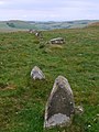
 Possible sheepfold on Big Law - geograph.org.uk - 1374052.jpg 640 × 480; 65 KB
-
 Possible sheepfold on Big Law - geograph.org.uk - 1374085.jpg 640 × 481; 78 KB
-
 River Tweed from Gattonside Chain Bridge - geograph.org.uk - 1351350.jpg 640 × 424; 117 KB
-
 Scowther Knowe from Big Law - geograph.org.uk - 1375100.jpg 640 × 481; 88 KB
-

-
 The Shearers - geograph.org.uk - 1373405.jpg 480 × 640; 80 KB
-
 The Street north of Big Law - geograph.org.uk - 1373699.jpg 640 × 360; 54 KB
-
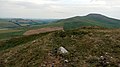
 The trig point on Morebattle Hill - geograph.org.uk - 1380803.jpg 640 × 427; 134 KB
-
 The village of Morebattle - geograph.org.uk - 1380816.jpg 640 × 422; 150 KB
-
 View north-east from Windy Law - geograph.org.uk - 1375056.jpg 640 × 481; 56 KB


_-_geograph.org.uk_-_1375047.jpg)
_-_geograph.org.uk_-_1375065.jpg)


