Category:May 2008 in County Down
Jump to navigation
Jump to search
English: Images taken in County Down, Northern Ireland in this month of 2008 (not the date of the upload).
| Jan | Feb | Mar | Apr | May | Jun | Jul | Aug | Sep | Oct | Nov | Dec | ||
| ← | 48 | 93 | 49 | 32 | 57 | 45 | 40 | 65 | 52 | 24 | 34 | 28 | → |
|---|
Subcategories
This category has the following 2 subcategories, out of 2 total.
M
Media in category "May 2008 in County Down"
The following 55 files are in this category, out of 55 total.
-
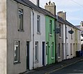
 'Peppers', Bangor - geograph.org.uk - 791428.jpg 480 × 640; 400 KB
-
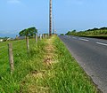
 A2 Newry to Warrenpoint Road - geograph.org.uk - 800078.jpg 640 × 480; 87 KB
-
 A2 Newry to Warrenpoint Road - geograph.org.uk - 800086.jpg 640 × 480; 120 KB
-
 Aghnamoira Road, Newry - geograph.org.uk - 800122.jpg 640 × 480; 86 KB
-
 Aghnamoira Road, Newry - geograph.org.uk - 800135.jpg 640 × 480; 116 KB
-
 Anchor, Ballymacormick Point - geograph.org.uk - 806737.jpg 632 × 640; 478 KB
-
 Ballyatwood Road near Ballywalter - geograph.org.uk - 806693.jpg 640 × 480; 240 KB
-
 Ballycoan Road near Carryduff (2) - geograph.org.uk - 791518.jpg 640 × 480; 303 KB
-
 Ballycoan Road near Carryduff (4) - geograph.org.uk - 791523.jpg 640 × 480; 479 KB
-
 Ballyhemlin Road near Kircubbin - geograph.org.uk - 806650.jpg 640 × 555; 281 KB
-
 Ballyvester Road, near Donaghadee (2) - geograph.org.uk - 806558.jpg 640 × 480; 201 KB
-
 Beatrice Avenue, Bangor - geograph.org.uk - 791426.jpg 640 × 566; 389 KB
-
 Blackbird, Ward Park - geograph.org.uk - 791405.jpg 640 × 494; 594 KB
-
 Bridge Street, Dromore - geograph.org.uk - 1354540.jpg 640 × 480; 68 KB
-
 Caged bird, Ward Park - geograph.org.uk - 791404.jpg 640 × 598; 528 KB
-
 Cattle at Nendrum - geograph.org.uk - 817698.jpg 617 × 408; 89 KB
-
 Cherry blossom, Banbridge - geograph.org.uk - 792104.jpg 640 × 403; 98 KB
-
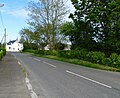
 Church Road near Holywood - geograph.org.uk - 824341.jpg 640 × 559; 452 KB
-
 Church Road, Holywood - geograph.org.uk - 811067.jpg 640 × 480; 309 KB
-
 Circular Road, Dromore - geograph.org.uk - 1354353.jpg 640 × 480; 52 KB
-
 Coach, Tollymore Forest Park - geograph.org.uk - 805479.jpg 640 × 412; 84 KB
-
 Contemplating cow, Clandeboye - geograph.org.uk - 793555.jpg 531 × 457; 85 KB
-
 Countryside near Clough - geograph.org.uk - 798741.jpg 639 × 407; 87 KB
-
 Drystone wall near Kilcoo - geograph.org.uk - 823481.jpg 640 × 396; 105 KB
-
 Dundrum and Dundrum Bay - geograph.org.uk - 798481.jpg 640 × 370; 80 KB
-
 Fishwick's coach, Strangford - geograph.org.uk - 808296.jpg 640 × 378; 64 KB
-
 Former estate houses, Seaforde - geograph.org.uk - 798310.jpg 640 × 435; 91 KB
-
 Gate and stile near Fofanny Dam - geograph.org.uk - 823560.jpg 640 × 377; 92 KB
-
 Glenlyon, Holywood (1) - geograph.org.uk - 811016.jpg 640 × 560; 379 KB
-
 Inishargy Road near Balligan - geograph.org.uk - 806675.jpg 640 × 503; 272 KB
-

-
 Keel Point near Dundrum - geograph.org.uk - 798610.jpg 640 × 414; 104 KB
-
 Killyleagh Castle 01.jpg 445 × 882; 100 KB
-
 Killyleagh Castle 02.jpg 1,163 × 873; 211 KB
-
 Kircubbin Road, Balligan - geograph.org.uk - 806686.jpg 640 × 522; 310 KB
-
 Land Rover, Donaghadee - geograph.org.uk - 793051.jpg 640 × 469; 88 KB
-
 Landscape from the Aghnamoira Road - geograph.org.uk - 800144.jpg 640 × 480; 109 KB
-
 Main Street, Dundrum - geograph.org.uk - 798432.jpg 640 × 399; 83 KB
-
 Millvale Road, Annaclone - geograph.org.uk - 800021.jpg 640 × 480; 82 KB
-
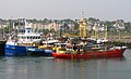 Mussel dredgers in Bangor harbour - geograph.org.uk - 797689.jpg 640 × 391; 345 KB
-
 Refuelling Donaghadee lifeboat - geograph.org.uk - 815924.jpg 640 × 398; 76 KB
-
 Road signs, Ballydown, Banbridge - geograph.org.uk - 792216.jpg 640 × 389; 78 KB
-
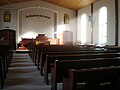 Saintfield Baptist Church auditorium 2 (Northern Ireland) 22 October 2008.jpg 3,264 × 2,448; 2.93 MB
-
 Stile, Banbridge - geograph.org.uk - 792136.jpg 592 × 435; 100 KB
-
 Stile, Clandeboye wood - geograph.org.uk - 793343.jpg 566 × 393; 118 KB
-
 The "Nest", Bryansford - geograph.org.uk - 805385.jpg 640 × 387; 73 KB
-

-
 The Annaghbane Road near Loughbrickland - geograph.org.uk - 814422.jpg 640 × 381; 103 KB
-

-
 The Barbican Gate, Tollymore forest - geograph.org.uk - 805119.jpg 640 × 419; 114 KB
-
 The Drive, Tollymore forest (2) - geograph.org.uk - 805227.jpg 640 × 397; 102 KB
-
 The Drumneath Road near Banbridge (1) - geograph.org.uk - 788208.jpg 640 × 402; 125 KB
-
 The Lough Cowey Road near Portaferry - geograph.org.uk - 808116.jpg 639 × 396; 92 KB
-
 Tree and bins, Ballyatwood Road - geograph.org.uk - 806698.jpg 563 × 640; 302 KB
-
 Ulster Way sign near Fofanny Dam - geograph.org.uk - 823581.jpg 640 × 438; 68 KB


_-_geograph.org.uk_-_791518.jpg)
_-_geograph.org.uk_-_791523.jpg)

_-_geograph.org.uk_-_806558.jpg)


_-_geograph.org.uk_-_811016.jpg)


_22_October_2008.jpg)


_-_geograph.org.uk_-_751332.jpg)

_-_geograph.org.uk_-_805227.jpg)
_-_geograph.org.uk_-_788208.jpg)


