Category:April 2008 in County Down
Jump to navigation
Jump to search
English: Images taken in County Down, Northern Ireland in this month of 2008 (not the date of the upload).
| Jan | Feb | Mar | Apr | May | Jun | Jul | Aug | Sep | Oct | Nov | Dec | ||
| ← | 48 | 93 | 49 | 32 | 57 | 45 | 40 | 65 | 52 | 24 | 34 | 28 | → |
|---|
Media in category "April 2008 in County Down"
The following 32 files are in this category, out of 32 total.
-
 Approaching Cultra - geograph.org.uk - 749753.jpg 640 × 480; 233 KB
-
 Attical village - geograph.org.uk - 1294590.jpg 600 × 337; 20 KB
-
 Ballybryan Road near Kirkubbin - geograph.org.uk - 762598.jpg 640 × 480; 444 KB
-
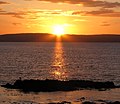
 Belfast Lough sunset (1) - geograph.org.uk - 776533.jpg 640 × 424; 226 KB
-
 Belfast Lough sunset (2) - geograph.org.uk - 776536.jpg 640 × 554; 346 KB
-
 Belfast Road, Holywood (1) - geograph.org.uk - 751414.jpg 640 × 480; 115 KB
-
 Belfast Road, Holywood (2) - geograph.org.uk - 751418.jpg 640 × 480; 147 KB
-
 Bus, Scarva - geograph.org.uk - 774790.jpg 590 × 448; 90 KB
-
 Cultra Railway halt (1) - geograph.org.uk - 749746.jpg 640 × 560; 235 KB
-

-
 Disused Railway Line towards Jerrettspass - geograph.org.uk - 778737.jpg 640 × 480; 102 KB
-
 Gate near Edenderry - geograph.org.uk - 772792.jpg 624 × 441; 101 KB
-
 Goose family, Kiltonga, Newtownards - geograph.org.uk - 773451.jpg 640 × 388; 58 KB
-
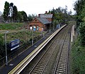
 Helen's Bay station (2) - geograph.org.uk - 768614.jpg 640 × 359; 72 KB
-
 Letter box, Nendrum near Comber - geograph.org.uk - 776021.jpg 640 × 453; 92 KB
-
 North County Down coastline near Bangor - geograph.org.uk - 781741.jpg 640 × 480; 233 KB
-
 North Down Coastal Path at Cultra (2) - geograph.org.uk - 749761.jpg 640 × 480; 175 KB
-
 Path near Edenderry - geograph.org.uk - 772933.jpg 640 × 392; 105 KB
-
 Railings along the Seacliff Road, Bangor - geograph.org.uk - 756894.jpg 640 × 495; 107 KB
-
 Rape field near Ballylesson - geograph.org.uk - 748703.jpg 640 × 510; 205 KB
-
 Sunset at Bangor harbour - geograph.org.uk - 783592.jpg 640 × 550; 335 KB
-
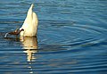 Swans on the Quoile (5) - geograph.org.uk - 766670.jpg 640 × 442; 56 KB
-

-

-

-
 The Belfast Road near Downpatrick - geograph.org.uk - 751233.jpg 640 × 391; 62 KB
-
 The Commons, Donaghadee - geograph.org.uk - 755861.jpg 638 × 406; 85 KB
-
 The Heysham boat, Warrenpoint - geograph.org.uk - 758678.jpg 640 × 381; 46 KB
-
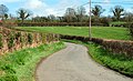 The Lisnoe Road near Ravernet - geograph.org.uk - 752965.jpg 640 × 391; 88 KB
-
 The shore at Donaghadee - geograph.org.uk - 755920.jpg 629 × 413; 100 KB
-
 Totem pole near Comber (2) - geograph.org.uk - 775666.jpg 640 × 498; 78 KB
-
 Train departing from Holywood - geograph.org.uk - 762723.jpg 640 × 463; 383 KB


_-_geograph.org.uk_-_776533.jpg)
_-_geograph.org.uk_-_776536.jpg)
_-_geograph.org.uk_-_751414.jpg)
_-_geograph.org.uk_-_751418.jpg)

_-_geograph.org.uk_-_749746.jpg)


_-_geograph.org.uk_-_768614.jpg)


_-_geograph.org.uk_-_749761.jpg)


_-_geograph.org.uk_-_766670.jpg)

_-_geograph.org.uk_-_751306.jpg)
_-_geograph.org.uk_-_751317.jpg)


_-_geograph.org.uk_-_775666.jpg)
