Category:Marnoch (civil parish)
Jump to navigation
Jump to search
Scottish parish in Aberdeenshire, Scotland, UK | |||||
| Upload media | |||||
| Instance of | |||||
|---|---|---|---|---|---|
| Location |
| ||||
| Population |
| ||||
| Area |
| ||||
 | |||||
Subcategories
This category has the following 2 subcategories, out of 2 total.
A
- Aberchirder (57 F)
K
- Kinnairdy Castle (2 F)
Media in category "Marnoch (civil parish)"
The following 185 files are in this category, out of 185 total.
-
 A95 crossing into Moray - geograph.org.uk - 4269118.jpg 640 × 442; 41 KB
-
 A95, Glenbarry - geograph.org.uk - 4269110.jpg 640 × 407; 35 KB
-
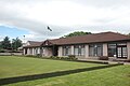 Aberchirder Bowling Club - geograph.org.uk - 5450594.jpg 3,008 × 2,000; 2.51 MB
-
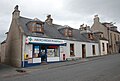 Aberchirder pharmacy and post office - geograph.org.uk - 5451537.jpg 2,782 × 1,889; 2.27 MB
-
 Aberchirder Primary School - geograph.org.uk - 5450599.jpg 2,654 × 1,667; 1.71 MB
-
 Aberchirder side street - geograph.org.uk - 5450605.jpg 3,008 × 2,000; 2.55 MB
-
 Aberchirder Square - geograph.org.uk - 2442733.jpg 1,280 × 856; 191 KB
-
 Aberchirder Square - geograph.org.uk - 2443244.jpg 1,280 × 856; 186 KB
-
 Aberchirder Square - geograph.org.uk - 2755250.jpg 640 × 427; 56 KB
-
 Auchinderran - geograph.org.uk - 2675224.jpg 640 × 427; 433 KB
-
 Auchinderran Moss - geograph.org.uk - 2675213.jpg 640 × 427; 428 KB
-
 B9025 towards Turriff - geograph.org.uk - 2099199.jpg 640 × 480; 63 KB
-
 B9025 towards Turriff - geograph.org.uk - 2099222.jpg 640 × 480; 57 KB
-
 Barbank - geograph.org.uk - 2675532.jpg 640 × 382; 301 KB
-

-

-

-
 Black Law Trig Point Flush Bracket S7098 - geograph.org.uk - 6809004.jpg 1,076 × 1,550; 1.55 MB
-
 Blackhillock - geograph.org.uk - 4364214.jpg 640 × 427; 274 KB
-
 Blackhillock - geograph.org.uk - 4364219.jpg 427 × 640; 499 KB
-
 Brokenfolds - geograph.org.uk - 2074561.jpg 640 × 480; 53 KB
-
 Burn near Rowantree Farm - geograph.org.uk - 2099217.jpg 640 × 480; 71 KB
-
 Burn of Arkland - geograph.org.uk - 2099173.jpg 640 × 480; 94 KB
-
 Burn of Arkland - geograph.org.uk - 2099180.jpg 640 × 480; 100 KB
-
 Burn of Auchintoul - geograph.org.uk - 2675373.jpg 640 × 427; 439 KB
-
 Burn of Auchintoul - geograph.org.uk - 4364210.jpg 640 × 427; 442 KB
-
 Burn of Finnygaud - geograph.org.uk - 3959992.jpg 1,600 × 1,200; 571 KB
-
 Burnside of Culvie - geograph.org.uk - 1721109.jpg 640 × 427; 242 KB
-
 Castlebrae - geograph.org.uk - 2099164.jpg 640 × 480; 63 KB
-
 Castlebrae - geograph.org.uk - 2675561.jpg 427 × 640; 378 KB
-
 Chalmers monument, Marnoch cemetery - geograph.org.uk - 5453732.jpg 3,008 × 2,000; 2.96 MB
-
 Cleanhill - geograph.org.uk - 2675471.jpg 452 × 640; 506 KB
-
 Clearing near Culvie - geograph.org.uk - 1721067.jpg 427 × 640; 238 KB
-
 Cobblehouse - geograph.org.uk - 4364299.jpg 640 × 415; 419 KB
-
 Cobblehouse and the River Deveron - geograph.org.uk - 990275.jpg 640 × 427; 246 KB
-
 Collapsed Building - geograph.org.uk - 1721447.jpg 640 × 427; 257 KB
-
 Contrasting Crops - geograph.org.uk - 2675444.jpg 640 × 427; 436 KB
-
 Cormickhillock - geograph.org.uk - 2675109.jpg 640 × 427; 439 KB
-
 Cottage at Monedie - geograph.org.uk - 2675362.jpg 640 × 394; 349 KB
-
 Craigiebrae - geograph.org.uk - 2675330.jpg 640 × 427; 394 KB
-
 Craigiebrae Farm - geograph.org.uk - 2485596.jpg 3,648 × 2,736; 2.33 MB
-
 Craignetherty - geograph.org.uk - 4365598.jpg 640 × 427; 393 KB
-
 Cranna Hill - geograph.org.uk - 2675494.jpg 640 × 427; 324 KB
-
 Culvie - geograph.org.uk - 1721350.jpg 640 × 427; 248 KB
-
 Damfolds - geograph.org.uk - 2074550.jpg 640 × 480; 78 KB
-
 Deep Ruts - geograph.org.uk - 2675141.jpg 640 × 427; 388 KB
-
 Denspark and Dens of Mayen - geograph.org.uk - 4033501.jpg 640 × 427; 377 KB
-
 Drainage Ditch near Culvie - geograph.org.uk - 1721085.jpg 427 × 640; 246 KB
-
 Entrance area from Bide-a-while cottage - geograph.org.uk - 2513245.jpg 3,648 × 2,736; 2.28 MB
-
 Farmland at Peterden - geograph.org.uk - 3960011.jpg 1,600 × 1,200; 468 KB
-
 Farmland near Brokenfolds - geograph.org.uk - 2074566.jpg 640 × 480; 61 KB
-
 Farmland near Castlebrae - geograph.org.uk - 2099169.jpg 640 × 480; 79 KB
-
 Farmland near Corskie Bridge - geograph.org.uk - 2099176.jpg 640 × 480; 79 KB
-
 Farmland near Damfolds - geograph.org.uk - 2074552.jpg 640 × 480; 52 KB
-
 Farmland near Haugh of Maggie - geograph.org.uk - 2074528.jpg 640 × 480; 74 KB
-
 Farmland near Mains of Canna - geograph.org.uk - 2099194.jpg 640 × 480; 52 KB
-
 Farmland near Mains of Cranna - geograph.org.uk - 2099182.jpg 640 × 480; 75 KB
-
 Farmland near Mossbank - geograph.org.uk - 2099157.jpg 640 × 480; 80 KB
-
 Farmland near Muiden of Canna - geograph.org.uk - 2099212.jpg 640 × 480; 71 KB
-
 Farmland near Shargerwells - geograph.org.uk - 2074557.jpg 640 × 480; 66 KB
-
 Farmland near Turf Hill - geograph.org.uk - 2074535.jpg 640 × 480; 64 KB
-
 Farmland south of Aberchirder - geograph.org.uk - 6210268.jpg 2,592 × 1,944; 1.15 MB
-
 Farmland, Netherdale - geograph.org.uk - 2074545.jpg 640 × 480; 72 KB
-
 Fishermen's Moss - geograph.org.uk - 2675171.jpg 640 × 427; 361 KB
-
 Fishing Hut by the Deveron - geograph.org.uk - 4365591.jpg 640 × 427; 367 KB
-
 Fishing hut, Birkenbrae - geograph.org.uk - 4452674.jpg 800 × 534; 479 KB
-
 Footpath Signposts - geograph.org.uk - 2675218.jpg 640 × 427; 460 KB
-
 Former Episcopal Church School, Aberchirder - geograph.org.uk - 5451648.jpg 2,686 × 2,000; 2.28 MB
-
 Frozen Bog - geograph.org.uk - 1721164.jpg 640 × 427; 279 KB
-
 Future Bales - geograph.org.uk - 990291.jpg 640 × 427; 245 KB
-
 Gallow Hill - geograph.org.uk - 2675577.jpg 640 × 427; 450 KB
-
 Gated farm track at Peterden - geograph.org.uk - 3960008.jpg 1,600 × 1,200; 567 KB
-
 Glacial Landforms - geograph.org.uk - 4364191.jpg 640 × 427; 428 KB
-
 Glacial Meltwater Channel - geograph.org.uk - 2675099.jpg 640 × 427; 399 KB
-
 Harper Hill - geograph.org.uk - 795602.jpg 640 × 427; 220 KB
-
 Haugh of Maggie - geograph.org.uk - 990453.jpg 640 × 427; 262 KB
-
 Haughs of Meaggie - geograph.org.uk - 998029.jpg 640 × 427; 238 KB
-
 Hilltown - geograph.org.uk - 2675510.jpg 640 × 427; 395 KB
-
 Home Farm of Netherdale - geograph.org.uk - 2074542.jpg 640 × 480; 62 KB
-
 Innes and Meldrum monuments, Marnoch Cemetery - geograph.org.uk - 5452599.jpg 3,008 × 2,000; 2.8 MB
-
 Innes monument, Marnoch cemetery - geograph.org.uk - 5453699.jpg 3,008 × 2,000; 2.99 MB
-
 Kirk of Marnoch from near Turtory - geograph.org.uk - 998018.jpg 640 × 427; 231 KB
-
 Kirktown from Craighead - geograph.org.uk - 4033485.jpg 640 × 427; 404 KB
-
 Knowes of Elrick - geograph.org.uk - 2675302.jpg 640 × 427; 378 KB
-
 Knowes of Elrick - geograph.org.uk - 2675347.jpg 640 × 427; 382 KB
-
 Knowhead - geograph.org.uk - 1721376.jpg 640 × 427; 246 KB
-
 Longhaugh Farm from near Wardwell - geograph.org.uk - 795587.jpg 640 × 427; 230 KB
-
 Looking Towards Blacklaw - geograph.org.uk - 2675180.jpg 640 × 427; 394 KB
-
 Looking ToWards Elrick - geograph.org.uk - 2675290.jpg 640 × 427; 418 KB
-
 Looking towards Peterden - geograph.org.uk - 2675134.jpg 640 × 427; 439 KB
-
 Loupin-on Stane - geograph.org.uk - 4743190.jpg 640 × 422; 445 KB
-
 Main Street, Aberchirder (view from the Square) - geograph.org.uk - 5450614.jpg 3,008 × 2,000; 2.46 MB
-
 Main Street, Aberchirder - geograph.org.uk - 2443240.jpg 856 × 1,280; 184 KB
-
 Main Street, Aberchirder - geograph.org.uk - 5451559.jpg 3,008 × 2,000; 2.66 MB
-
 Main Street, Aberchirder - geograph.org.uk - 5451595.jpg 3,008 × 2,000; 2.34 MB
-
 Mains of Kinnairdy - geograph.org.uk - 4364225.jpg 640 × 427; 407 KB
-
 Marnoch Old Kirk - geograph.org.uk - 5453771.jpg 3,008 × 2,000; 2.85 MB
-
 Marnoch Parish Kirk - geograph.org.uk - 4743184.jpg 640 × 427; 481 KB
-
 Meldrum monument, cartouche and bust - geograph.org.uk - 5453609.jpg 2,000 × 2,386; 2.5 MB
-
 Meldrum monument, heraldry - geograph.org.uk - 5453598.jpg 2,513 × 1,961; 2.56 MB
-
 Meldrum monument, inscription - geograph.org.uk - 5453622.jpg 3,008 × 2,000; 2.87 MB
-
 Meldrum monument, Marnoch cemetery - geograph.org.uk - 5452608.jpg 2,000 × 2,993; 2.96 MB
-
 Milbethill - geograph.org.uk - 2675151.jpg 640 × 427; 388 KB
-
 Minor road at Auchintoul Moss - geograph.org.uk - 3959989.jpg 1,600 × 1,200; 518 KB
-
 Minor road near Blacklaw - geograph.org.uk - 3959968.jpg 1,600 × 1,200; 491 KB
-
 Minor road near Dogshillock - geograph.org.uk - 3959978.jpg 1,600 × 1,200; 393 KB
-
 Minor road near Finnygaud - geograph.org.uk - 3959997.jpg 1,600 × 1,200; 533 KB
-
 Minor road near Nether Backieley - geograph.org.uk - 3959982.jpg 1,600 × 1,200; 342 KB
-
 Moss of Auchinderran - geograph.org.uk - 2675201.jpg 640 × 427; 419 KB
-
 Mossbank - geograph.org.uk - 2099155.jpg 640 × 480; 64 KB
-
 Mossbank - geograph.org.uk - 2675526.jpg 640 × 368; 342 KB
-
 Mosshead - geograph.org.uk - 4364182.jpg 640 × 427; 419 KB
-
 Muiden of Canna - geograph.org.uk - 2099208.jpg 640 × 480; 51 KB
-
 Muir of Kinnairdy - geograph.org.uk - 4364236.jpg 640 × 427; 363 KB
-
 Myreside - geograph.org.uk - 2675449.jpg 640 × 427; 409 KB
-
 Near Ardmeallie - geograph.org.uk - 2675401.jpg 640 × 427; 449 KB
-
 Near Gledfield - geograph.org.uk - 2675194.jpg 640 × 407; 469 KB
-
 Near Windyedge - geograph.org.uk - 2675278.jpg 640 × 427; 401 KB
-
 New Farm Near Milbethill - geograph.org.uk - 2675187.jpg 640 × 427; 397 KB
-
 New House above Newton of Culvie - geograph.org.uk - 1721399.jpg 640 × 427; 257 KB
-
 New Pond - geograph.org.uk - 2675208.jpg 640 × 427; 440 KB
-
 Newton of Culvie - geograph.org.uk - 1721395.jpg 640 × 427; 251 KB
-
 North Cranna - geograph.org.uk - 2675502.jpg 640 × 427; 350 KB
-
 Old Crombie Trig Point Flush Bracket S6991 - geograph.org.uk - 6809818.jpg 1,137 × 1,515; 1.33 MB
-

-
 Ordnance Survey Flush Bracket G939 - geograph.org.uk - 3184045.jpg 3,264 × 2,448; 2.41 MB
-

-
 Path to North Cranna - geograph.org.uk - 2675566.jpg 640 × 427; 441 KB
-
 Peatknowe - geograph.org.uk - 2099152.jpg 640 × 480; 80 KB
-
 Ploughing at Marnoch - geograph.org.uk - 2675419.jpg 640 × 427; 460 KB
-
 Ploughing below Bellman's Wood - geograph.org.uk - 2675410.jpg 640 × 427; 389 KB
-
 Recycled Railway Carriage - geograph.org.uk - 1721147.jpg 640 × 427; 226 KB
-
 Reidside Burn - geograph.org.uk - 3960015.jpg 1,600 × 1,200; 680 KB
-
 Reidside Moss - geograph.org.uk - 2675125.jpg 640 × 427; 498 KB
-
 River Deveron - geograph.org.uk - 4365573.jpg 640 × 427; 387 KB
-
 River Deveron - geograph.org.uk - 4365586.jpg 640 × 427; 381 KB
-
 River Deveron - geograph.org.uk - 4365603.jpg 640 × 427; 365 KB
-
 River Deveron - geograph.org.uk - 5453738.jpg 3,008 × 2,000; 3.3 MB
-
 River Deveron and Auldtown - geograph.org.uk - 990258.jpg 640 × 427; 268 KB
-
 River Deveron and Logg Island - geograph.org.uk - 4365579.jpg 640 × 427; 367 KB
-
 River Deveron east of Inverkeithny - geograph.org.uk - 2081899.jpg 640 × 480; 86 KB
-
 River Deveron near Drachlaw House - geograph.org.uk - 2081882.jpg 640 × 480; 82 KB
-
 River Deveron Near Inverkeithny - geograph.org.uk - 990270.jpg 640 × 427; 247 KB
-
 River Deveron, Birkenbrae - geograph.org.uk - 4452676.jpg 800 × 534; 404 KB
-
 Road out of the village. - geograph.org.uk - 5451580.jpg 3,008 × 2,000; 2.87 MB
-
 Rough Grazing at Culvie - geograph.org.uk - 1721132.jpg 640 × 427; 241 KB
-
 Ruined Cottage - geograph.org.uk - 2675551.jpg 640 × 427; 300 KB
-
 Ruined Cottage - geograph.org.uk - 6557440.jpg 5,184 × 3,456; 3.21 MB
-
 Shargerwells - geograph.org.uk - 2074554.jpg 640 × 480; 68 KB
-
 Sheep at Whitemuir - geograph.org.uk - 2675386.jpg 640 × 427; 415 KB
-
 Sheet Ice^ - geograph.org.uk - 1721366.jpg 427 × 640; 245 KB
-
 Sign of the New Inn, Aberchirder - geograph.org.uk - 5451681.jpg 2,400 × 1,537; 1.72 MB
-
 Single-track road - geograph.org.uk - 5453801.jpg 3,008 × 2,000; 2.9 MB
-
 Skeebhill Bridge - geograph.org.uk - 2675483.jpg 640 × 427; 451 KB
-
 St Marnan's Chair - geograph.org.uk - 4743172.jpg 427 × 640; 552 KB
-
 St Marnan's Chair - geograph.org.uk - 4743186.jpg 427 × 640; 480 KB
-
 St Marnan's Chair - geograph.org.uk - 5453778.jpg 2,000 × 2,471; 2.29 MB
-
 St Marnan's Kirk - geograph.org.uk - 4743182.jpg 640 × 427; 441 KB
-
 Standing Stone - geograph.org.uk - 4743166.jpg 427 × 640; 505 KB
-
 Straw Bales - geograph.org.uk - 2675407.jpg 640 × 427; 414 KB
-
 Telecommunications - geograph.org.uk - 2675426.jpg 640 × 395; 441 KB
-
 Telephone Exchange and Castle - geograph.org.uk - 2675432.jpg 640 × 409; 452 KB
-
 Terraced cottages, North Street, Aberchirder - geograph.org.uk - 5451586.jpg 2,585 × 1,904; 1.95 MB
-
 The Bogs, Elrick - geograph.org.uk - 4588687.jpg 4,608 × 3,456; 4.42 MB
-
 The Brae and North Braeside - geograph.org.uk - 2675466.jpg 640 × 427; 442 KB
-
 The Fife Arms, Aberchirder - geograph.org.uk - 5450630.jpg 2,831 × 2,000; 2.47 MB
-
 The Garage at Glenbarry - geograph.org.uk - 922297.jpg 640 × 480; 103 KB
-
 The New Inn, Foggieloan (Aberchirder) - geograph.org.uk - 5451667.jpg 2,551 × 1,946; 2.23 MB
-
 The North Bank of the River Deveron - geograph.org.uk - 990300.jpg 640 × 427; 248 KB
-
 The Square, Aberchirder - geograph.org.uk - 5451532.jpg 3,008 × 2,000; 2.26 MB
-
 Track near Moss-Side of Mayen - geograph.org.uk - 5977362.jpg 1,024 × 683; 212 KB
-
 Track to Haugh of Maggie - geograph.org.uk - 2074532.jpg 640 × 480; 125 KB
-
 Victoria Fountain, the Square, Aberchirder - geograph.org.uk - 5451659.jpg 2,000 × 2,538; 2.08 MB
-
 View over the fields - geograph.org.uk - 5453797.jpg 3,008 × 2,000; 2.51 MB
-
 Villa, Main Street, Aberchirder - geograph.org.uk - 5452543.jpg 1,900 × 1,756; 1.71 MB
-
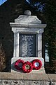 War Memorial at Culvie - geograph.org.uk - 1721121.jpg 427 × 640; 249 KB
-
 Watch-house, Marnoch cemetery - geograph.org.uk - 5453754.jpg 2,861 × 1,993; 2.64 MB
-
 Whitemuir - geograph.org.uk - 2675394.jpg 640 × 463; 412 KB
-
 Whitemuir Cottage - geograph.org.uk - 2675379.jpg 640 × 427; 401 KB
-
 Wild Geese - geograph.org.uk - 2675251.jpg 640 × 409; 91 KB
-
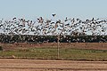 Wild Geese - geograph.org.uk - 2675260.jpg 640 × 427; 313 KB
-
 Wild Geese at Auchinderran - geograph.org.uk - 2675234.jpg 640 × 331; 258 KB
-
 Winding Road - geograph.org.uk - 1721412.jpg 640 × 427; 233 KB
-
 Windyedge - geograph.org.uk - 1721100.jpg 640 × 427; 232 KB
-
 Woodland, Turf Hill - geograph.org.uk - 2074538.jpg 640 × 480; 124 KB


_-_geograph.org.uk_-_4743217.jpg)
_-_geograph.org.uk_-_4743224.jpg)
_-_geograph.org.uk_-_4743229.jpg)


_-_geograph.org.uk_-_5450614.jpg)


_-_geograph.org.uk_-_5451667.jpg)


