Category:March 2011 in North Yorkshire
Jump to navigation
Jump to search
Deutsch: Bilder, die im März 2011 in North Yorkshire aufgenommen worden sind. Bitte beachten Sie, dass dies weder das Datum des Uploads noch das Datum des Scannens eines Fotos ist.
English: Images/pictures taken in North Yorkshire during March 2011. Note this is not the date of the upload, nor the date a photo was scanned.
Español: Fotografías o imágenes tomadas en North Yorkshire durante marzo 2011. No es la fecha de subida ni escaneo, sino la fecha en que las fotografías o imágenes se crearon.
Esperanto: Bildoj faritaj en North Yorkshire en marto 2011. Tio ne estas la dato, kiam la bildoj estis alŝutitaj aŭ skanitaj.
Français : Photographies ou images prises en North Yorkshire durant mars 2011. Ce n'est pas la date du téléchargement ou du scan.
Galego: Fotografías ou imaxes tomadas en North Yorkshire durante marzo 2011. Non é a data de subida nin escaneamento, senón a data na que se crearon as fotografías ou imaxes.
Italiano: Fotografie o immagini scattate a North Yorkshire nel marzo 2011. Nota bene: la data non si riferisce né a quella di upload né a quella in cui la foto è stata digitalizzata.
Norsk bokmål: Bilder tatt i North Yorkshire i løpet av mars 2011. Merk at dette ikke er datoen for opplasting, eller når et bilde har blitt skannet.
Norsk nynorsk: Bilete teke i North Yorkshire i løpet av mars 2011. Merk at dette ikkje er datoen for opplasting, eller når eit bilete har vorte skanna.
Русский: Изображения, сделанные в North Yorkshire в течение март 2011 (не дата загрузки изображения).
Українська: Зображення, зроблені в North Yorkshire протягом березень 2011. Зауважте, що це не дата завантаження чи дата сканування фотографії.
| March 2010 | ← | March 2011 | → | March 2012 | |||||||
| Jan | Feb | Mar | Apr | May | Jun | Jul | Aug | Sep | Oct | Nov | Dec |
| 15 | 40 | 46 | 33 | 48 | 40 | 524 | 38 | 44 | 37 | 20 | 19 |
|---|---|---|---|---|---|---|---|---|---|---|---|
Subcategories
This category has only the following subcategory.
Y
Media in category "March 2011 in North Yorkshire"
The following 45 files are in this category, out of 45 total.
-
 A63 towards York - geograph.org.uk - 2324741.jpg 1,600 × 1,200; 519 KB
-
 Aireville Park (geograph 2296029).jpg 3,456 × 2,592; 4.23 MB
-
 Aireville School (geograph 2296036).jpg 3,456 × 2,592; 4.25 MB
-
 All Saints Church Helmsley - geograph.org.uk - 2316379.jpg 1,920 × 2,560; 1.9 MB
-
 Bridge over the River Derwent (geograph 2324597).jpg 1,600 × 1,200; 369 KB
-
 Christ Church, Skipton.jpg 3,640 × 2,735; 5.43 MB
-
 Crocuses in Langton (1 of 5). By Thomas Tolkien (5509194050).jpg 3,000 × 1,932; 8.54 MB
-
 Esso Northallerton.JPG 4,176 × 2,784; 4.33 MB
-
 Helmsley All Saints GeoUK 2316379.jpg 948 × 1,140; 188 KB
-
 Howardian Hills landscape - geograph.org.uk - 2336022 Cropped.jpg 3,264 × 1,507; 2.26 MB
-
 Ingleton, UK - panoramio (10).jpg 1,087 × 815; 346 KB
-
 Ingleton, UK - panoramio (12).jpg 1,087 × 815; 430 KB
-
 Ingleton, UK - panoramio (13).jpg 1,087 × 815; 384 KB
-
 Ingleton, UK - panoramio (14).jpg 1,087 × 815; 291 KB
-
 Ingleton, UK - panoramio (15).jpg 1,087 × 815; 358 KB
-
 Ingleton, UK - panoramio (16).jpg 1,087 × 815; 402 KB
-
 Ingleton, UK - panoramio (5).jpg 1,087 × 815; 393 KB
-
 Ingleton, UK - panoramio (6).jpg 1,087 × 815; 317 KB
-
 Ingleton, UK - panoramio (7).jpg 1,087 × 815; 365 KB
-
 Ingleton, UK - panoramio (8).jpg 1,087 × 815; 429 KB
-
 Ingleton, UK - panoramio (9).jpg 1,087 × 815; 340 KB
-
 Inside Studfold Ring - geograph.org.uk - 2328147.jpg 3,264 × 2,448; 1.93 MB
-

-
 Malham Cove cliff face - geograph.org.uk - 5104793.jpg 3,072 × 2,304; 1.58 MB
-
 Markington with Wallerthwaite, UK - panoramio.jpg 4,288 × 2,416; 3.93 MB
-
 Narrowboats in the Springs Canal, Skipton (5550956733).jpg 2,981 × 3,726; 7.07 MB
-
 One of the worst paths in the North York Moors - geograph.org.uk - 3254922.jpg 1,600 × 1,200; 496 KB
-

-
 Skipton Girls High School (geograph 2296051).jpg 3,456 × 2,592; 4.31 MB
-
 Studfold Ring - geograph.org.uk - 2327412.jpg 2,892 × 1,632; 791 KB
-
 Studfold Ring - outer bank - geograph.org.uk - 2327417.jpg 3,264 × 2,448; 2.78 MB
-
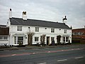
 The Boot and Shoe, Tockwith (geograph 2306239).jpg 800 × 600; 249 KB
-

-
 The level crossings at Kirkham - geograph.org.uk - 2326021.jpg 800 × 600; 283 KB
-
 The Oak Tree reborn (geograph 2321369).jpg 3,146 × 1,957; 1.31 MB
-
 The River Derwent (geograph 2324601).jpg 1,600 × 1,200; 306 KB
-
 The Sun Inn, Long Marston (geograph 2306275).jpg 800 × 600; 225 KB
-
 The Sun Inn, Long Marston (geograph 2306278).jpg 800 × 600; 205 KB
-
 The Sun Inn, Long Marston (geograph 2306281).jpg 600 × 800; 205 KB
-
 The Sun Inn, Long Marston (geograph 2306285).jpg 800 × 600; 245 KB
-
 The Sun Inn, Long Marston (geograph 2306292).jpg 800 × 600; 240 KB
-
 The Tankard Inn, a Sam Smiths pub in Rufforth (geograph 2416532).jpg 800 × 600; 259 KB
-
 The way to Danebury Manor near Fordon (geograph 2317863).jpg 800 × 600; 204 KB
-
 York Lane towards Flaxton - geograph.org.uk - 2319727.jpg 800 × 600; 269 KB
-
 York Road, Cliffe - geograph.org.uk - 2324719.jpg 1,600 × 1,200; 439 KB

.jpg)
.jpg)

.jpg)

._By_Thomas_Tolkien_(5509194050).jpg)


.jpg)
.jpg)
.jpg)
.jpg)
.jpg)
.jpg)
.jpg)
.jpg)
.jpg)
.jpg)
.jpg)


.jpg)

.jpg)
.jpg)


.jpg)
_at_Salents_Lane_in_Duggleby_-_geograph.org.uk_-_3228905.jpg)

.jpg)
.jpg)
.jpg)
.jpg)
.jpg)
.jpg)
.jpg)
.jpg)
.jpg)

