Category:June 2011 in North Yorkshire
Jump to navigation
Jump to search
Deutsch: Bilder, die im Juni 2011 in North Yorkshire aufgenommen worden sind. Bitte beachten Sie, dass dies weder das Datum des Uploads noch das Datum des Scannens eines Fotos ist.
English: Images/pictures taken in North Yorkshire during June 2011. Note this is not the date of the upload, nor the date a photo was scanned.
Español: Fotografías o imágenes tomadas en North Yorkshire durante junio 2011. No es la fecha de subida ni escaneo, sino la fecha en que las fotografías o imágenes se crearon.
Esperanto: Bildoj faritaj en North Yorkshire en junio 2011. Tio ne estas la dato, kiam la bildoj estis alŝutitaj aŭ skanitaj.
Français : Photographies ou images prises en North Yorkshire durant juin 2011. Ce n'est pas la date du téléchargement ou du scan.
Galego: Fotografías ou imaxes tomadas en North Yorkshire durante xuño 2011. Non é a data de subida nin escaneamento, senón a data na que se crearon as fotografías ou imaxes.
Italiano: Fotografie o immagini scattate a North Yorkshire nel giugno 2011. Nota bene: la data non si riferisce né a quella di upload né a quella in cui la foto è stata digitalizzata.
Norsk bokmål: Bilder tatt i North Yorkshire i løpet av juni 2011. Merk at dette ikke er datoen for opplasting, eller når et bilde har blitt skannet.
Norsk nynorsk: Bilete teke i North Yorkshire i løpet av juni 2011. Merk at dette ikkje er datoen for opplasting, eller når eit bilete har vorte skanna.
Русский: Изображения, сделанные в North Yorkshire в течение июнь 2011 (не дата загрузки изображения).
Українська: Зображення, зроблені в North Yorkshire протягом червень 2011. Зауважте, що це не дата завантаження чи дата сканування фотографії.
| June 2010 | ← | June 2011 | → | June 2012 | |||||||
| Jan | Feb | Mar | Apr | May | Jun | Jul | Aug | Sep | Oct | Nov | Dec |
| 15 | 40 | 46 | 34 | 49 | 40 | 524 | 38 | 44 | 37 | 20 | 19 |
|---|---|---|---|---|---|---|---|---|---|---|---|
Subcategories
This category has only the following subcategory.
Y
Media in category "June 2011 in North Yorkshire"
The following 39 files are in this category, out of 39 total.
-
 A path leading to Knox, north of Harrogate (geograph 2459973).jpg 800 × 600; 249 KB
-
 All Saints Church, Helmsley - geograph.org.uk - 2489321.jpg 3,000 × 4,000; 3.53 MB
-
 All Saints Church, Helmsley - geograph.org.uk - 2489324.jpg 4,000 × 3,000; 1.84 MB
-
 Benchmark on Swinithwaite Farm (geograph 2638005).jpg 683 × 1,024; 307 KB
-
 Coastliner Bus on A64 - geograph.org.uk - 2524678.jpg 2,958 × 1,984; 3.49 MB
-
 Enticing track - geograph.org.uk - 2481593.jpg 1,024 × 768; 296 KB
-
 Farmland near Willow Garths Nature Reserve - geograph.org.uk - 2476134.jpg 1,600 × 1,200; 442 KB
-
 Feversham Monument in the market place - geograph.org.uk - 2441375.jpg 1,585 × 2,048; 543 KB
-
 Harrogate bus station - geograph.org.uk - 2461483.jpg 800 × 600; 293 KB
-
 Helmsley Castle - geograph.org.uk - 2441428.jpg 1,520 × 2,048; 503 KB
-
 Helmsley Methodist Church - geograph.org.uk - 2441343.jpg 2,048 × 1,462; 580 KB
-
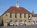 Helmsley Town Hall.jpg 1,024 × 789; 226 KB
-
 Lochs & Glens coach Volvo B12BT Jonckheere SHV, 18 June 2011.jpg 361 × 276; 71 KB
-
 Locomotives at Grosmont - geograph.org.uk - 2484694.jpg 3,296 × 2,472; 1.87 MB
-
 Loftsome bridge. (geograph 2448179).jpg 640 × 480; 92 KB
-
 Mini roundabout, monument and market place - geograph.org.uk - 2441392.jpg 2,048 × 1,514; 558 KB
-
 Poppy field at Langton - geograph.org.uk - 3231850.jpg 2,304 × 1,728; 988 KB
-
 Radcliffe Arms, Follifoot (geograph 4275732).jpg 1,600 × 1,200; 454 KB
-
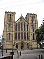 Ripon Cathedral (Ripon Minster) - geograph.org.uk - 2492855.jpg 3,000 × 4,000; 2.93 MB
-
 Rutted bridleway by Common Plantation - geograph.org.uk - 2455889.jpg 1,024 × 768; 233 KB
-
 Scoreboard, Huntington Stadium (geograph 2483638).jpg 427 × 640; 243 KB
-
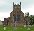 St Andrew church, Gargrave.jpg 2,447 × 2,239; 2.89 MB
-
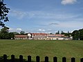 St John Fisher School, Harrogate (geograph 2522398).jpg 640 × 480; 61 KB
-
 St Matthew's Church, Grosmont, N. Yorks - geograph.org.uk - 2484680.jpg 3,296 × 2,472; 1.84 MB
-
 Street life (5804790713).jpg 4,288 × 2,848; 1.06 MB
-
 Street life (5805340480).jpg 4,032 × 3,024; 1.2 MB
-
 Street life (5805341558).jpg 2,848 × 4,288; 1.18 MB
-
 Sudforth Lane entrance, Kellingley Colliery (geograph 2477979).jpg 1,024 × 768; 95 KB
-
 Swinithwaite Farm, north side A684 (geograph 2638013).jpg 1,024 × 683; 200 KB
-
 Tadcaster Bridge parapet and a bench mark (geograph 2493077).jpg 640 × 480; 147 KB
-
 The back room bar at the Marquis of Granby (geograph 2456808).jpg 800 × 600; 273 KB
-
 The nave of St Mary the Virgin, Ebberston (geograph 2502933).jpg 480 × 640; 122 KB
-
 The White Bear, Bedale (geograph 2476540).jpg 1,280 × 960; 560 KB
-
 The Woodlands public house on Wetherby Road (geograph 2458504).jpg 800 × 600; 227 KB
-
 View to Castlegate - geograph.org.uk - 2441859.jpg 2,048 × 1,349; 513 KB
-
 Weathered bench mark on Tadcaster Bridge (geograph 2493074).jpg 480 × 640; 199 KB
-
 Weaverthorpe Signal Box and Crossing - geograph.org.uk - 2459059.jpg 640 × 427; 240 KB
-
 Welburn Lodge - geograph.org.uk - 2524631.jpg 2,878 × 1,830; 4.86 MB
-
 Whitby West Cliff railway station (site), Yorkshire (geograph 3276301).jpg 1,024 × 768; 130 KB
.jpg)


.jpg)


.jpg)


.jpg)
_-_geograph.org.uk_-_2492855.jpg)

.jpg)

.jpg)

.jpg)
.jpg)
.jpg)
.jpg)
.jpg)
.jpg)
.jpg)
.jpg)
.jpg)
.jpg)

.jpg)


,_Yorkshire_(geograph_3276301).jpg)