Category:March 2010 in Highland (council area)
Jump to navigation
Jump to search
Council areas (municipalities) of Scotland: Aberdeen · Aberdeenshire · Argyll and Bute · Edinburgh · Glasgow · Highland · Perth and Kinross · Renfrewshire · Scottish Borders ·
Deutsch: Bilder, die im März 2010 in Highland (council area) aufgenommen worden sind. Bitte beachten Sie, dass dies weder das Datum des Uploads noch das Datum des Scannens eines Fotos ist.
English: Images/pictures taken in Highland (council area) during March 2010. Note this is not the date of the upload, nor the date a photo was scanned.
Español: Fotografías o imágenes tomadas en Highland (council area) durante marzo 2010. No es la fecha de subida ni escaneo, sino la fecha en que las fotografías o imágenes se crearon.
Esperanto: Bildoj faritaj en Highland (council area) en marto 2010. Tio ne estas la dato, kiam la bildoj estis alŝutitaj aŭ skanitaj.
Français : Photographies ou images prises en Highland (council area) durant mars 2010. Ce n'est pas la date du téléchargement ou du scan.
Galego: Fotografías ou imaxes tomadas en Highland (council area) durante marzo 2010. Non é a data de subida nin escaneamento, senón a data na que se crearon as fotografías ou imaxes.
Italiano: Fotografie o immagini scattate a Highland (council area) nel marzo 2010. Nota bene: la data non si riferisce né a quella di upload né a quella in cui la foto è stata digitalizzata.
Norsk bokmål: Bilder tatt i Highland (council area) i løpet av mars 2010. Merk at dette ikke er datoen for opplasting, eller når et bilde har blitt skannet.
Norsk nynorsk: Bilete teke i Highland (council area) i løpet av mars 2010. Merk at dette ikkje er datoen for opplasting, eller når eit bilete har vorte skanna.
Русский: Изображения, сделанные в Highland (council area) в течение март 2010 (не дата загрузки изображения).
Українська: Зображення, зроблені в Highland (council area) протягом березень 2010. Зауважте, що це не дата завантаження чи дата сканування фотографії.
| March 2009 | ← | March 2010 | → | March 2011 | |||||||
| Jan | Feb | Mar | Apr | May | Jun | Jul | Aug | Sep | Oct | Nov | Dec |
| 56 | 122 | 70 | 146 | 13 | 20 | 31 | 32 | 5 | 2 | 3 | 5 |
|---|---|---|---|---|---|---|---|---|---|---|---|
Subcategories
This category has the following 2 subcategories, out of 2 total.
G
- March 2010 in Glenfinnan (1 F)
I
- March 2010 in Inverness (8 F)
Media in category "March 2010 in Highland (council area)"
The following 68 files are in this category, out of 68 total.
-
 "The Hay Wain" (Wester Calrichie) - geograph.org.uk - 1761098.jpg 640 × 480; 220 KB
-
 A' Bhuidheanach Bheag - geograph.org.uk - 1754939.jpg 640 × 359; 44 KB
-
 Allt Iarairidh crossing clearing in forest - geograph.org.uk - 1763017.jpg 3,264 × 2,448; 2.42 MB
-
-
 Allt Iarairidh crossing moorland and enteting forest - geograph.org.uk - 1765591.jpg 3,264 × 2,448; 3.05 MB
-

-
 Allt Iarairidh crossing moorland north of Carnis Mhòr - geograph.org.uk - 1763009.jpg 3,264 × 2,448; 3.52 MB
-
 Allt Iarairidh crossing moorland to enter forest - geograph.org.uk - 1765819.jpg 3,264 × 2,448; 2.65 MB
-
 Allt Iarairidh in glen below track - geograph.org.uk - 1765578.jpg 3,264 × 2,448; 3.09 MB
-
 Allt Ruadh crossing moorland above Dundreggen - geograph.org.uk - 1763836.jpg 3,264 × 2,448; 795 KB
-
 Allt Ruadh crossing moorland to Beinn Bhreac in shadow - geograph.org.uk - 1763979.jpg 3,264 × 2,448; 572 KB
-
 Allt Ruadh decending through birch wood above Dundreggen - geograph.org.uk - 1763022.jpg 3,264 × 2,448; 1.86 MB
-
 Allt Ruadh meeting tributaries coming down corrie - geograph.org.uk - 1763988.jpg 3,264 × 2,448; 1.22 MB
-
 An Coileach at very low tide - geograph.org.uk - 1733917.jpg 640 × 474; 89 KB
-
 An Staonach east summit - geograph.org.uk - 1762852.jpg 640 × 480; 69 KB
-
 An Staonach west summit - geograph.org.uk - 1762854.jpg 640 × 480; 46 KB
-
 Blackrock Cottage - geograph.org.uk - 1731786.jpg 640 × 480; 55 KB
-
 Blackrock cottage - geograph.org.uk - 1731790.jpg 640 × 480; 47 KB
-
 Broadford Bay - geograph.org.uk - 1745896.jpg 1,024 × 768; 715 KB
-
 Broadford Bay - geograph.org.uk - 1745899.jpg 1,024 × 768; 757 KB
-
 Church in Tain - panoramio.jpg 2,592 × 3,872; 4.06 MB
-
 Coral beach, Isle of Skye - panoramio - Tobias Barkskog.jpg 4,752 × 3,168; 4.24 MB
-
 Coral beach, Isle of Skye - panoramio.jpg 3,168 × 4,752; 4.13 MB
-

-
 Eilean Donan - geograph.org.uk - 1749638.jpg 3,456 × 2,304; 1.15 MB
-
 Fence post and Allt Ruadh going down Dundreggan - geograph.org.uk - 1763854.jpg 3,264 × 2,448; 1.16 MB
-
 Fence post following Allt Ruadh towards Dundreggan - geograph.org.uk - 1763774.jpg 3,264 × 2,448; 3.32 MB
-
 Foraging sheep, Strath of Kildonan - geograph.org.uk - 1749478.jpg 640 × 480; 224 KB
-
 Ford and junction in Glen Einich - geograph.org.uk - 1764195.jpg 640 × 427; 337 KB
-

-

-
 Glen Docherty and the new A832 - geograph.org.uk - 1739201.jpg 1,200 × 797; 439 KB
-
 Isle of Skye - panoramio - Tobias Barkskog (1).jpg 3,168 × 4,752; 5.1 MB
-
 Loch Dunvegan - geograph.org.uk - 1733269.jpg 640 × 426; 163 KB
-
 Loch Ericht - geograph.org.uk - 1768123.jpg 640 × 480; 102 KB
-
 Loch Ericht - geograph.org.uk - 1768125.jpg 640 × 480; 103 KB
-
 Loch Ericht - geograph.org.uk - 1768128.jpg 640 × 480; 104 KB
-
 Loch Ness from B852 near Inverfarigaig - geograph.org.uk - 1734100.jpg 3,264 × 2,448; 1.54 MB
-
 Loch Ravag - frozen - geograph.org.uk - 1733760.jpg 1,024 × 768; 690 KB
-
 Loch Ravag - geograph.org.uk - 1733764.jpg 1,024 × 768; 780 KB
-
 Loch Ravag - geograph.org.uk - 1733770.jpg 1,024 × 768; 763 KB
-
 Loch Ravag - geograph.org.uk - 1733773.jpg 1,024 × 768; 738 KB
-
 Loch Ravag - geograph.org.uk - 1733776.jpg 1,024 × 768; 647 KB
-
 Loch Ravag - geograph.org.uk - 1733783.jpg 1,024 × 768; 621 KB
-
 Loch Ravag - geograph.org.uk - 1733787.jpg 1,024 × 768; 740 KB
-
 Loch Ravag - geograph.org.uk - 1733788.jpg 1,024 × 768; 747 KB
-
 Loch Ravag - geograph.org.uk - 1733791.jpg 1,024 × 768; 803 KB
-
 Lochan by Easter Heathfield - geograph.org.uk - 1761155.jpg 640 × 480; 155 KB
-
 Lochan near Easter Heathfield - geograph.org.uk - 1761125.jpg 640 × 480; 205 KB
-
 Lochan near Wester Calrichie farm - geograph.org.uk - 1761040.jpg 640 × 480; 128 KB
-
 Muir of Ord railway station and car park - geograph.org.uk - 1751624.jpg 1,024 × 768; 235 KB
-
 Parking for Divach Falls - geograph.org.uk - 1768977.jpg 3,264 × 2,448; 3.13 MB
-
 Portree Community Hospital - geograph.org.uk - 1751415.jpg 640 × 416; 232 KB
-
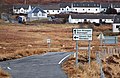 Road junction south of Lonmore - geograph.org.uk - 1749874.jpg 640 × 414; 173 KB
-
 Rocky hill near Point of Sleat - geograph.org.uk - 1739353.jpg 1,024 × 768; 405 KB
-
 Sango Bay, Durness. - panoramio.jpg 800 × 1,180; 183 KB
-
 Scrubland near Wester Calrichie - geograph.org.uk - 1761113.jpg 640 × 480; 227 KB
-
 Slott - Eilean Donan Castle - panoramio.jpg 4,752 × 3,168; 6.27 MB
-
 Snack bar in Dunvegan car park - geograph.org.uk - 1733277.jpg 640 × 426; 129 KB
-
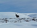 Stag near Achentoul Lodge - geograph.org.uk - 1750395.jpg 640 × 480; 127 KB
-
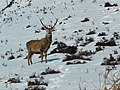 Stag near Baile an Or - geograph.org.uk - 1750399.jpg 640 × 480; 152 KB
-
 Stag near Lochside - geograph.org.uk - 1749484.jpg 640 × 480; 148 KB
-
 Start of walk from Divach Falls - geograph.org.uk - 1768981.jpg 3,264 × 2,448; 3.27 MB
-
 Talisker Beach at low spring tide - geograph.org.uk - 1731326.jpg 640 × 426; 129 KB
-
 The A832 at Achanalt - geograph.org.uk - 1777730.jpg 640 × 480; 76 KB
-
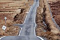 The road to Lonmore - geograph.org.uk - 1749881.jpg 640 × 426; 182 KB
-

-
 Weak bridge over the railway, Muir of Ord - geograph.org.uk - 1751676.jpg 1,024 × 768; 184 KB
_-_geograph.org.uk_-_1761098.jpg)


.jpg)


