Category:January 2010 in Highland (council area)
Jump to navigation
Jump to search
Council areas (municipalities) of Scotland: Argyll and Bute · Dumfries and Galloway · Edinburgh · Glasgow · Highland · North Lanarkshire · Perth and Kinross · Scottish Borders ·
Deutsch: Bilder, die im Januar 2010 in Highland (council area) aufgenommen worden sind. Bitte beachten Sie, dass dies weder das Datum des Uploads noch das Datum des Scannens eines Fotos ist.
English: Images/pictures taken in Highland (council area) during January 2010. Note this is not the date of the upload, nor the date a photo was scanned.
Español: Fotografías o imágenes tomadas en Highland (council area) durante enero 2010. No es la fecha de subida ni escaneo, sino la fecha en que las fotografías o imágenes se crearon.
Esperanto: Bildoj faritaj en Highland (council area) en januaro 2010. Tio ne estas la dato, kiam la bildoj estis alŝutitaj aŭ skanitaj.
Français : Photographies ou images prises en Highland (council area) durant janvier 2010. Ce n'est pas la date du téléchargement ou du scan.
Galego: Fotografías ou imaxes tomadas en Highland (council area) durante xaneiro 2010. Non é a data de subida nin escaneamento, senón a data na que se crearon as fotografías ou imaxes.
Italiano: Fotografie o immagini scattate a Highland (council area) nel gennaio 2010. Nota bene: la data non si riferisce né a quella di upload né a quella in cui la foto è stata digitalizzata.
Norsk bokmål: Bilder tatt i Highland (council area) i løpet av januar 2010. Merk at dette ikke er datoen for opplasting, eller når et bilde har blitt skannet.
Norsk nynorsk: Bilete teke i Highland (council area) i løpet av januar 2010. Merk at dette ikkje er datoen for opplasting, eller når eit bilete har vorte skanna.
Русский: Изображения, сделанные в Highland (council area) в течение январь 2010 (не дата загрузки изображения).
Українська: Зображення, зроблені в Highland (council area) протягом січень 2010. Зауважте, що це не дата завантаження чи дата сканування фотографії.
| January 2009 | ← | January 2010 | → | January 2011 | |||||||
| Jan | Feb | Mar | Apr | May | Jun | Jul | Aug | Sep | Oct | Nov | Dec |
| 56 | 122 | 70 | 146 | 13 | 20 | 31 | 32 | 5 | 2 | 3 | 5 |
|---|---|---|---|---|---|---|---|---|---|---|---|
Subcategories
This category has only the following subcategory.
C
Media in category "January 2010 in Highland (council area)"
The following 55 files are in this category, out of 55 total.
-
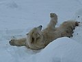 "Are my nails dry yet" - geograph.org.uk - 1660765.jpg 640 × 481; 122 KB
-
 "Mercedes" at Highland Wildlife Park - geograph.org.uk - 1660758.jpg 640 × 480; 121 KB
-
 Allt Dail a' Chuirn - geograph.org.uk - 1650476.jpg 640 × 354; 75 KB
-
 Allt Lundie - geograph.org.uk - 1650514.jpg 640 × 480; 98 KB
-
 Allt Lundie - geograph.org.uk - 1651670.jpg 640 × 359; 99 KB
-
 Ardersier, UK - panoramio - nmdl04669.jpg 4,000 × 3,000; 3.95 MB
-
 Ardersier, UK - panoramio.jpg 4,000 × 3,000; 3.61 MB
-
 Aviemore Post Office - geograph.org.uk - 1658070.jpg 640 × 480; 72 KB
-
 Birches beside the Invervigar Burn - geograph.org.uk - 1652427.jpg 640 × 359; 59 KB
-
-
 Crossing the Allt Lundie - geograph.org.uk - 1651661.jpg 640 × 359; 71 KB
-
 Dail Lundie - geograph.org.uk - 1650511.jpg 640 × 480; 57 KB
-
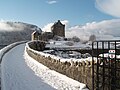 Eilean Donan in snow.jpeg 3,072 × 2,304; 1.55 MB
-
 Eilean Donan winter panorama.jpeg 6,100 × 1,550; 2.08 MB
-
 Eilean na Faoileige - geograph.org.uk - 1652357.jpg 640 × 359; 57 KB
-
 Fort George - panoramio.jpg 4,000 × 3,000; 4.36 MB
-
 Gate, Glac na Connspeach - geograph.org.uk - 1651624.jpg 640 × 480; 85 KB
-
 Gate, Munerigie - Loch Oich path - geograph.org.uk - 1660870.jpg 640 × 480; 102 KB
-
 Glac na Connspeach - geograph.org.uk - 1651611.jpg 640 × 359; 61 KB
-
 Glac na Connspeach - geograph.org.uk - 1651640.jpg 640 × 480; 95 KB
-
 Grampian Road, Aviemore - geograph.org.uk - 1650122.jpg 640 × 480; 55 KB
-
 Grampian Road, Aviemore - geograph.org.uk - 1658067.jpg 640 × 480; 71 KB
-
 Grant Road, Grantown-on-Spey - geograph.org.uk - 1690011.jpg 3,000 × 4,000; 2.81 MB
-
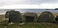
 Grave, Aird nan Uan, Muck - geograph.org.uk - 1760245.jpg 640 × 426; 85 KB
-
 Grave, Aird nan Uan, Muck - geograph.org.uk - 1760246.jpg 640 × 426; 88 KB
-
 Grave, Aird nan Uan, Muck - geograph.org.uk - 1760247.jpg 640 × 426; 92 KB
-
 Graves, Aird nan Uan, Muck - geograph.org.uk - 1760248.jpg 1,024 × 491; 109 KB
-
 Highland, UK - panoramio - nmdl04669.jpg 4,000 × 3,000; 3.87 MB
-
 Invergarry - Dail a' Chuirn track - geograph.org.uk - 1651683.jpg 640 × 359; 64 KB
-
 Invergarry - Dail a' Chuirn track - geograph.org.uk - 1652363.jpg 640 × 480; 121 KB
-
 Invergarry - Dail a' Chuirn track - geograph.org.uk - 1652374.jpg 640 × 480; 53 KB
-
 Inverness Airport - panoramio.jpg 4,000 × 3,000; 3.55 MB
-
 Loch Cleat - geograph.org.uk - 1654453.jpg 640 × 480; 50 KB
-
 Loch Fada with a blanket of snow. - geograph.org.uk - 1652924.jpg 640 × 480; 42 KB
-
 Loch Lundie - geograph.org.uk - 1652384.jpg 640 × 135; 23 KB
-
 Loch Lundie - geograph.org.uk - 1660861.jpg 640 × 480; 83 KB
-

-
 Moorland beside Loch Lundie - geograph.org.uk - 1651947.jpg 640 × 359; 62 KB
-
 Moorland by Loch Lundie - geograph.org.uk - 1660883.jpg 640 × 359; 63 KB
-
 Moorland near Loch Lundie - geograph.org.uk - 1652368.jpg 640 × 359; 42 KB
-
 Munerigie to Loch Oich track - geograph.org.uk - 1651648.jpg 640 × 359; 74 KB
-
 Munerigie to Loch Oich track - geograph.org.uk - 1660851.jpg 640 × 359; 65 KB
-
 Munerigie to Loch Oich track - geograph.org.uk - 1660897.jpg 640 × 359; 62 KB
-
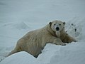
 Polar Bear at Highland Wildlife Park - geograph.org.uk - 1660750.jpg 640 × 482; 120 KB
-
 Quiraing information panels - geograph.org.uk - 1652157.jpg 1,280 × 838; 453 KB
-
 Rubh a' Ghiubhais in winter - geograph.org.uk - 1657548.jpg 640 × 480; 77 KB
-
 Sheep fence, Coille Reidh nan Làir - geograph.org.uk - 1652428.jpg 640 × 359; 72 KB
-
 Shops, Aviemore - geograph.org.uk - 1658072.jpg 640 × 359; 73 KB
-
 Shops, Grampian Road - geograph.org.uk - 1659027.jpg 640 × 359; 72 KB
-
 Tesco, Aviemore - geograph.org.uk - 1658074.jpg 640 × 359; 62 KB
-
 The A837 near Stronchrubie - geograph.org.uk - 1654315.jpg 640 × 480; 132 KB
-
 Track by Doire Daraich - geograph.org.uk - 1650489.jpg 640 × 359; 73 KB
-
 Track by Loch Lundie - geograph.org.uk - 1650505.jpg 640 × 359; 56 KB
-
 Track by Loch Lundie - geograph.org.uk - 1651928.jpg 640 × 480; 69 KB
-
 Track, Dail a' Chuirn - geograph.org.uk - 1650481.jpg 640 × 480; 99 KB


