Category:Maps showing the 1940s
Jump to navigation
Jump to search
| Maps showing the 20th century:
←1900s 1910s 1920s 1930s 1940s 1950s 1960s 1970s 1980s 1990s → |
Not to be confused with maps made in the 1940s.
Subcategories
This category has the following 11 subcategories, out of 11 total.
- Maps of the world in the 1940s (28 F)
Media in category "Maps showing the 1940s"
The following 3 files are in this category, out of 3 total.
-
 East Turkestan MBAM.png 2,263 × 1,659; 164 KB
-
 Manchu State.png 998 × 999; 264 KB
-
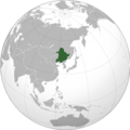
 Second ETR (within China).png 2,409 × 2,048; 652 KB


.png)