Category:Maps of towns in Wales
Appearance
Subcategories
This category has the following 11 subcategories, out of 11 total.
A
- Maps of Aberystwyth (7 F)
B
- Maps of Beaumaris (9 F)
C
- Maps of Caernarfon (8 F)
L
- Maps of Llandudno (12 F)
M
- Maps of Brecon (3 F)
- Maps of Carmarthen (5 F)
- Maps of Haverfordwest (10 F)
O
P
- Maps of Penarth (4 F)
Media in category "Maps of towns in Wales"
The following 17 files are in this category, out of 17 total.
-
Angleseymôncloseup.png 541 × 522; 14 KB
-
Angleseymôncloseup.svg 541 × 522; 24 KB
-
Anglessey map.png 889 × 659; 23 KB
-
Bangor town plan 4669575.jpg 3,607 × 2,810; 4.55 MB
-
Carmarthenmap 1952.jpg 2,880 × 1,520; 626 KB
-
Conwy town wall plan.jpg 811 × 539; 107 KB
-
Conwymap1947.png 1,047 × 876; 1.64 MB
-
Electoral wards in Holyhead.jpg 640 × 470; 62 KB
-
Electoral wards in the town of Rhyl, Denbighshire, Wales.png 700 × 610; 87 KB
-
Llantwit Major map.png 997 × 1,209; 337 KB
-
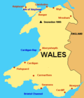
Map of Wales.GIF 379 × 441; 7 KB
-
Narberthmap1952.jpg 1,273 × 873; 692 KB
-
Speed Carmarthen insert.jpg 754 × 583; 314 KB
-
Tenby walls.png 1,137 × 480; 166 KB
-
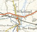
Whitlandmap1952.jpg 740 × 642; 278 KB


