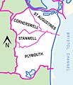
Category:Maps of Penarth
Jump to navigation
Jump to search
Media in category "Maps of Penarth"
The following 4 files are in this category, out of 4 total.
-
Electoral wards in the town of Penarth, Vale of Glamorgan.jpg 505 × 590; 90 KB
-
Map of Cardiff and its Environs OS Map name 047-07, Ordnance Survey, 1875-1882.png 11,290 × 7,496; 20.88 MB
-
Map of Cardiff and its Environs OS Map name 047-11, Ordnance Survey, 1875-1882.png 11,314 × 7,525; 18.48 MB
-
Vale of Glamorgan UK community map (Penarth).svg 1,425 × 895; 522 KB


