Category:Maps of the province of Castellón
Jump to navigation
Jump to search
Provinces of Spain: Álava · Albacete · Alicante · Almería · Asturias‡ · Ávila · Badajoz · Balearic Islands‡ · Barcelona · Biscay · Burgos · Cáceres · Cádiz · Cantabria‡ · Castellón · Ciudad Real · Córdoba · A Coruña · Cuenca · Gipuzkoa · Girona · Granada · Guadalajara · Huelva · Huesca · Jaén · León · Lleida · Lugo · Madrid‡ · Málaga · Murcia‡ · Navarre‡ · Ourense · Palencia · Las Palmas · Pontevedra · La Rioja‡ · Salamanca · Santa Cruz de Tenerife · Segovia · Seville · Soria · Tarragona · Teruel · Toledo · Valencia · Valladolid · Zamora · Zaragoza · Autonomous cities: Ceuta · Melilla
‡: uniprovincial autonomous communities.
‡: uniprovincial autonomous communities.

Subcategories
This category has the following 5 subcategories, out of 5 total.
Media in category "Maps of the province of Castellón"
The following 13 files are in this category, out of 13 total.
-
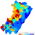 Castellon Crecimiento-1998-2008.png 1,000 × 1,000; 139 KB
-
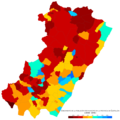 Castellon Crecimiento-2008-2018.png 1,000 × 1,000; 133 KB
-
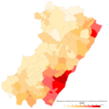 Castellon Densidad-2018.png 1,000 × 1,000; 131 KB
-
 Castellon Poblacion-2018.png 1,000 × 1,000; 126 KB
-
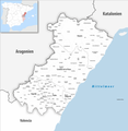
 Conca del Bergantes.svg 721 × 899; 417 KB
-
 Grösste Orte im Provinz Castellón.png 613 × 589; 97 KB
-
 Karte Gemeinden Provinz Castellón 2022.png 5,000 × 5,142; 2.09 MB
-
 Karte Gemeinden und Gerichtsbezirke Provinz Castellón 2022.png 5,000 × 5,142; 1.91 MB
-
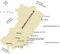 Main towns in the province of Castellón.png 1,183 × 1,067; 200 KB
-
 Mapa forestal de la província de Castelló.png 643 × 405; 61 KB
-
 Principales localidades de la provincia de Castellón.png 1,182 × 1,067; 201 KB
-
 Principales localités de la province de Castellón.png 660 × 596; 101 KB
-
 Rambla.Vidua.jpg 604 × 444; 69 KB


