Category:Maps of the province of Almería
Jump to navigation
Jump to search
Provinces of Spain: Álava · Albacete · Alicante · Almería · Asturias‡ · Ávila · Badajoz · Balearic Islands‡ · Barcelona · Biscay · Burgos · Cáceres · Cádiz · Cantabria‡ · Castellón · Ciudad Real · Córdoba · A Coruña · Cuenca · Gipuzkoa · Girona · Granada · Guadalajara · Huelva · Huesca · Jaén · León · Lleida · Lugo · Madrid‡ · Málaga · Murcia‡ · Navarre‡ · Ourense · Palencia · Las Palmas · Pontevedra · La Rioja‡ · Salamanca · Santa Cruz de Tenerife · Segovia · Seville · Soria · Tarragona · Teruel · Toledo · Valencia · Valladolid · Zamora · Zaragoza · Autonomous cities: Ceuta · Melilla
‡: uniprovincial autonomous communities.
‡: uniprovincial autonomous communities.
Wikimedia category | |||||
| Upload media | |||||
| Instance of | |||||
|---|---|---|---|---|---|
| Category combines topics | |||||
| Almería Province | |||||
province of Andalusia, Spain | |||||
| Instance of | |||||
| Location | Andalusia, Spain | ||||
| Located in or next to body of water | |||||
| Capital | |||||
| Executive body | |||||
| Highest point |
| ||||
| Population |
| ||||
| Area |
| ||||
| official website | |||||
 | |||||
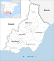
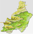
Maps of the province of Almería.
Subcategories
This category has the following 8 subcategories, out of 8 total.
Pages in category "Maps of the province of Almería"
This category contains only the following page.
Media in category "Maps of the province of Almería"
The following 39 files are in this category, out of 39 total.
-
Almeria - Mapa municipal.svg 778 × 413; 225 KB
-
Almería (Andalucía).png 452 × 422; 12 KB
-
Admiralty Chart No 774 Adra to Cartagena, Published 1894, Large Corrections 1949.jpg 16,309 × 11,108; 24.26 MB
-
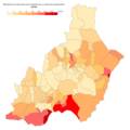
Almeria - Mapa municipa (municipios por población).svg 450 × 405; 452 KB
-
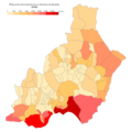
Almeria Crecimiento 08-18.png 1,000 × 1,000; 131 KB
-
Almeria Crecimiento 98-08.png 1,000 × 1,000; 135 KB
-
Almeria densidad 2018.png 1,000 × 1,000; 128 KB
-
Almeria densidad poblacion.svg 778 × 413; 257 KB
-
Almeria poblacion 2018.png 1,000 × 1,000; 128 KB
-
AlmeriaMurciaSureste.png 1,024 × 663; 152 KB
-
Wikiproyecto Almería.png 475 × 487; 11 KB
-
Almería - mapa municipal y Partidos Judiciales.svg 512 × 559; 249 KB
-
Almería PNCaboGataNijarLOC.png 688 × 478; 149 KB
-
ATLAS JUSTUS PERTHES 07.jpg 4,525 × 3,965; 13.07 MB
-
Baza1821.svg 880 × 755; 444 KB
-
Densidad Almería.png 1,170 × 827; 63 KB
-
Guadix1813.svg 695 × 755; 311 KB
-
Helicella-stiparum-map-eur-nm-moll.jpg 570 × 493; 175 KB
-
Hidrografia almeria.png 1,217 × 1,266; 181 KB
-
Inmigracion Almería.png 2,340 × 1,654; 165 KB
-
Karte Gemeinden Provinz Almería 2022.png 2,500 × 2,802; 881 KB
-
Karte Gemeinden und Gerichtsbezirke Provinz Almería 2022.png 3,000 × 3,362; 1.03 MB
-
LocAlmería.svg 512 × 559; 300 KB
-
Location map Taifa of Almeria Arabic.svg 713 × 601; 279 KB
-
Location map Taifa of Almería.svg 713 × 601; 279 KB
-
Mapa terremoto berja 1993 Epicentro.png 480 × 530; 326 KB
-
Maps-for-free Sierra Nevada.png 497 × 399; 377 KB
-
PNCGN-Playas (cropped).png 1,499 × 1,123; 274 KB
-
PNCGN-Playas.png 1,512 × 1,134; 214 KB
-
Poblacion Almería.png 2,340 × 1,654; 172 KB
-
Provincias de Andalucía Oriental con los colores de su bandera.svg 424 × 367; 46 KB
-
Provinz Almería 2022.png 2,500 × 2,802; 823 KB
-
Relieve almería.png 1,092 × 1,147; 1.14 MB
-
Surco Intrabetico.png 877 × 620; 747 KB
-
Terremoto de Berja de 1993 y sus réplicas.png 1,123 × 897; 889 KB
-
VdlT Desierto de Almería.svg 947 × 549; 124 KB
-
VdlT Laujar-Alpujarra.svg 947 × 549; 122 KB
-
VdlT Ribera del Andarax.svg 947 × 549; 124 KB
-
Zonificación sanitaria de la provincia de Almería.svg 600 × 700; 708 KB
