Category:Maps of the islands of the North Atlantic
Jump to navigation
Jump to search
This category is for maps which show the various countries of the area known as the wikipedia:Islands of the North Atlantic.
See also:
Subcategories
This category has the following 13 subcategories, out of 13 total.
Media in category "Maps of the islands of the North Atlantic"
The following 3 files are in this category, out of 3 total.
-
 1827 Finley Map of Rhode Island - Geographicus - RhodeIsland-finley-1827.jpg 2,314 × 3,000; 1.67 MB
-
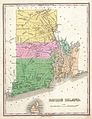
 Block Island Map of Rhode Island.png 238 × 310; 12 KB
-


