
Category:Maps of the British Isles
English: Maps of the countries and islands within the British Isles region of the North Atlantic — in Western Europe.
See also
[edit]- Wikimedia Commons
- Wikipedia
Subcategories
This category has the following 10 subcategories, out of 10 total.
*
+
O
T
Media in category "Maps of the British Isles"
The following 78 files are in this category, out of 78 total.
-
 003 British Isles.png 414 × 516; 9 KB
-
 327 of 'Ethnographie des peuples de l'Europe avant Jésus-Christ, etc' (11096208586).jpg 2,256 × 3,257; 1.42 MB
-
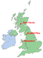 3peaks.png 290 × 396; 15 KB
-

-

-

-

-
 Amfidromieën.jpg 300 × 346; 608 KB
-
 An introduction to the study of prehistoric art (1915) (14775789264).jpg 1,472 × 1,858; 136 KB
-
 Atlantic Isles.png 400 × 400; 27 KB
-
 Atlantic Isles.PNG 600 × 600; 82 KB
-
 B&Q Locations.jpg 416 × 638; 46 KB
-
 BBC television weather chart - 1936-11-13.jpg 765 × 513; 65 KB
-
 Bi-density.png 663 × 1,069; 132 KB
-
 BIThumbMap BI.png 663 × 1,069; 99 KB
-
 BIThumbMap SCO ISLES.png 663 × 1,069; 120 KB
-

-
 British Isles - DPLA - bf20bc676c64f84a6a8cde84afd94ab8.jpg 3,351 × 4,524; 1.81 MB
-
 British Isles - UK & Ireland.png 2,103 × 1,415; 174 KB
-
 British Isles 7C kingdoms with Bernicia and Deira.gif 902 × 1,166; 375 KB
-
 British Isles Highlighted.png 332 × 332; 115 KB
-
 British Isles mountains over 610m in height (called P610s).gif 1,348 × 1,820; 424 KB
-
 British Isles Scotland.png 2,000 × 3,496; 476 KB
-
 British Isles slope map.png 6,991 × 8,265; 15.67 MB
-
 British Isles terms.gif 463 × 655; 46 KB
-
 British Isles Venn Diagram-en (3).png 640 × 636; 75 KB
-
 Britske ostrovy 01.PNG 510 × 710; 16 KB
-
 Brittiskaoarna.gif 576 × 618; 254 KB
-
 Broxtowe.jpg 160 × 199; 6 KB
-
 CommonTravelArea.png 450 × 422; 9 KB
-
 Crown dependencies location.png 520 × 556; 47 KB
-
 Distribution of Scandinavian place names in England (4479234771).png 561 × 648; 101 KB
-
 Echmarcach mac Ragnaill (map).png 1,018 × 1,513; 382 KB
-
 Echmarcach mac Ragnaill (map2).png 625 × 549; 104 KB
-
 English Irredentist Map.png 2,170 × 2,439; 300 KB
-
 Gaelic British Isles.jpg 469 × 580; 35 KB
-
 Gaels.png 886 × 1,369; 195 KB
-
 Geograph depth small.png 120 × 170; 24 KB
-
 GPC Polygon Clipper difference.gif 240 × 255; 3 KB
-
 GPC Polygon Clipper intersection.gif 240 × 255; 3 KB
-
 GPC Polygon Clipper union.gif 240 × 255; 3 KB
-
 GPC Polygon Clipper xor.gif 240 × 255; 3 KB
-
 Ham sandwich theorem 2d.png 1,024 × 1,536; 142 KB
-
 Ireland (island) in Europe.png 720 × 600; 62 KB
-
 Irish And English Regions.png 4,765 × 9,251; 2 MB
-
 Islas.brit.png 661 × 661; 588 KB
-
 KIngs Lynn globe close up.JPG 4,320 × 2,880; 4.85 MB
-
 Kishvarhoi podshohii muttahida.png 366 × 500; 39 KB
-
 Lisbon Portugal 067 (5107498155).jpg 3,264 × 2,448; 1.28 MB
-
 Location Great Britain and Ireland.png 250 × 115; 5 KB
-
 Location map of British Isles.png 551 × 551; 46 KB
-
 LocationBritishIsles-noborders.png 1,245 × 1,245; 65 KB
-
 Lǫgmaðr Guðrøðarson (map1).png 1,018 × 1,513; 337 KB
-
 Lǫgmaðr Guðrøðarson (map2).png 1,686 × 1,181; 355 KB
-
 Maeneo chini ya taji la Uingereza.PNG 361 × 600; 65 KB
-
 Map - Kingdom of the Isles 2 (png).png 511 × 637; 112 KB
-
 Map of Marilyns.png 976 × 1,496; 72 KB
-
 Map of the administrative geography of the British Isles with postcode areas.jpg 4,208 × 5,056; 4.02 MB
-
 Map of the administrative geography of the British Isles.jpg 4,208 × 5,056; 3.5 MB
-
 Map of the British Islands, showing the locations of the Herds in Harting's list.png 1,680 × 2,202; 91 KB
-
 Map of the Location of the Kingdom of Northumbria.png 518 × 614; 22 KB
-
 North Channel.png 972 × 821; 1.14 MB
-
 PAT - United Kingdom and Ireland.gif 1,650 × 1,950; 646 KB
-
 Patrol area USA submarines.gif 275 × 425; 56 KB
-
 Porto 15 31 05 217000.jpeg 3,024 × 4,032; 6.51 MB
-
-
 The Atlantic Archipelago.png 1,572 × 2,264; 814 KB
-
 The British Isles - DPLA - 4ac696f2ac1d82378c706acb29975c32.jpg 8,428 × 12,592; 9.66 MB
-
 The British Isles - DPLA - 754a18890d9772a126dbfe9387c37c31.jpg 8,412 × 12,588; 9.97 MB
-
 The British Isles winter weather event deaths of 2010.png 3,320 × 3,752; 825 KB
-
 The Gaels.png 886 × 1,369; 197 KB
-
 TheBritishIsles.png 334 × 390; 144 KB
-
 Uk outline map2.PNG 600 × 800; 32 KB
-
 UK scotland.png 290 × 396; 10 KB
-
 United Kingdom Scilly islands.png 336 × 359; 7 KB
-
 Western Approaches.PNG 700 × 655; 27 KB
-
 WWII Divide and Conquer 12.jpg 720 × 480; 38 KB
-
 Кельцкія народы Брытанскіх астравоў.png 1,250 × 1,600; 155 KB

.jpg)

.jpg)
.jpg)
.jpg)
.jpg)

_(14775789264).jpg)


.gif)


.png)


.png)
.png)
.png)


_in_Europe.png)


.jpg)


.png)
.png)

.png)


