Category:Maps of the history of the canton of Valais
Jump to navigation
Jump to search
Cantons of Switzerland: Bern (BE) · Fribourg (FR) · Geneva (GE) · Graubünden (GR) · Valais (VS) · Vaud (VD) · Zürich (ZH)
Media in category "Maps of the history of the canton of Valais"
The following 15 files are in this category, out of 15 total.
-
 Burgunderkriege.png 2,500 × 2,527; 1.13 MB
-
 Carte des attaques du Monstre du Valais-fr.svg 1,719 × 1,290; 538 KB
-
 Carte-Royaume-dArles.png 1,500 × 1,529; 412 KB
-
 Cosmographia (Sebastian Münster) p 063.jpg 2,000 × 1,571; 565 KB
-
 Droysens-25d.jpg 2,626 × 1,390; 3.89 MB
-
 Droysens-25g.jpg 5,661 × 4,307; 4.61 MB
-
 Karte-Entwicklung-Savoyen-bis-1789.png 2,500 × 2,542; 1.05 MB
-
 Karte-Herzogtum-Savoyen-1475.png 1,500 × 1,551; 583 KB
-
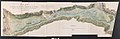 Projet de route de Genève à Milan par le Simplon - Archives nationales - CP-F-14-10192-3.jpg 7,000 × 2,268; 4.57 MB
-
 Struktur Eidgenossenschaft 1474-fr.svg 2,500 × 1,518; 322 KB
-
 Stumpf Froschauer Landtaflen Wallis.jpg 2,130 × 1,239; 1.51 MB
-
 Valais Sanson 1693.jpg 1,759 × 717; 695 KB
-
 Valais1300 english.png 1,063 × 785; 177 KB
-
 Vallispoeninaklein.png 2,056 × 1,340; 73 KB
-
 Wallis1300.png 1,063 × 785; 123 KB


_p_063.jpg)


