Category:Maps of the history of the canton of Geneva
Jump to navigation
Jump to search
Cantons of Switzerland: Bern (BE) · Fribourg (FR) · Geneva (GE) · Graubünden (GR) · Valais (VS) · Vaud (VD) · Zürich (ZH)
Media in category "Maps of the history of the canton of Geneva"
The following 16 files are in this category, out of 16 total.
-

-
 Burgunderkriege.png 2,500 × 2,527; 1.13 MB
-
 Carte-Royaume-dArles.png 1,500 × 1,529; 412 KB
-
 Droysens-25g.jpg 5,661 × 4,307; 4.61 MB
-
 Droysens-25h.jpg 987 × 848; 798 KB
-
 Extrait Tablede Peutinger Secteur Rhône et Alpes.jpg 896 × 356; 196 KB
-
 Genève-Communes-1815-1816.jpg 1,033 × 1,012; 146 KB
-
 GenèveCommunes-1815-1816-clr.jpg 1,033 × 1,012; 203 KB
-
 Karte-Departement-Léman-1798.png 2,500 × 2,101; 669 KB
-
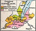
 Karte-Entstehung-Kanton-Genf.png 2,500 × 1,928; 605 KB
-
 Karte-Kanton-Genf-1792.png 2,500 × 1,767; 518 KB
-
 Karte-Kanton-Genf-1814-Erster-Friede-von-Paris.png 2,500 × 2,210; 621 KB
-
 Karte-Kanton-Genf-1815-Pariser-Vertrag.png 2,500 × 2,210; 594 KB
-
 Karte-Kanton-Genf-1816-Turiner-Vertrag.png 2,500 × 2,210; 694 KB
-
 Trois-Chêne-Communes.png 313 × 206; 48 KB
-
 Trois-Chêne-Communes2.png 960 × 751; 316 KB


