Category:Maps of the history of the Maghreb
Jump to navigation
Jump to search
Subcategories
This category has the following 14 subcategories, out of 14 total.
K
- Kingdom of Altava (4 F)
M
- Maps of the Aghlabid Emirate (16 F)
- Maps of the Hafsid dynasty (19 F)
- Maps of the Hammadid dynasty (39 F)
- Maps of the Ifranids (9 F)
- Maps of the Marinid dynasty (22 F)
- Maps of the Rustamid dynasty (27 F)
- Maps of the Shabiya dynasty (3 F)
- Maps of the Wattasid dynasty (7 F)
- Maps of the Zirid dynasty (51 F)
Media in category "Maps of the history of the Maghreb"
The following 39 files are in this category, out of 39 total.
-
 1Empire of Theodoric the Great 523.png 523 × 478; 31 KB
-
 Berber Revolt East.png 1,247 × 1,247; 282 KB
-
 Berber Revolt West.png 2,495 × 1,247; 604 KB
-
 Carte des Royaumes antiques Berbères.jpg 2,182 × 1,208; 848 KB
-
 Carte du Royaume de Maurétanie.jpg 1,125 × 611; 131 KB
-
 Carte détaillée de l’empire almohade.jpg 1,125 × 751; 250 KB
-
 Ifran Dynasty.jpg 1,125 × 1,071; 365 KB
-
 Ifranids of Tlemcen.jpg 1,125 × 1,017; 413 KB
-
 Kabyle Kingdoms in the Ottoman era at their height .jpg 1,125 × 1,587; 195 KB
-
 Localisation des Meknassa VIIIe siècle.png 829 × 383; 59 KB
-
 Localisation Meknassa VIIIe siècle.png 851 × 368; 41 KB
-
 Maghrawa dynasty - dynastie maghraoua.jpg 1,125 × 1,203; 246 KB
-
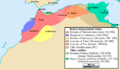
 Maghrebian dynasties 15th century.png 1,202 × 1,051; 104 KB
-
 Map depicting the Romano-Berber Kingdoms-ar.png 900 × 662; 276 KB
-
 Map depicting the Romano-Berber Kingdoms.png 900 × 662; 279 KB
-
 Map of the sultanate of touggourt.jpg 5,000 × 2,592; 387 KB
-
 Maroc - fin XVIe siècle.PNG 636 × 608; 13 KB
-
 Maroc - fin XVIe siècle2-es.svg 402 × 388; 860 KB
-
 Mauretania cesarea and tingitan10 A JC.jpg 296 × 170; 8 KB
-
 Maximal Rustamid Extent (9th Century).png 1,599 × 946; 130 KB
-
 Meknassa 8th century.png 4,824 × 1,953; 623 KB
-
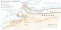
 Morocco and the Maghreb after the Berber Revolt-ar.png 636 × 371; 45 KB
-
 Morocco and the Maghreb after the Berber Revolt-es.svg 2,420 × 1,009; 333 KB
-
 Morocco and the Maghreb after the Berber Revolt.PNG 636 × 371; 17 KB
-
 Muslim conquest of the Maghreb.png 3,742 × 1,247; 927 KB
-
 Numide.png 889 × 335; 175 KB
-
 Occ-Mus-14e-b.PNG 699 × 379; 16 KB
-
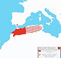
 Regency of Algiers 15th-18th Century.jpg 2,250 × 1,974; 1.34 MB
-
 Royaume de Maurétanie.png 727 × 436; 22 KB
-
 Saadiens - Carte fin XVIe siècle (revised).jpg 1,575 × 1,368; 192 KB
-
 Saadiens - Carte fin XVIe siècle.jpg 1,575 × 1,368; 380 KB
-
 Tamsamanii.gif 598 × 439; 24 KB
-
 The Ifranid Dynasty.jpg 1,125 × 877; 260 KB
-
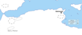
 Tlemcen-carte .png 413 × 241; 88 KB
-
 Tribus Maghreb époque médiévale.png 3,554 × 1,452; 406 KB
-
 West Mediterranean Areas 279 BC-de.png 1,112 × 837; 45 KB
-
 امتداد الدولة العلوية سنة 1798م.png 957 × 697; 1.2 MB
-
 فتوح المغرب 2.jpg 935 × 630; 214 KB
-
 فتوح المغرب.jpg 929 × 634; 234 KB


.png)


.jpg)


