Category:Maps of the Wattasid dynasty
Jump to navigation
Jump to search
Media in category "Maps of the Wattasid dynasty"
The following 9 files are in this category, out of 9 total.
-
 Wattasid dynasty 1420 - 1547 (AD).PNG 821 × 440; 32 KB
-
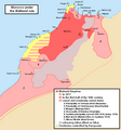
 Wattasid Morocco EN.PNG 636 × 741; 37 KB
-
 Wattasid Morocco-es.svg 1,278 × 1,013; 255 KB
-
 Wattasids - Simplified map-ar.png 636 × 681; 71 KB
-
 Wattasids - Simplified map-es.svg 1,275 × 886; 243 KB
-
 Wattasids - Simplified map-pt.svg 1,299 × 986; 243 KB
-
 Wattasids - Simplified map.PNG 636 × 681; 33 KB
-

-
 دولة بني الوطاس.jpg 701 × 789; 59 KB
.PNG)


