Category:Maps of Hadhramaut
Jump to navigation
Jump to search
Subcategories
This category has the following 2 subcategories, out of 2 total.
D
M
- Maps of Ancient Hadhramaut (17 F)
Media in category "Maps of Hadhramaut"
The following 14 files are in this category, out of 14 total.
-
 Aden Protectorate map (1946).jpg 1,469 × 920; 281 KB
-
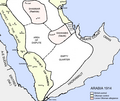 Arabia 1914.png 976 × 821; 111 KB
-
 Banu Nahd in Hadhramaut.png 1,884 × 829; 255 KB
-
 Banu Nahd of Hadhramaut.png 1,858 × 853; 286 KB
-
 Hadramaut (1846).jpg 8,480 × 8,704; 6.14 MB
-
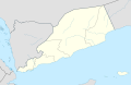
 Location of Hadhramaut.svg 1,208 × 719; 63 KB
-
 Map of Banu Nahd.png 1,889 × 1,061; 334 KB
-
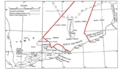
 Map of Hadramut, Theodore Bent journey.jpg 2,400 × 1,508; 470 KB
-
 Nahd Map.png 1,912 × 869; 292 KB
-
 Periplus World Map.jpg 2,142 × 1,774; 785 KB
-
 QuaitiState.png 623 × 359; 133 KB
-
 South Yemen location map خريطة موقع الجنوب العربي محافظات اليمن الجنوبي.svg 1,524 × 995; 109 KB
-
 Versuch einer Darstellung der Küsten-Gegend von Oman und Mahra.jpg 8,480 × 8,704; 5.78 MB
-
 الجنوب العربي 1965 South Arabia 1965.jpg 1,916 × 1,390; 779 KB
.jpg)


.jpg)


