Category:Maps of the history of Hainaut
Jump to navigation
Jump to search
Provinces of Belgium: Hainaut ·
Use the appropriate category for maps showing all or a large part of Hainaut. See subcategories for smaller areas:
| If the map shows | Category to use |
|---|---|
| Hainaut on a recently created map | Category:Maps of Hainaut or its subcategories |
| Hainaut on a map created more than 70 years ago | Category:Old maps of Hainaut or its subcategories |
| the history of Hainaut on a recently created map | Category:Maps of the history of Hainaut or its subcategories |
| the history of Hainaut on a map created more than 70 years ago | Category:Old maps of the history of Hainaut or its subcategories |
Media in category "Maps of the history of Hainaut"
The following 15 files are in this category, out of 15 total.
-

-
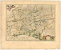 Blaeu 1645 - Comitatuum Hannoniæ et Namurci descriptio.jpg 3,649 × 3,053; 1.57 MB
-

-
 Carte du comté de Hainaut.jpg 1,619 × 1,305; 2.77 MB
-
 Carte du comté de Hainaut.png 1,675 × 1,392; 3.84 MB
-
 ChatellenieAth1700.jpg 886 × 751; 204 KB
-
 County of Soissons (1180).png 427 × 398; 107 KB
-
 Hainaut in France (1789).svg 2,000 × 1,922; 1.05 MB
-
 Locator County of Hainaut (1350).svg 2,818 × 3,608; 422 KB
-
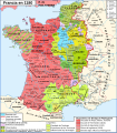
 Map France 1180-br.svg 988 × 1,124; 1.9 MB
-
 Map France 1180-de.svg 988 × 1,124; 1.94 MB
-
 Map France 1180-es.svg 988 × 1,124; 1.97 MB
-
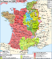 Map France 1180-fr.svg 988 × 1,124; 1.88 MB
-
 Map France 1180-ru.svg 988 × 1,124; 1.88 MB
-
 Map France 1180-uk.svg 988 × 1,124; 1.68 MB


.png)


.png)
.svg)
.svg)


