Category:Maps of the history of Groningen (province)
Jump to navigation
Jump to search
Provinces of the Netherlands: Friesland · Groningen · Zeeland
Media in category "Maps of the history of Groningen (province)"
The following 26 files are in this category, out of 26 total.
-
Departments of French Empire EmsOcc 1811.svg 957 × 838; 938 KB
-
Fivelboezem bedijkingen.gif 684 × 601; 25 KB
-
Friesische Seelande um 1300.png 800 × 447; 37 KB
-
Friesische Seelande.png 1,191 × 666; 255 KB
-
Friesland region.png 360 × 300; 16 KB
-
Frisians-es.png 961 × 871; 236 KB
-
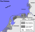
Frisians.png 769 × 697; 128 KB
-
Greater Groningen ±1500.png 329 × 366; 11 KB
-
Groningen Franse Tijd.PNG 360 × 788; 21 KB
-
Groningenhistorisch.png 463 × 450; 130 KB
-
Kliefsloot.jpg 442 × 347; 54 KB
-
Kloosterkaart Groningen.gif 801 × 583; 50 KB
-
LocatieMiddag.png 185 × 176; 9 KB
-
Locator Fivelingo.png 2,000 × 2,225; 384 KB
-
Locator Gorecht.png 2,000 × 2,225; 383 KB
-
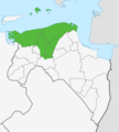
Locator Hunsingo.png 2,000 × 2,225; 383 KB
-
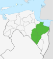
Locator Oldambt.png 2,000 × 2,225; 384 KB
-
Locator Westerkwartier.png 2,000 × 2,225; 382 KB
-
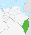
Locator Westerwolde.png 2,000 × 2,225; 379 KB
-
Middag-Humsterland.jpg 483 × 601; 139 KB
-
Middeleeuwse landinbraken Groningen.gif 667 × 485; 36 KB
-
OFrie1477.png 297 × 272; 127 KB
-
Zijlvesten-en-dijkrechtenkaart.jpg 651 × 601; 149 KB
-
Zijlvestenkaart Aduard rood.jpg 651 × 601; 205 KB
-
Zijlvestenkaart DrieDelfzijlen.jpg 651 × 601; 164 KB
-
Zijlvestenkaart Winsum Schap.jpg 651 × 601; 199 KB


