Category:Old maps of Groningen (province)
Jump to navigation
Jump to search
Provinces of the Netherlands: Drenthe · Friesland · Gelderland · Groningen · North Brabant · North Holland · Overijssel · South Holland · Zeeland
Subcategories
This category has the following 16 subcategories, out of 16 total.
B
- Old maps of Bourtange (8 F)
D
- Old maps of Delfzijl (11 F)
G
H
- Hottinger kaarten (92 F)
O
- Old maps of Oudeschans (5 F)
P
- Old maps of Pekela (6 F)
R
- Old maps of Reiderland (10 F)
S
- Old maps of Stadskanaal (4 F)
W
Media in category "Old maps of Groningen (province)"
The following 8 files are in this category, out of 8 total.
-
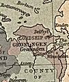
Groningen 1559-1608.jpg 268 × 317; 569 KB
-
Groningen en Ommelanden - Republic of the 7 United Netherlands map.jpg 1,992 × 2,048; 971 KB
-
Haubois - Garrelsweer ca. 1645.jpg 1,709 × 998; 505 KB
-
Kaart van Groningen, 1940, RP-P-2019-434-1.jpg 5,518 × 3,962; 3.39 MB
-
Kaart, Bestanddeelnr 195-0063.jpg 3,188 × 1,806; 2 MB
-
OUDE kaart BLAD 20 AANKOOP ARA DEN HAAG D.W.C.HA - Unknown - 20521022 - RCE.jpg 1,200 × 900; 192 KB
-
Panser1.jpg 654 × 718; 82 KB


