Category:Maps of the history of Galicia (Spain)
Appearance
Autonomous communities of Spain: Andalusia · Aragon · Asturias · Balearic Islands · Canary Islands · Cantabria · Castilla–La Mancha · Catalonia · Galicia · Community of Madrid · Region of Murcia · Navarre · Valencian Community · Autonomous cities: Ceuta · Melilla
Use the appropriate category for maps showing all or a large part of Galicia. See subcategories for smaller areas:
| If the map shows | Category to use |
|---|---|
| Galicia on a recently created map | Category:Maps of Galicia (Spain) or its subcategories |
| Galicia on a map created more than 70 years ago | Category:Old maps of Galicia (Spain) or its subcategories |
| the history of Galicia on a recently created map | Category:Maps of the history of Galicia (Spain) or its subcategories |
| the history of Galicia on a map created more than 70 years ago | Category:Old maps of the history of Galicia (Spain) or its subcategories |
Subcategories
This category has the following 7 subcategories, out of 7 total.
Media in category "Maps of the history of Galicia (Spain)"
The following 95 files are in this category, out of 95 total.
-
C. 710 Iberian Peninsula Visigothic Provinces.jpg 1,611 × 1,230; 855 KB
-
Arquitectura castrexa.jpg 940 × 676; 244 KB
-
Arte esquematico iberico.png 984 × 844; 412 KB
-
Avrupa 814.jpg 1,477 × 1,164; 383 KB
-
Battle of Corunna.jpg 1,944 × 2,592; 1.9 MB
-
Britonen6JHundert.png 1,670 × 2,928; 441 KB
-
Britonia6hcentury-ar.jpg 1,670 × 2,928; 375 KB
-
Britonia6hcentury.png 1,670 × 2,928; 542 KB
-
Britonia6hcentury2.svg 1,464 × 2,405; 181 KB
-
Cultura Castrexa.png 723 × 579; 158 KB
-
Empire français 1811.png 254 × 243; 29 KB
-
Espagne guerre aout.png 446 × 472; 26 KB
-
Espagne guerre nove.png 446 × 472; 25 KB
-
Espagne guerre octo.png 446 × 472; 25 KB
-
España - División provincial y regional de 1833.svg 2,500 × 1,895; 1.25 MB
-
Estatutos de autonomia 1936.svg 2,496 × 1,885; 460 KB
-
Europe en 1812 (c. 1854).jpg 2,867 × 2,282; 5.11 MB
-
Europe map Napoleon Blocus.png 415 × 397; 67 KB
-
Galiciamaptimes.gif 1,000 × 1,445; 235 KB
-
Galiza coas sete provincias (1753).jpg 2,051 × 2,176; 364 KB
-
Galiza coas sete provincias sobre o territorio actual (1753).jpg 2,111 × 2,175; 391 KB
-
Galiza coas xurisdicións (1753).jpg 2,048 × 2,176; 1.22 MB
-
Galiza coas xurisdicións sobre o territorio actual (1753).jpg 2,087 × 2,179; 1.27 MB
-
Iberian Peninsula 1811 with locations-es.svg 2,611 × 1,579; 85 KB
-
Iberian Peninsula 1811.svg 2,611 × 1,579; 568 KB
-
K.v. Spruner's histor. Atlas Nº 40 - Die iberische Halbinsel nach ihrer Kirchlichen Eintheilung.jpg 11,449 × 9,541; 16.18 MB
-
Map of Galaecia and its territorial subdivisions in Latin and Arabic.jpg 1,478 × 1,405; 124 KB
-
Map of Galaecia and territorial subdivisions. Names in Latin- Arabic..jpg 1,477 × 1,375; 130 KB
-
Map of Galaecia´s territorial subdivisions. Names in Latin- Arabic.jpg 1,516 × 1,335; 117 KB
-
Map of Hispania beginning of the 10th century.Names in Latin-Arabic and "states".jpg 1,485 × 1,370; 216 KB
-
Map Spain 1822.png 256 × 233; 8 KB
-
Map Spain 1833.png 467 × 394; 17 KB
-
Map Spain 1978.png 256 × 233; 8 KB
-
Map Spain Diócesis.png 257 × 233; 9 KB
-
Mapa de España - Constitución de 1873.svg 416 × 349; 1.44 MB
-
Mapa de España - Decreto de Escosura de 1847.svg 416 × 349; 1.44 MB
-
Mapa de España - Proyecto de reforma de Moret de 1884.svg 416 × 349; 1.44 MB
-
Mapa de las Diócesis de España.svg 1,285 × 822; 1.26 MB
-
Mapa Galicia epoca romana (Assegonia).png 992 × 877; 902 KB
-
Mapa Galicia epoca romana.png 988 × 873; 898 KB
-
O Barbanza en 1753.png 3,000 × 3,063; 2.58 MB
-
ORNM 01 - O Parroquial Suevo.pdf 1,752 × 2,479; 30.32 MB
-
ORNM 01 - O Parroquial Suevo.png 3,508 × 4,961; 1.88 MB
-
ORNM 02 - O encastelamento do Reino.pdf 1,752 × 2,479; 42.05 MB
-
ORNM 02 - O encastelamento do Reino.png 3,508 × 4,961; 3.31 MB
-
ORNM 03 - O monacato no Reino.pdf 1,752 × 2,479; 30.19 MB
-
ORNM 03 - O monacato no Reino.png 3,508 × 4,961; 3.12 MB
-
ORNM 04 - Mulleres na lírica medieval.pdf 1,752 × 2,479; 25.36 MB
-
ORNM 04 - Mulleres na lírica medieval.png 3,508 × 4,961; 2.95 MB
-
ORNM 05 - O Reino no comercio marítimo europeo.pdf 1,752 × 2,479; 24.36 MB
-
ORNM 05 - O Reino no comercio marítimo europeo.png 3,508 × 4,961; 1.55 MB
-
ORNM 06 - Produción e comercio do viño.pdf 1,752 × 2,479; 22.08 MB
-
ORNM 06 - Produción e comercio do viño.png 3,508 × 4,961; 3.41 MB
-
ORNM 07 - Nobres galegas en desprazamento.pdf 1,752 × 2,479; 14.18 MB
-
ORNM 07 - Nobres galegas en desprazamento.png 3,508 × 4,961; 2.2 MB
-
ORNM 08 - As sete provincias galegas.pdf 1,752 × 2,479; 23.08 MB
-
ORNM 08 - As sete provincias galegas.png 3,508 × 4,961; 3.54 MB
-
Provinces Crown of Castile 1590.svg 586 × 454; 832 KB
-
Provincia Betanzos.png 794 × 500; 24 KB
-
Provincia de Galicia en 1800.svg 468 × 343; 473 KB
-
Region of Galicia.png 1,800 × 1,160; 192 KB
-
Región de Galica (España) en 1975.svg 2,496 × 1,885; 460 KB
-
Regiõs direito foral 1975.svg 2,496 × 1,885; 512 KB
-
Reino de Galicia - kingdom of Galicia - Jalilkiah.jpg 1,604 × 1,064; 996 KB
-
Routes of the Spanish Armada.gif 415 × 756; 27 KB
-
SieteProvinciasGalicia1753.jpg 3,409 × 3,841; 1.26 MB
-
Territorial subdivisions of Gallaecia. Names in Latin and Arabic..jpg 1,516 × 1,290; 114 KB
-
Territorio de Trastámara (cos castelos).png 4,015 × 2,716; 701 KB
-
Territorio de Trastámara.png 4,015 × 2,716; 657 KB
-
Territory ruled by Pedro Fróilaz de Traba.PNG 325 × 279; 75 KB
-
TRIBOS CALAICAS DO NORTE.png 612 × 506; 443 KB
-
Valores do ferrado superficial em varas qadradas na província da Crunha em 1753.png 4,153 × 3,508; 696 KB
-
Valores do ferrado superficial em varas qadradas na província de Betanços em 1753.png 3,498 × 4,092; 1.28 MB
-
Valores do ferrado superficial em varas qadradas na província de Lugo em 1753.png 5,291 × 4,961; 3.07 MB
-
Valores do ferrado superficial em varas qadradas na província de Mondonhedo em 1753.png 3,926 × 3,508; 1.2 MB
-
Valores do ferrado superficial em varas qadradas na província de Ourense em 1753.png 6,393 × 4,693; 3.17 MB
-
Valores do ferrado superficial em varas qadradas na província de Tui em 1753.png 3,985 × 3,508; 1.38 MB
-
Villa Sancti Iacobi.png 986 × 943; 169 KB
-
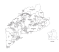
Xurisdicións da provincia da Coruña (1753).jpg 1,734 × 1,622; 402 KB
-
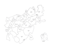
Xurisdicións da provincia de Betanzos (1753).jpg 1,741 × 2,163; 543 KB
-
Xurisdicións da provincia de Lugo (1753).jpg 2,993 × 2,920; 1.39 MB
-
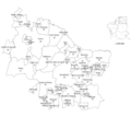
Xurisdicións da provincia de Mondoñedo (1753).jpg 1,813 × 1,710; 518 KB
-
Xurisdicións da provincia de Ourense (1753).jpg 3,638 × 2,433; 1.17 MB
-
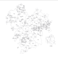
Xurisdicións da provincia de Santiago (1753).jpg 2,993 × 3,219; 1.51 MB
-
Xurisdicións da provincia de Tui (1753).jpg 2,455 × 2,406; 869 KB
-
Züge, Landnahmen und Siedlungsgebiete der Nordmänner - 800-1050.png 4,026 × 2,502; 12.13 MB
-
فتح الأندلس 92هـ - 711م.jpg 933 × 639; 250 KB


