Category:Maps of the Khazars
Jump to navigation
Jump to search
Media in category "Maps of the Khazars"
The following 52 files are in this category, out of 52 total.
-
1p copy--.png 1,905 × 1,376; 5.68 MB
-
7. yüzyıl Hazarlar.jpg 1,905 × 1,376; 2.31 MB
-
Avrupa 814.jpg 1,477 × 1,164; 383 KB
-
Balkans 960s.JPG 551 × 386; 30 KB
-
Banduri and Lisle. Imperii Orientalis et Circumjacentium Regionum.E (Chazaria).jpg 1,948 × 2,004; 779 KB
-
Buffer-state-of-khazaria.png 458 × 307; 11 KB
-
Caucasus 1000 map alt de.png 2,990 × 2,324; 3.77 MB
-
Caucasus 1000 map de.png 2,990 × 2,324; 3.74 MB
-
Caucasus 1000 map de.svg 1,155 × 898; 4.61 MB
-
Caucasus 1000 map en.png 1,604 × 1,246; 1.42 MB
-
Caucasus 1000 map hu.svg 1,155 × 898; 4.59 MB
-
Cazars - Extension maximala de l'influéncia cazara.png 1,328 × 1,037; 91 KB
-
Chasaren-ar.jpg 1,394 × 1,133; 409 KB
-
Chasaren.jpg 1,394 × 1,133; 959 KB
-
Europa 814.png 1,350 × 1,022; 167 KB
-
Europe 814 japref.jpg 1,450 × 1,150; 349 KB
-
Europe in 814AD.png 1,218 × 888; 115 KB
-
Hazarlar (tr).png 637 × 553; 30 KB
-
Hazarlar.jpg 1,400 × 1,139; 994 KB
-
Hazarların düşüşü.png 593 × 447; 67 KB
-
Hazarların düşüşü1.png 670 × 448; 76 KB
-
Honfoglalas.gif 1,014 × 728; 1.31 MB
-
Khazar map1.PNG 939 × 592; 548 KB
-
Khazar-Volga-Don-map.png 728 × 662; 114 KB
-
Khazar1.png 498 × 448; 12 KB
-
Khazarfall1-ar.svg 838 × 560; 537 KB
-
Khazarfall1.png 670 × 448; 32 KB
-
Khazarfall1.svg 670 × 448; 43 KB
-
Khazarfallzhs.svg 838 × 560; 152 KB
-
Khazaria Empire.png 415 × 437; 149 KB
-
Khazaria750.png 1,264 × 788; 40 KB
-
L'impero bizantino nel 1045.jpg 800 × 554; 351 KB
-
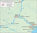
LowerVolga.jpg 1,927 × 1,713; 862 KB
-
Map Byzantine Empire 1045 2000px svg.png 2,000 × 1,385; 1,000 KB
-
Map Byzantine Empire 1045 el.svg 1,300 × 900; 338 KB
-
NE 500ad.jpg 1,424 × 1,049; 238 KB
-
Pays des tchétchènes Khazaria.jpg 576 × 400; 40 KB
-
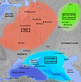
Pontic steppe region around 650 AD-svg-en.svg 512 × 444; 94 KB
-
Pontic steppe region around 650 AD-svg-es.svg 523 × 549; 1.22 MB
-
Pontic steppe region around 650 AD-svg-fr.svg 512 × 444; 94 KB
-
Pontic steppe region around 650 AD-zh.svg 1,473 × 1,280; 85 KB
-
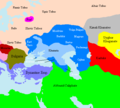
Pontic steppe region around 650 AD.png 637 × 553; 40 KB
-
Pontic-650 hu.png 800 × 883; 162 KB
-
Pontic-650-nl.PNG 406 × 448; 15 KB
-
Pontic-650.png 406 × 448; 14 KB
-
Sivashovka group.svg 480 × 300; 644 KB
-
World in 820.png 1,200 × 600; 42 KB
-
Xəzər xaqanlığının xəritəsi (820-ci il).png 998 × 714; 85 KB
-
Δνείπ-Βόλγ 10ος αι.jpg 872 × 886; 182 KB
-
高加索 750n alt zh cn.svg 1,155 × 898; 4.45 MB
Categories:
- Maps of the history of Armenia
- Khazar Khaganate
- Maps of ancient peoples
- Maps of Eurasia
- Historical maps of ethnic groups in Ukraine
- Maps of the history of Europe by former country
- Maps of the history of the Caucasus
- Maps of the history of Russia
- Maps of the history of Ukraine in the Middle Ages
- Maps of the history of Crimea
- Judaism distribution maps


