Category:Maps of the West Slavs
Jump to navigation
Jump to search
Subcategories
This category has the following 2 subcategories, out of 2 total.
M
Media in category "Maps of the West Slavs"
The following 8 files are in this category, out of 8 total.
-

-
 Germanische und slavische Volksstaemme zwischen Elbe und Weichsel.jpg 1,973 × 1,665; 1.03 MB
-

-

-
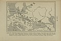
 Democratic Ideals and Reality, 1919 Fig 29 p 163.jpg 1,254 × 1,215; 192 KB
-
 Mitteleuropa BV042517659.jpg 1,954 × 1,337; 297 KB
-
 Polabian.png 536 × 617; 35 KB
-
 White serbia white croatia02.png 870 × 966; 48 KB
.jpg)

%27_(11286985195).jpg)
%27_(11176649225).jpg)


