Category:Maps of the Lechites
Jump to navigation
Jump to search
speakers of Lechitic West Slavic languages in the region of Poland | |||||
| Upload media | |||||
| Instance of | |||||
|---|---|---|---|---|---|
| Subclass of | |||||
| Part of | |||||
| Culture | |||||
| Has part(s) |
| ||||
| Population |
| ||||
| |||||
Subcategories
This category has the following 12 subcategories, out of 12 total.
L
M
- Maps of Cremlingen (12 F)
- Maps of Rundlings (14 F)
- Maps of the Kashubians (10 F)
- Maps of the Rugii (21 F)
- Maps of White Serbia (28 F)
- Maps related to Polans (2 F)
- Maps related to Veleti (5 F)
Media in category "Maps of the Lechites"
The following 13 files are in this category, out of 13 total.
-
1861 р.. Ходзько Борейко Леонард Стан на 862 р.jpg 1,600 × 1,198; 553 KB
-
East-Hem 400ad (cropped).jpg 1,079 × 574; 117 KB
-
Havelland FHSW.gif 1,035 × 781; 129 KB
-
Joh Mejer Stormarn 1650.jpg 5,216 × 3,762; 19.05 MB
-
Karte Wagrien.jpg 1,412 × 1,164; 845 KB
-
Lange diercke sachsen freistaat sachsen hauptsiedlungsformen.jpg 1,710 × 998; 540 KB
-
Polaba-Serba-Siedlungsgebiet.png 193 × 261; 51 KB
-
Reitling Vorwerk.gif 281 × 391; 43 KB
-
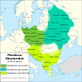
Slavic Tribes in the 7th to 9th century PL.svg 902 × 903; 1.47 MB
-
Treaty of Verdun - Sorbs (Sorben).png 660 × 500; 93 KB
-
White serbia white croatia02.png 870 × 966; 48 KB
-
Die Slaven in Deutschland 1902 (117434929).jpg 3,929 × 2,480; 1.71 MB
-
Die Slaven in Deutschland 1902 (117435665).jpg 4,000 × 3,815; 2.75 MB


