Category:Maps of the Utica Formation
Jump to navigation
Jump to search
Media in category "Maps of the Utica Formation"
The following 10 files are in this category, out of 10 total.
-
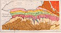 Annual report of the Regents - New York State Museum. (1896) (19179983869).jpg 4,036 × 2,170; 2.32 MB
-
 Major structural and tectonic features in the region of the Utica play (26796534595).jpg 3,507 × 2,480; 783 KB
-

-
 Structure map of the Point Pleasant formation (26729708861).jpg 3,507 × 2,480; 906 KB
-
 Structure map of the Utica formation (26796542625).jpg 3,507 × 2,480; 948 KB
-
 Thickness map of the combined Utica-Point Pleasant interval (26796552265).jpg 3,507 × 2,480; 852 KB
-
 Thickness map of the Point Pleasant formation (26729715011).jpg 3,507 × 2,480; 842 KB
-
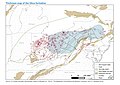 Thickness map of the Utica formation (26191453814).jpg 3,507 × 2,480; 798 KB
-
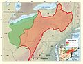
 Utica and Marcellus shale plays (14773202801).png 468 × 388; 78 KB
-
 Utica Shale assessment - 01.jpg 1,324 × 1,026; 662 KB
_(19179983869).jpg)
.jpg)
.png)
.jpg)
.jpg)
.jpg)
.jpg)
.jpg)
.png)
