Category:Maps of the River Severn
Jump to navigation
Jump to search
Media in category "Maps of the River Severn"
The following 30 files are in this category, out of 30 total.
-
-

-

-
 64 of 'About England- or, First lessons in English Geography' (11301035054).jpg 1,221 × 1,186; 281 KB
-
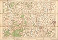
 COMMERCIAL INTELLIGENCE JOURNAL (CANADA) 1921 pt. 1 (1921) (14784777222).jpg 2,378 × 1,712; 622 KB
-
 FMIB 37985 Noose Sandbank.jpeg 839 × 714; 57 KB
-
 FMIB 37998 Course of the River Severn from Gloucester to the Severn Tunnel.jpeg 792 × 1,587; 427 KB
-
 Ordnance Survey Drawings - Ironbridge, Telford and Wrekin (OSD 213).jpg 5,840 × 4,175; 3.86 MB
-
 Ordnance Survey Drawings - Tewkesbury (OSD 173).jpg 4,000 × 2,553; 4.39 MB
-
 Ordnance Survey One-Inch Sheet 103 Stroud & Chepstow, Published 1919.jpg 11,874 × 8,910; 11.76 MB
-
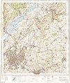
 Ordnance Survey One-Inch Sheet 118 Shrewsbury, Published 1947.jpg 10,951 × 12,826; 16.51 MB
-
 Ordnance Survey One-Inch Sheet 118 Shrewsbury, Published 1961.jpg 8,268 × 9,870; 11.83 MB
-
 Ordnance Survey One-Inch Sheet 128 Montgomery & Llandrindod Wells, Published 1966.jpg 8,285 × 9,865; 12.59 MB
-
 Ordnance Survey One-Inch Sheet 128 Montgomery and Llandrindod Wells, Published 1947.jpg 8,180 × 9,568; 12.17 MB
-
 Ordnance Survey One-Inch Sheet 130 Kidderminster, Published 1947.jpg 10,921 × 12,779; 18.93 MB
-
 Ordnance Survey One-Inch Sheet 130 Kidderminster, Published 1967.jpg 8,317 × 9,880; 13.52 MB
-
 Ordnance Survey One-Inch Sheet 143 Gloucester & Malvern, Published 1946.jpg 8,181 × 9,556; 12.07 MB
-
 Ordnance Survey One-Inch Sheet 143 Gloucester & Malvern, Published 1953.jpg 8,327 × 9,966; 12.85 MB
-
 Ordnance Survey One-Inch Sheet 143 Gloucester & Malvern, Published 1968.jpg 8,331 × 9,901; 11.58 MB
-
 Ordnance Survey One-Inch Sheet 155 Bristol & Newport, Published 1946.jpg 10,929 × 12,822; 17.45 MB
-
 Ordnance Survey One-Inch Sheet 155 Bristol & Newport, Published 1953.jpg 8,282 × 9,952; 12.01 MB
-
 Ordnance Survey One-Inch Sheet 155 Bristol & Newport, Published 1972.jpg 11,058 × 13,150; 47.6 MB
-
 Ordnance Survey One-Inch Sheet 156 Bristol & Stroud, Published 1946.jpg 10,939 × 12,823; 18.14 MB
-
 Ordnance Survey One-Inch Sheet 156 Bristol & Stroud, Published 1953.jpg 8,245 × 9,924; 10.47 MB
-
 Ordnance Survey One-Inch Sheet 156 Bristol & Stroud, Published 1972.jpg 11,086 × 13,175; 48.11 MB
-
 Ordnance Survey One-Inch Sheet 92 Gloucester & Forest of Dean, Published 1919.jpg 12,150 × 8,410; 43.4 MB
-
 Ordnance Survey One-Inch Tourist Map of the Wye Valley & Lower Severn, published 1961.jpg 13,124 × 16,665; 27.94 MB
-
 River Severn map.png 2,006 × 1,625; 3.98 MB
-
 RiverSevernMap.jpg 871 × 774; 389 KB
-
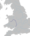 Severn River Route.png 1,268 × 1,492; 179 KB
.jpg)
.jpg)
.jpg)
_1921_pt._1_(1921)_(14784777222).jpg)


.jpg)
.jpg)


%27_(11292127976).jpg)