Category:Maps of the Neolithic
Jump to navigation
Jump to search
Subcategories
This category has the following 9 subcategories, out of 9 total.
K
- Kama culture (3 F)
M
- Maps of the Andronovo culture (12 F)
- Maps of the Baden culture (13 F)
- Maps of the Corded Ware culture (27 F)
- Maps of the European Neolithic (89 F)
- Maps of the Maykop culture (7 F)
- Maps of the Yamna culture (56 F)
Media in category "Maps of the Neolithic"
The following 21 files are in this category, out of 21 total.
-
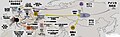
 Agriculture Beginning.png 1,357 × 628; 21 KB
-
 Ancient Caucasoid Horizon.jpg 651 × 317; 35 KB
-
-
 Centres of origin and spread of agriculture labelled.svg 940 × 415; 1.49 MB
-
 Centres of origin and spread of agriculture v2.svg 940 × 415; 1.49 MB
-
 Centres of origin and spread of agriculture.svg 940 × 415; 1.62 MB
-
 Chronology of arrival times of the Neolithic transition in Europe.jpg 4,413 × 3,070; 4.76 MB
-

-
 Europe agricultural revolution.gif 1,361 × 1,203; 3.11 MB
-
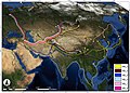
 Expansion of farming in western Eurasia, 9600 - 4000 cal BC.jpg 2,158 × 1,373; 1.72 MB
-
 Expansion of farming in western Eurasia, 9600–4000 BCE.png 3,467 × 2,196; 5.01 MB
-
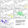
 Genetic analysis on the spread of barley from 9000 to 2000 BCE.jpg 2,229 × 1,592; 3.32 MB
-

-
 Holocene-crop-domestication-de.svg 1,576 × 743; 252 KB
-
 Holocene-crop-domestication-en.svg 1,613 × 743; 252 KB
-
 Journal.pbio.0030410.g001.png 2,800 × 2,187; 694 KB
-
 Modern distribution of the haplotypes of PPNB farmers.jpg 2,051 × 1,418; 561 KB
-
 Neolithic Expansion.gif 741 × 363; 16 KB
-
 Neolithikum Ausbreitung.jpg 700 × 694; 239 KB
-
 Neolithikum Ausbreitung.png 1,400 × 1,388; 1.01 MB
-
 Период неолит - миграция культур с керамикой и охотников собирателей.jpg 6,359 × 2,679; 5.5 MB


_and_modern_Western_Eurasian_populations.jpg)


%E6%97%A5%E6%9C%AC%E8%AA%9E.jpg)