Category:Maps of the European Neolithic
Jump to navigation
Jump to search
This category envelops European prehistory from 7000 BCE until 3000 BCE. It is preceded by Category:Maps of European Paleolithic (1.8 million years ago to 7000 BCE) and succeeded by Category:Maps of European Bronze and Iron Age (3000–50 CE).
Media in category "Maps of the European Neolithic"
The following 93 files are in this category, out of 93 total.
-
-

-
 Archaeological map of Pispa settlement in Finland.png 1,404 × 1,701; 194 KB
-
 Baalberge culture Saxony Anhalt.png 849 × 1,000; 1.14 MB
-
 Balkan Late Neolithic.png 960 × 1,053; 1.16 MB
-
 Beaker culture.png 450 × 450; 76 KB
-
 Bell beaker culture Saxony Anhalt.png 849 × 1,000; 1.13 MB
-
 Bellbeaker map europe.jpg 650 × 597; 124 KB
-
 Bernburg culture Saxony Anhalt.png 849 × 1,000; 1.14 MB
-
 Cardial map-es.svg 1,392 × 876; 78 KB
-
 Cardial map-pt.svg 1,392 × 876; 42 KB
-
 Cardial map.png 1,044 × 657; 83 KB
-
 Chronology of arrival times of the Neolithic transition in Europe.jpg 4,413 × 3,070; 4.76 MB
-
 Corded ware culture Saxony Anhalt.png 849 × 1,000; 1.13 MB
-
 ETH-BIB-Malta, Neolithische Monumente (Ugolini, aus Fig.3)-Dia 247-Z-00374.tif 3,600 × 2,962; 30.6 MB
-
 Europe agricultural revolution.gif 1,361 × 1,203; 3.11 MB
-
 Europe en -5000.pdf 1,752 × 1,239; 343 KB
-
 European Late Neolithic.gif 1,320 × 663; 103 KB
-
 European Middle Neolithic (crop).gif 497 × 323; 27 KB
-
 European Middle Neolithic.gif 1,307 × 648; 101 KB
-
 European neolithic cultures.gif 1,024 × 508; 190 KB
-
 European-late-neolithic-dutch.svg 1,042 × 893; 416 KB
-
 European-late-neolithic-english.svg 1,042 × 893; 416 KB
-
 European-late-neolithic-es.svg 1,042 × 893; 421 KB
-
 European-late-neolithic-fr.svg 1,042 × 893; 426 KB
-
 European-late-neolithic-pt.svg 1,042 × 893; 421 KB
-
 European-middle-neolithic-en.svg 1,042 × 893; 421 KB
-
 European-middle-neolithic-eo.svg 1,042 × 893; 424 KB
-
 European-middle-neolithic-es.svg 1,111 × 953; 651 KB
-
 European-middle-neolithic-fr.svg 1,042 × 893; 427 KB
-
 European-middle-neolithic-ko.svg 1,042 × 893; 427 KB
-
 European-middle-neolithic-mk.svg 1,042 × 893; 511 KB
-
 European-middle-neolithic-nl.svg 1,042 × 893; 421 KB
-
 European-middle-neolithic-pt.svg 1,111 × 953; 432 KB
-
 Expansion néolithique.png 1,687 × 1,106; 346 KB
-
 Expansion of farming in western Eurasia, 9600 - 4000 cal BC.jpg 2,158 × 1,373; 1.72 MB
-
 Expansion of farming in western Eurasia, 9600–4000 BCE.png 3,467 × 2,196; 5.01 MB
-
 Fig. 9 mapa.jpg 857 × 559; 129 KB
-
 Francie neolit.png 575 × 479; 58 KB
-
 Gatersleben culture Saxony Anhalt.png 849 × 1,000; 1.15 MB
-
 Gatersleben culture Saxony.png 888 × 648; 890 KB
-
 Gatersleben culture Thuringia.png 849 × 666; 949 KB
-
 Genetic landscape of Europe Mesolithic-Neolithic.png 1,384 × 799; 1.51 MB
-

-
 Globular amphora culture Saxony Anhalt.png 849 × 1,000; 1.12 MB
-
 Havelland culture Saxony Anhalt.png 849 × 1,000; 1.16 MB
-
 IE4500BP.png 370 × 169; 47 KB
-
 IE5500BP.png 370 × 169; 43 KB
-
 Impact génétique de la culture Yamna en Europe.svg 1,523 × 918; 1.44 MB
-
 Indoeuropean homeland be.svg 614 × 329; 35 KB
-
 Indoeuropean homeland.png 614 × 329; 12 KB
-
 Indogermaische Ursprache 3500BC-pt.svg 960 × 582; 356 KB
-
 Indogermaische Ursprache 3500BC.svg 960 × 582; 367 KB
-
 Kostolac culture-sr.png 520 × 542; 28 KB
-
 Kostolac culture.png 520 × 542; 33 KB
-
 Kura-Araxes culture (Wang et al, 2019).png 2,050 × 670; 1.46 MB
-
 Linear pottery culture Saxony Anhalt.png 849 × 1,000; 1.13 MB
-
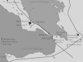
 Map of Early Neolithic migrations.jpg 4,680 × 3,052; 2.15 MB
-
 Map of the spread of Neolithic farming cultures in Europe.jpg 3,158 × 2,114; 1.59 MB
-
 Map of the spread of Neolithic farming cultures in Europe1.jpg 3,158 × 2,114; 1.67 MB
-
 MapNeolithicHeart.gif 548 × 416; 55 KB
-
 MapOrcaciaNeolithica.gif 508 × 599; 45 KB
-
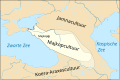 Maykop culture-nl.svg 605 × 399; 1.5 MB
-
 Megalitismo Europa.svg 1,188 × 1,500; 190 KB
-
 Michelsberg and Jordanow culture Saxony Anhalt.png 849 × 1,000; 1.16 MB
-
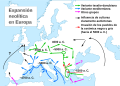 Neolithic expansion-es.svg 680 × 487; 691 KB
-
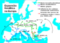 Neolithic expansion-pt.svg 680 × 487; 314 KB
-
 Neolithic expansion.svg 680 × 487; 608 KB
-
 Neolithic vinca culture en.png 888 × 930; 54 KB
-
 Neolithic vinca culture sr.png 888 × 930; 56 KB
-
 Neolithic-expansion-rus.png 1,059 × 758; 257 KB
-
 Neolítico en Europa.png 963 × 646; 591 KB
-
 Old Europe.png 500 × 364; 87 KB
-
 Old Europe2.png 500 × 364; 77 KB
-

-
 Rössen culture Saxony Anhalt.png 849 × 1,000; 1.14 MB
-
 Salzmünde culture Saxony Anhalt.png 849 × 1,000; 1.16 MB
-
 Schönfeld culture Saxony Anhalt.png 849 × 1,000; 1.16 MB
-
 SEE-Eneolithic-cultures-Cucuteni.jpg 3,509 × 2,480; 6.99 MB
-
 Seredniy kamianyi vik Evropy.svg 1,042 × 893; 426 KB
-
 Simplified model for demographic history of Europeans during Neolithic.png 1,995 × 1,412; 389 KB
-
 Simplified model for the recent demographic history of Europeans.jpg 1,995 × 1,412; 1.03 MB
-
 Single grave culture Saxony Anhalt.png 849 × 1,000; 1.15 MB
-
 Starcevo culture-sr.png 1,151 × 1,027; 65 KB
-
 Starcevo culture.png 1,088 × 960; 26 KB
-
 Stroke ornamented ware culture Saxony Anhalt.png 849 × 1,000; 1.14 MB
-
 Tiefstichkeramik culture Saxony Anhalt.png 849 × 1,000; 1.16 MB
-
 Verspreiding Neolithicum naar Europa.jpg 700 × 694; 266 KB
-
 Vucedol culture map.png 815 × 1,137; 78 KB
-
 Walternienburg culture Saxony Anhalt.png 849 × 1,000; 1.14 MB
-
 КартаЯсторф.png 961 × 564; 2.07 MB
-
 Средний каменный век Европы.svg 1,042 × 893; 428 KB
-
 Старая Европа.svg 500 × 364; 165 KB


.gif)


_and_modern_Western_Eurasian_populations.jpg)


.png)